Swatara, Minnesota
| Swatara, Minnesota | |
|---|---|
| Unincorporated community | |
 Swatara, Minnesota  Swatara, Minnesota Location of the community of Swatara | |
| Coordinates: 46°53′44″N 93°40′27″W / 46.89556°N 93.67417°WCoordinates: 46°53′44″N 93°40′27″W / 46.89556°N 93.67417°W | |
| Country | United States |
| State | Minnesota |
| County | Aitkin |
| Township | Macville Township |
| Elevation | 1,299 ft (396 m) |
| Time zone | Central (CST) (UTC-6) |
| • Summer (DST) | CDT (UTC-5) |
| ZIP code | 55785 |
| Area code(s) | 218 |
| GNIS feature ID | 658572[1] |
Swatara is an unincorporated community in Macville Township, Aitkin County, Minnesota, United States. Although unincorporated, Swatara has a post office with the ZIP code 55785.[2]
History
The community at one time was served by the Soo Line Railroad and had a railroad station.
Geography
Swatara is located along Aitkin County Road 7 (610th Street) near the junction with County Road 29 (Osprey Avenue). Nearby places include Hill City, Remer, and Haypoint. U.S. 169 is nearby. Swatara is located in the northwest part of Aitkin County. It is 7 miles southwest of Hill City.
References
Municipalities and communities of Aitkin County, Minnesota, United States | ||
|---|---|---|
| Cities | 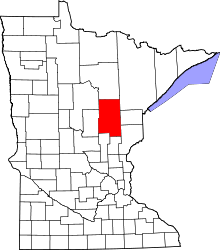 | |
| Townships |
| |
| Unorganized territories | ||
| Unincorporated communities | ||
| Indian reservations | ||
| Footnotes | ‡This populated place also has portions in an adjacent county or counties | |
This article is issued from Wikipedia - version of the 7/28/2016. The text is available under the Creative Commons Attribution/Share Alike but additional terms may apply for the media files.