Superior, Arizona
| Superior | |
|---|---|
| Town | |
| Superior, Arizona | |
|
Apache Leap in Superior | |
 Location in Pinal County and the state of Arizona | |
 Superior Location in the United States | |
| Coordinates: 33°17′20″N 111°6′14″W / 33.28889°N 111.10389°WCoordinates: 33°17′20″N 111°6′14″W / 33.28889°N 111.10389°W | |
| Country | United States |
| State | Arizona |
| County | Pinal |
| Incorporated | 1976 |
| Government | |
| • Mayor | Mila Besich-Lira.[1] |
| Area | |
| • Total | 1.9 sq mi (5.0 km2) |
| • Land | 1.9 sq mi (5.0 km2) |
| • Water | 0.0 sq mi (0.0 km2) |
| Elevation | 2,888 ft (880 m) |
| Population (2010)[2] | |
| • Total | 2,837 |
| • Estimate (2014)[3] | 2,916 |
| • Density | 1,662.1/sq mi (631.6/km2) |
| Time zone | MST (no DST) (UTC-7) |
| ZIP code | 85173 |
| Area code(s) | 520 |
| FIPS code | 04-71300 |
| Website | Town of Superior |

Superior (Western Apache: Yooʼ Łigai)[4] is a town in Pinal County, Arizona, United States. According to the 2010 census, the population of the town is 2,837.[2]
Such films as U Turn by Oliver Stone, Eight Legged Freaks, How the West Was Won, Blind Justice, The Prophecy, Skinwalkers, The Gauntlet with Clint Eastwood, and Young Billy Young are set in Superior. In 2005, a sci-fi film named The Salena Incident, also called Alien Invasion Arizona, was filmed in Superior.
Geography
Superior is located approximately 70 miles (110 km) east of Phoenix and the same distance north of Tucson. According to the United States Census Bureau, the town has a total area of 1.9 sq mi (5.0 km2), all land.[5]
Demographics
| Historical population | |||
|---|---|---|---|
| Census | Pop. | %± | |
| 1920 | 2,464 | — | |
| 1930 | 4,295 | 74.3% | |
| 1960 | 4,875 | — | |
| 1970 | 4,975 | 2.1% | |
| 1980 | 4,600 | −7.5% | |
| 1990 | 3,468 | −24.6% | |
| 2000 | 3,254 | −6.2% | |
| 2010 | 2,837 | −12.8% | |
| Est. 2015 | 2,943 | [6] | 3.7% |
| U.S. Decennial Census[7] 2014 Estimate[3][8] | |||
As of the census[9] of 2000, there were 3,254 people, 1,237 households, and 847 families residing in the town. The population density was 1,684.6 people per square mile (651.0/km²). There were 1,470 housing units at an average density of 761.0 per square mile (294.1/km²). The racial makeup of the town was 72.68% White, 0.46% Black or African American, 1.63% Native American, 0.34% Asian, 0.09% Pacific Islander, 23.05% from other races, and 1.75% from two or more races. 69.08% of the population were Hispanic or Latino of any race.
There were 1,237 households out of which 26.9% had children under the age of 18 living with them, 48.3% were married couples living together, 14.3% had a female householder with no husband present, and 31.5% were non-families. 27.4% of all households were made up of individuals and 15.0% had someone living alone who was 65 years of age or older. The average household size was 2.63 and the average family size was 3.20.
In the town the population was spread out with 26.9% under the age of 18, 8.0% from 18 to 24, 21.7% from 25 to 44, 23.4% from 45 to 64, and 19.9% who were 65 years of age or older. The median age was 39 years. For every 100 females there were 99.4 males. For every 100 females age 18 and over, there were 98.7 males.
The median income for a household in the town was $27,069, and the median income for a family was $31,250. Males had a median income of $34,297 versus $21,607 for females. The per capita income for the town was $12,490. About 22.5% of families and 27.8% of the population were below the poverty line, including 39.0% of those under age 18 and 16.5% of those age 65 or over.
Places of interest
The Boyce Thompson Arboretum State Park is a 323-acre (1.31 km2) botanical collection that includes a wide range of habitats and a 1.5-mile (2.4 km) walking trail. Founded in 1925, the arboretum is the largest and oldest botanical garden in Arizona.
Climate
Superior has a hot semi-arid climate. In January, the average high temperature is 61 °F (16 °C) with a low of 43 °F (6 °C). In July, the average high temperature is 98 °F (37 °C) with a low of 76 °F (24 °C). Annual precipitation is just over 18 inches, but is higher at greater altitudes.[10] Despite its relatively high precipitation due to favourable aspect, Superior is too low for significant snow even in winter.

| Climate data for Superior, Arizona | |||||||||||||
|---|---|---|---|---|---|---|---|---|---|---|---|---|---|
| Month | Jan | Feb | Mar | Apr | May | Jun | Jul | Aug | Sep | Oct | Nov | Dec | Year |
| Record high °F (°C) | 81 (27) |
87 (31) |
91 (33) |
96 (36) |
105 (41) |
111 (44) |
112 (44) |
110 (43) |
106 (41) |
102 (39) |
89 (32) |
83 (28) |
112 (44) |
| Average high °F (°C) | 60.9 (16.1) |
64.1 (17.8) |
68.5 (20.3) |
76.4 (24.7) |
86.1 (30.1) |
95.6 (35.3) |
97.7 (36.5) |
95.4 (35.2) |
92.3 (33.5) |
82.5 (28.1) |
69.8 (21) |
61.6 (16.4) |
79.2 (26.2) |
| Average low °F (°C) | 43.2 (6.2) |
45.4 (7.4) |
48.2 (9) |
54.4 (12.4) |
62.7 (17.1) |
72.0 (22.2) |
75.7 (24.3) |
74.2 (23.4) |
71.2 (21.8) |
62.0 (16.7) |
51.1 (10.6) |
44.0 (6.7) |
58.7 (14.8) |
| Record low °F (°C) | 20 (−7) |
20 (−7) |
24 (−4) |
29 (−2) |
38 (3) |
51 (11) |
59 (15) |
61 (16) |
50 (10) |
33 (1) |
29 (−2) |
19 (−7) |
19 (−7) |
| Average rainfall inches (mm) | 2.00 (50.8) |
1.98 (50.3) |
2.02 (51.3) |
.80 (20.3) |
.34 (8.6) |
.26 (6.6) |
1.91 (48.5) |
2.80 (71.1) |
1.48 (37.6) |
1.18 (30) |
1.41 (35.8) |
2.11 (53.6) |
18.29 (464.5) |
| Average rainy days (≥ 0.01 inch) | 5 | 5 | 5 | 3 | 2 | 1 | 7 | 8 | 4 | 3 | 4 | 5 | 52 |
| Source: Western Regional Climate Center[10] | |||||||||||||
See also

References
- ↑ "Mila Besich-Lira promises to work hard to make Superior better on being sworn in as Mayor". CopperArea.com Retrieved October 6, 2016.
- 1 2 "American FactFinder". United States Census Bureau. Retrieved 2014-08-31.
- 1 2 "Population Estimates". United States Census Bureau. Retrieved July 11, 2015.
- ↑ William J. de Reuse (2006), A Practical Grammar of the San Carlos Apache Language, Lincom Europa
- ↑ "US Gazetteer files: 2010, 2000, and 1990". United States Census Bureau. 2011-02-12. Retrieved 2011-04-23.
- ↑ "Annual Estimates of the Resident Population for Incorporated Places: April 1, 2010 to July 1, 2015". Retrieved July 2, 2016.
- ↑ United States Census Bureau. "Census of Population and Housing". Retrieved August 31, 2014.
- ↑ Census figures for 1960 & 1970 enumerated prior to incorporation.
- ↑ "American FactFinder". United States Census Bureau. Retrieved 2008-01-31.
- 1 2 "SUPERIOR, ARIZONA: Period of Record General Climate Summary". Retrieved 2012-03-28.
External links
![]() Media related to Superior, Arizona at Wikimedia Commons
Media related to Superior, Arizona at Wikimedia Commons
Municipalities and communities of Pinal County, Arizona, United States | ||
|---|---|---|
| Cities | 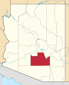 | |
| Towns | ||
| CDPs |
| |
| Unincorporated communities | ||
| Indian reservations | ||
| Ghost towns | ||
| Footnotes | ‡This populated place also has portions in an adjacent county or counties | |