Sunderland, Maryland
| Sunderland, Maryland | |
|---|---|
| Unincorporated community | |
|
| |
 Sunderland | |
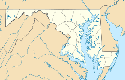
| Coordinates: 38°40′16″N 76°35′53″W / 38.67111°N 76.59806°WCoordinates: 38°40′16″N 76°35′53″W / 38.67111°N 76.59806°W | |
| Country | United States |
| State | Maryland |
| County | Calvert |
| Elevation | 171 ft (52 m) |
| Time zone | Eastern (EST) (UTC-5) |
| • Summer (DST) | EDT (UTC-4) |
| ZIP code | 20689 |
| Area code(s) | 410, 443, and 667 |
| GNIS feature ID | 591378[1] |

Sunderland is a small, rural unincorporated community located at the crossroads of MD 2, MD 4, MD 262, Dalrymple Road, and Pushaw Station Road in Calvert County, Maryland, approximately 5 miles south of Dunkirk, Maryland and 10 miles north of Prince Frederick, Maryland. Although Sunderland is not incorporated and does not have a central business district, it does have a zip code, 20689. However, as of November 2007, the former Sunderland post office had closed its doors due to a lease dispute without opening a new location, and postal officials are determining where to locate a new post office location.[2]
All Saints' Church was listed on the National Register of Historic Places in 1973.[3] Joseph D. Lyons House was listed in 1998.[3]
References
- ↑ "Sunderland". Geographic Names Information System. United States Geological Survey.
- ↑ Calvert Recorder. "Lease issue closes post office- November 10, 2007".
- 1 2 National Park Service (2008-04-15). "National Register Information System". National Register of Historic Places. National Park Service.
Municipalities and communities of Calvert County, Maryland, United States | ||
|---|---|---|
| Towns | 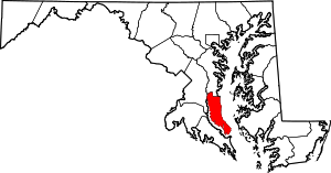 | |
| CDPs | ||
| Other communities | ||
| Ghost town | ||
This article is issued from Wikipedia - version of the 10/14/2016. The text is available under the Creative Commons Attribution/Share Alike but additional terms may apply for the media files.