Stumptown, West Virginia
| Stumptown | |
|---|---|
| Unincorporated community | |
| Coordinates: 38°50′56″N 80°59′38″W / 38.84889°N 80.99389°WCoordinates: 38°50′56″N 80°59′38″W / 38.84889°N 80.99389°W | |
| Country | United States |
| State | West Virginia |
| County | Gilmer |
| Elevation | 725 ft (221 m) |
| Time zone | Eastern (EST) (UTC-5) |
| • Summer (DST) | EDT (UTC-4) |
| ZIP codes | 25280 |
| FIPS code | 1555732[1] |
Stumptown is an unincorporated community in Gilmer County, West Virginia, United States, at the confluence of the left and right forks of Steer Creek.[2] It was named for Michael Stump III, a pioneer settler.[3][4] It lies at an elevation of 725 feet (221 m). The Stumptown Post Office opened 5/29/1883 and closed 2/1/1997.[5]
See also
References
- ↑ U.S. Geological Survey Geographic Names Information System: Stumptown, West Virginia
- ↑ West Virginia Atlas & Gazetteer. Yarmouth, Me.: DeLorme. 1997. p. 34. ISBN 0-89933-246-3.
- ↑ Weaver, Bob (May 25, 2016). "HISTORIC STUMP FAMILY WAS 'FRUITFUL' - Family Brought Life To Region, Recalling The Michael Stumps". The Hur Herald. Hur Herald Publishing. Retrieved March 30, 2016.
- ↑ Kenny, Hamill (1945). West Virginia Place Names: Their Origin and Meaning, Including the Nomenclature of the Streams and Mountains. Piedmont, WV: The Place Name Press. p. 609.
- ↑ http://webpmt.usps.gov/pmt015.cfm
Municipalities and communities of Gilmer County, West Virginia, United States | ||
|---|---|---|
| Towns | 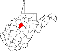 | |
| Unincorporated communities | ||
| Footnotes | ‡This populated place also has portions in an adjacent county or counties | |
This article is issued from Wikipedia - version of the 9/4/2016. The text is available under the Creative Commons Attribution/Share Alike but additional terms may apply for the media files.