Springfield, Georgia
| Springfield, Georgia | |
|---|---|
| City | |
| Motto: "Where What's Close to Your Heart Still Matters"[1] | |
 Location in Effingham County and the state of Georgia | |
| Coordinates: 32°22′6″N 81°18′37″W / 32.36833°N 81.31028°WCoordinates: 32°22′6″N 81°18′37″W / 32.36833°N 81.31028°W | |
| Country | United States |
| State | Georgia |
| County | Effingham |
| Government | |
| • Mayor | Barton Alderman |
| Area | |
| • Total | 2.7 sq mi (7.1 km2) |
| • Land | 2.7 sq mi (7.1 km2) |
| • Water | 0 sq mi (0 km2) |
| Elevation | 79 ft (24 m) |
| Population (2010) | |
| • Total | 2,852 |
| • Density | 1,034/sq mi (399.3/km2) |
| Time zone | EST (UTC-5) |
| • Summer (DST) | EDT (UTC-4) |
| ZIP code | 31329 |
| Area code(s) | 912 |
| FIPS code | 13-72780[2] |
| GNIS feature ID | 0333107[3] |
| Website | City of Springfield Georgia |
Springfield is a city in Effingham County, Georgia, United States. The population was 2,852 at the 2010 census,[4] up from 1,821 at the 2000 census. The city is the county seat of Effingham County.[5] Springfield is part of the Savannah Metropolitan Statistical Area.
History
Springfield is the seat of government for Effingham County.[6] Ebenezer was the county seat from 1797 to 1799. In 1799, Effingham County had three different county seats.[1] The state legislature appointed a commission to select a new centrally located site for the permanent county seat. A location five miles from the center of the county was chosen and named Springfield, for the plantation of General David Blackshear.[6]
The county government surveyed the new town, and designated streets, lots, and the public squares that were to be used for the courthouse and the jail. The lots were sold to finance the construction of these public buildings. A map drawn in 1821 shows four north–south streets and nine east–west streets. Development of the new county seat was slow, as it was isolated from customary routes of trade. At the turn of the 20th century, it was listed as having only about twelve houses.
A 1907 map showed the railroad had come to town, an impetus for growth. Four new east–west streets had been added, as well as several new north–south streets. This period saw the greatest growth in Springfield. The Brinson Railroad from Savannah was built about 1907, as was the George M. Brinson Sawmill. In 1908 a new county courthouse was constructed. In the decade from 1900 to 1910, the population of Springfield increased to 500 from 134.
Throughout the 19th- and early 20th-century, the courthouse square served as the nucleus of town activity and the anchor around which the community was planned. The courthouse was usually surrounded by public space or by a square. Houses emerged on the fringes of the square, and growth would usually radiate from the courthouse, developing a square town plan. Springfield has examples of such development, but much early architecture was lost due to a series of fires from the late 19th century through the 1960s. Springfield's 1908 courthouse, designed in the classical Greek style as a symbol of republican government, is an example of the courthouse as town anchor.
At the turn of the 20th century, the Effingham County Courthouse was a two-story frame building facing Early Street. The lower floor contained the courtroom and a few offices. The second floor served as the jury room. In 1908, the present courthouse was built, designed by Savannah architect Hyman W. Witcover. In 1979 an annex was added for additional space. The courthouse had become more than a building in which to hear legal cases. County business had expanded, requiring space for offices such as the tax assessor, tax collector, and county commissioners. Also located in the courthouse was the probate court, which administered wills and testaments and looked after orphans and widows. The magistrate's court ruled on criminal and civil cases.
Springfield experienced its major residential growth around 1910. During that period, the architectural fashion in houses was shifting from the elaborate and highly detailed Victorian style to the simpler Arts and Crafts or bungalow style. The majority of Springfield's historic homes reflect this later style. This transitional fashion is often referred to as Folk Victorian. It is recognizable by the use of spindle work around eaves and porches, decorative porch supports, patterned shingles in the gables, and single-paned, double-hung windows.
The houses were adapted to coastal Georgia's warm environment. Most houses were built on raised foundations, to escape heat rising from the ground and allow for ventilation to reduce dampness and mold. Windows were strategically placed to provide cross-ventilation and to capture cool evening breeze. The exaggerated eaves and porches protect the interior from direct sun, reducing the absorption of heat, and also provide an outdoor living area. Interior elements of high ceilings and double-hung windows also helped with cooling. On warm days the upper window sash could be lowered to allow the hot air to escape, while cool air was drawn in the raised lower window sash. These elements coupled with thick plaster walls created a comfortable environment.
Another coastal condition is heavy rain. Therefore, most roofs are steeply pitched to improve roof drainage. Many of the historic roofs are metal, to shed rain and to prevent the spread of fire from one structure to the next. As Springfield was historically a sawmill town, easily accessible lumber contributed to the predominance of wooden-frame houses. The majority of the historic homes were constructed before the automobile, so they did not have carports or garages.
Geography
Springfield is located in central Effingham County at 32°22′6″N 81°18′37″W / 32.36833°N 81.31028°W (32.368240, -81.310152).[7] Georgia State Route 21 bypasses the city center on the west, while Route 119 passes closer to the center of town. Via GA 21 it is 26 miles (42 km) south to Savannah and 33 miles (53 km) northwest to Sylvania, while GA 119 leads southwest 5 miles (8 km) to Guyton and north 12 miles (19 km) to the South Carolina border.
According to the United States Census Bureau, Springfield has a total area of 2.7 square miles (7.1 km2), all of it land.[4]
Demographics
| Historical population | |||
|---|---|---|---|
| Census | Pop. | %± | |
| 1870 | 32 | — | |
| 1910 | 504 | — | |
| 1920 | 377 | −25.2% | |
| 1930 | 402 | 6.6% | |
| 1940 | 458 | 13.9% | |
| 1950 | 627 | 36.9% | |
| 1960 | 858 | 36.8% | |
| 1970 | 1,001 | 16.7% | |
| 1980 | 1,075 | 7.4% | |
| 1990 | 1,415 | 31.6% | |
| 2000 | 1,821 | 28.7% | |
| 2010 | 2,852 | 56.6% | |
| Est. 2015 | 2,889 | [8] | 1.3% |
As of the 2010 United States Census, there were 2,852 people residing in the city. The racial makeup of the city was 66.3% White, 28.6% Black, 0.6% Native American, 0.4% Asian, 0.1% Pacific Islander, 0.1% from some other race and 1.2% from two or more races. 2.8% were Hispanic or Latino of any race.
As of the census[2] of 2000, there were 1,821 people, 633 households, and 453 families residing in the city. The population density was 854.3 people per square mile (330.1/km²). There were 704 housing units at an average density of 330.3 per square mile (127.6/km²). The racial makeup of the city was 76.28% White, 22.13% African American, 0.38% Native American, 0.05% Asian, 0.11% Pacific Islander, 0.77% from other races, and 0.27% from two or more races. Hispanic or Latino of any race were 2.03% of the population.
There were 633 households out of which 36.2% had children under the age of 18 living with them, 51.0% were married couples living together, 17.4% had a female householder with no husband present, and 28.3% were non-families. 25.6% of all households were made up of individuals and 11.5% had someone living alone who was 65 years of age or older. The average household size was 2.48 and the average family size was 2.97.
In the city the population was spread out with 24.1% under the age of 18, 9.7% from 18 to 24, 30.2% from 25 to 44, 18.9% from 45 to 64, and 17.1% who were 65 years of age or older. The median age was 36 years. For every 100 females there were 96.7 males. For every 100 females age 18 and over, there were 93.8 males.
The median income for a household in the city was $36,544, and the median income for a family was $41,071. Males had a median income of $35,096 versus $25,192 for females. The per capita income for the city was $16,519. About 11.1% of families and 13.4% of the population were below the poverty line, including 17.4% of those under age 18 and 8.6% of those age 65 or over.
Education
Effingham County School District
The Effingham County School District holds pre-school to grade twelve, and consists of eight elementary schools, three middle schools, and two high schools.[10] The district has 511 full-time teachers and over 9,037 students.[11]
- Blandford Elementary School
- Ebenezer Elementary School
- Guyton Elementary School
- Marlow Elementary School
- Rincon Elementary School
- Sand Hill Elementary School
- South Effingham Elementary School
- Springfield Elementary School
- Ebenezer Middle School
- Effingham County Middle School
- South Effingham Middle School
- Effingham County High School
- South Effingham High School
Notable people
- Charlton W. Tebeau, historian
References
- 1 2 "City of Springfield Georgia". City of Springfield Georgia. Retrieved September 4, 2012.
- 1 2 "American FactFinder". United States Census Bureau. Retrieved 2008-01-31.
- ↑ "US Board on Geographic Names". United States Geological Survey. 2007-10-25. Retrieved 2008-01-31.
- 1 2 "Geographic Identifiers: 2010 Demographic Profile Data (G001): Springfield city, Georgia". American Factfinder. U.S. Census Bureau. Retrieved January 26, 2016.
- ↑ "Find a County". National Association of Counties. Retrieved 2011-06-07.
- 1 2 "Profile for Springfield, Georgia, GA". ePodunk. Retrieved September 4, 2012.
- ↑ "US Gazetteer files: 2010, 2000, and 1990". United States Census Bureau. 2011-02-12. Retrieved 2011-04-23.
- ↑ "Annual Estimates of the Resident Population for Incorporated Places: April 1, 2010 to July 1, 2015". Retrieved July 2, 2016.
- ↑ "Census of Population and Housing". Census.gov. Retrieved June 4, 2015.
- ↑ Georgia Board of Education, Retrieved June 8, 2010.
- ↑ School Stats, Retrieved June 8, 2010.
External links
| Wikimedia Commons has media related to Springfield, Georgia. |
- City of Springfield official website
- Springfield at CityData.com
Municipalities and communities of Effingham County, Georgia, United States | ||
|---|---|---|
| Cities | 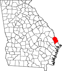 | |
| Town | ||
| Unincorporated communities | ||