South Circular Road, London
| |
|---|---|
|
The route of the South Circular Road in Greater London, with the North Circular Road and Woolwich Ferry shown | |
|
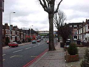
Brownhill Road in Catford | |
| Route information | |
| Length: | 20.5 mi[1] (33.0 km) |
| Major junctions | |
| From: | Hart |
| |
| To: | South Ealing |
| Road network | |

The South Circular Road (formally the A205 and often simply called the South Circular) is a road in south London, England, running from the Woolwich Ferry in the east to the Chiswick Flyover in the west via Catford, Dulwich, Clapham Common and Kew Bridge. Together with the North Circular Road and Woolwich Ferry, it makes a complete ring-road of Central London. The South Circular is largely a sequence of urban streets joined together, requiring several at-grade turns and is frequently congested.
The South Circular was originally a proposed new build route across South London in the 1920s, and a small section of the road near Eltham was built to this specification. The remainder of the road was supposed to be of a similar standard, but was repeatedly delayed through to the late 1930s, when the current route was assigned to existing urban streets. Despite several proposals to either upgrade the road or replace it with a parallel motorway, there has been little change in the century since the route was first planned and most of the road is still urban streets. The South Circular has received sustained criticism over its poor congestion and pollution record and is one of the least popular roads in Britain.
Route
The South Circular is 20.5 miles (33.0 km) long. The majority of the road is single carriageway, one lane each way, aside from a small section of dual carriageway near the Woolwich Ferry.[1]
Woolwich – Clapham
The route starts just south of the ferry terminal where the A2204 Ferry Approach road meets the main east-west road through Woolwich, the A206.[1] It goes south, climbing up John Wilson Street, a section of dual carriageway, until it meets Grand Depot Road and becomes single carriageway through Woolwich Common and Academy Road past the former Royal Military Academy. It continues south to the A2 at a grade separated junction (one of only two on the route), and continues south westerly as a dual carriageway, crossing Eltham Road (A210) and Sidcup Road (A20), until the junction with Burnt Ash Hill when it becomes urban single carriageway again – which remains the case for most of the remainder of the route.[1]
The first section of the single carriageway is Saint Mildreds Road; then, shortly after passing under the railway line, it is Brownhill Road due west all the way to the Catford gyratory system which crosses the A21 to follow Catford Road past the now closed Catford Stadium,[2] and a medley of surban roads towards Forest Hill and Horniman Museum, Dulwich Common and Dulwich College, Tulse Hill and Brixton Hill to Clapham Common.[1]
Clapham – Kew
_South_Circular_Road_-_geograph.org.uk_-_677236.jpg)
Beyond the common, the South Circular merges with the A3 London to Portsmouth road for two miles, travelling along Wandsworth High Street (passing the old Ram Brewery), and West Hill where the routes diverge; the A205 going north-west along Upper Richmond Road, past the south end of Barnes Common and the home ground of Rosslyn Park F.C., then along Upper Richmond Road West, before turning north at East Sheen onto Clifford Avenue.[1]
The road then crosses the A316, and passes the National Archives, Kew Green, and over Kew Bridge. It ends at the Chiswick Roundabout, which is the junction for the M4 and the A406 North Circular Road.[1]
History
Early plans
.jpg)
The South Circular Road was planned by the Ministry of Transport in the early 20th century as part of a general programme of traffic improvements across London.[3] In 1903, a proposal for new approach roads was submitted to the Royal Commission on London Traffic, but was rejected. The Road Board was formed in 1910 to address traffic issues, which led to the London Arterial Road Conferences in 1913–14 that revived the earlier plans. Progress halted because of the war, but resumed in 1920, when it was hoped it would find work for demobilised soldiers.[4]
The first section near Woolwich was under construction by 1921, as it ran on open land that was easy to purchase, but plans for the remainder of the route had not yet been decided and there were delays due to compulsory purchasing of properties.[5][6] In 1925, The Times announced a replacement bridge for the Woolwich Ferry was planned as part of the South Circular project to tie in with the East Ham and Barking Bypass (now the A13).[7] A significant amount of new housing had been built along the route of the South Circular since the original 1903 plans, and the construction cost had risen because of labour and because of further demolition required.[4] In 1927, the Governors of Dulwich College formally objected to the road as it would put the Memorial Library right next to a main road and remove part of the college green.[8]
A short section from Well Hall Road to Eltham Road had been completed by 1930, aside from a bridge underneath the Hither Green – Dartford railway, and the road had been built as far west as Burnt Ash Hill by the middle of the decade.[9][10] Sir Charles Bressey's Highway Development Survey (also known as the Bressey Report), published in 1937, showed a 15 miles (24 km)-long South Circular that would have a new-build section near Wandsworth Bridge (then being rebuilt) but otherwise be a series of online improvements to existing roads.[11]
Abercrombie redevelopment
Sir Patrick Abercrombie was frustrated by the lack of progress, and in 1933 said "There is not a single complete Ring Road in the County or Region of London".[12] Plans for an improved South Circular were revisited as part of Abercrombie's County of London Plan of 1943, as the southern half of one of several ring roads around the capital.[13] Abercrombie designated it as the "C Ring" (the third ring out from the city centre); however, the high-quality road was never built and the semi-circular route was assigned to existing roads through the southern suburbs;[12] these roads retain their historic names. The current recognised route of the South Circular was created by local motoring organisations putting up strategically placed signposts to direct traffic. Sir Richard Sharples, then MP for Sutton and Cheam felt this was inadequate, and complained that "I do not think that the South Circular Road could be said to exist at all."[14]
Ringway 2
In the 1960s, Abercrombie's plans were revived by the Greater London Council (GLC) as the London Ringways Plan which proposed the construction of a series of motorways in and around London to control traffic congestion. The existing South Circular route was recognised as being unsuitable for upgrading and a new motorway, Ringway 2, was planned for construction further south.[15]
Because of the destruction required and cost involved in the proposed plans the majority of the Ringway Plans had stagnated by 1973. However, local Members of Parliament (MPs), including Toby Jessel, MP for Twickenham, complained the cancellation should not be indefinite, as the existing South Circular was completely unacceptable to traffic.[15] The plans were scrapped after Labour won the GLC election.[16]
Later plans
In 1985, the London Chamber of Commerce and Industry proposed a £300m partial replacement for the South Circular that would have seen a dual-carriageway built over existing suburban railway lines between Barnes and Wandsworth Bridge, and Wandsworth Common to Nine Elms.[17] In 1989, the Government announced a large-scale upgrade of the South Circular in the Roads for Prosperity white paper, but it was cancelled the following year.[18]
Traffic
The South Circular Road has long been the target of criticism over its poor capacity and lack of improvement schemes. MPs have dismissed the road as "a collection of signposts"[19] and "not so much a coherent through route".[20] In 1969, the chairman of the Greater London Council planning and transportation committee call the South Circular "a joke".[21] In 1971, Jessel reported it could take over an hour to travel the route end to end, a little over 20 miles.[22]
Some of the wider sections of the road as it travels through Brixton and Clapham, which used to be single carriageway, albeit with two lanes each way, have had the outside lanes turned into bus lanes. This has an adverse effect on the traffic flow, and has increased congestion and journey times in many areas. However it is the policy of Transport for London (TFL) to encourage the use of public transport, and reduce car journeys within the capital.
In 1988, a single road closure (resulting from a gas leak on a side road in Wandsworth) caused severe congestion along the entire South Circular. A representative from Scotland Yard's Central Communications complex said the inadequate design of the road was indicative of several single points of failure in the London road network.[23]
The South Circular has been criticised for its poor air quality and pollution. This affects drivers, cyclists and pedestrians, all of which regularly travel along the road.[24] A 2007 report in the Daily Telegraph said it was the eighth worst road in Britain.[25]
Future
In July 2013, a task force set up by the Mayor of London Boris Johnson reported back proposing that large stretches of the South Circular (as well as the North Circular), be put underground in road tunnels, freeing up space on the surface to provide public space, extensive cycle routes, and better link existing communities currently severed by the busy road. Caroline Pidgeon, deputy chair of the London Assembly's Transport Committee responded, "It doesn't make sense and it won't add up – [there's a] £30bn estimate, but I'm sure it'll cost at least double that, and the reality is we'll lose homes around these roads and so on."[26]
See also
References
Citations
- 1 2 3 4 5 6 7 "A205". Google Maps. Retrieved 16 September 2016.
- ↑ Catford Dogs, Derelict London.
- ↑ Hart 1976, p. 74.
- 1 2 Jeffreys, Rees (5 April 1927). "New Arterial Roads". The Times. Retrieved 16 September 2016.
- ↑ "Road Construction". Hansard. 6 June 1921. Retrieved 18 August 2015.
- ↑ "By-Pass Roads (Eltham to Welling)". Hansard. 1 July 1924. Retrieved 18 August 2015.
- ↑ "New London Bridges". The Times. 23 January 1925. p. 13. Retrieved 16 September 2016.
- ↑ "South Circular Road". The Times. 24 October 1927. p. 9. Retrieved 16 September 2016.
- ↑ "South Circular Road, Woolwich". Hansard. 3 December 1930. Retrieved 18 August 2015.
- ↑ "South Circular Road". Hansard. 6 December 1933. Retrieved 18 August 2015.
- ↑ "Bressey Report". Hansard. 20 July 1938. Retrieved 26 August 2015.
- 1 2 Hart 1976, p. 75.
- ↑ Bressey, Charles (16 July 1943). "London of Tomorrow". The Spectator. Retrieved 26 August 2015.
- ↑ "Roads, London (Development Plan)". Hansard. 7 April 1955. Retrieved 26 August 2015.
- 1 2 "London Motorway Box". Hansard. 20 March 1973. Retrieved 26 August 2015.
- ↑ Young, John (5 July 1975). "Crosland statement may end road doubts". The Times. Retrieved 16 September 2016.
- ↑ Baily, Michael (23 March 1985). "£300m plan to build trunk road over railways". The Times. p. 2. Retrieved 16 September 2016.
- ↑ Dynes, Michael (27 March 1990). "London roads plan 'scrapped'". The Times. Retrieved 16 September 2016.
- ↑ "New Roads add to Congestion". New Scientist: 5. 25 December 1986. Retrieved 18 August 2015.
- ↑ Weinreb 2008, p. 851.
- ↑ "South circular road 'a joke'". The Times. 6 February 1969. p. 4. Retrieved 16 September 2016.
- ↑ "Motorways, London". Hansard. 15 December 1971. Retrieved 27 August 2015.
- ↑ "Traffic nightmare returns to haunt London". The Times. 6 December 1988. Retrieved 16 September 2016.
- ↑ Scott, Jenny (5 April 2014). "Are these the worst ring roads in England?". BBC News. Retrieved 16 September 2016.
- ↑ "M25 Voted Worst Road in Britain". The Daily Telegraph. 22 October 2007. Retrieved 17 September 2016.
- ↑ "London roads £30bn plan unveiled". BBC News. 10 July 2013.
Sources
External links
| Wikimedia Commons has media related to South Circular Road, London. |
A roads in Zone 2 of the Great Britain road numbering scheme | ||
|---|---|---|
Coordinates: 51°26′26″N 0°06′35″W / 51.4405°N 0.1098°W