Snir
| Snir | |
|---|---|
|
Neighborhood in Snir | |
 Snir | |
| Coordinates: 33°14′25.44″N 35°40′40.07″E / 33.2404000°N 35.6777972°ECoordinates: 33°14′25.44″N 35°40′40.07″E / 33.2404000°N 35.6777972°E | |
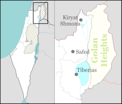
| District | Northern |
| Council | Upper Galilee |
| Affiliation | Kibbutz Movement |
| Founded | 26 September 1967 |
| Founded by | Nahal |
| Population (2015)[1] | 544 |
Snir (Hebrew: שניר) is a kibbutz in northern Israel. Located in the Hula Valley near Kiryat Shmona, it falls under the jurisdiction of Upper Galilee Regional Council. In 2015 it had a population of 544.
History
The village was established on 26 September 1967 as a Nahal settlement in what had formerly been demilitarized zone until the Six-Day War. It was converted to a civilian kibbutz in 1968 by Hashomer Hatzair members. Its name is derived from the Hebrew name for the nearby Hasbani River (Nahal Snir), for example mentioned in the Bible in Deuteronomy/Dwarim 3:9.
During the Six-Day war, a minor Syrian force tried to capture the water plant at Tel Dan (the subject of a fierce escalation two years earlier), Kibbutz Dan, and She'ar Yashuv. Several Syrian tanks are reported to have sunk in the Banias river.
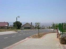
Gallery
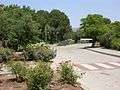 Park
Park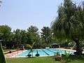 Swimming pool
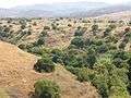 The Banias / Hermon river valley
 Syrian tank in the Banias river bed
 The Syrian tank
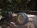 The Syrian tank
References
- ↑ "List of localities, in Alphabetical order" (PDF). Israel Central Bureau of Statistics. Retrieved 16 October 2016.