Shawnee Township, Allen County, Ohio
| Shawnee Township, Allen County, Ohio | |
|---|---|
| Township | |
|
The Griffith Breese Farm, a historic site in the township | |
 Location of Shawnee Township, Allen County, Ohio | |
| Coordinates: 40°41′49″N 84°9′15″W / 40.69694°N 84.15417°WCoordinates: 40°41′49″N 84°9′15″W / 40.69694°N 84.15417°W | |
| Country | United States |
| State | Ohio |
| County | Allen |
| Area | |
| • Total | 29.3 sq mi (75.8 km2) |
| • Land | 29.0 sq mi (75.1 km2) |
| • Water | 0.3 sq mi (0.8 km2) |
| Elevation[1] | 840 ft (256 m) |
| Population (2010) | |
| • Total | 12,433 |
| • Density | 429/sq mi (165.6/km2) |
| Time zone | Eastern (EST) (UTC-5) |
| • Summer (DST) | EDT (UTC-4) |
| FIPS code | 39-71955[2] |
| GNIS feature ID | 1085699[1] |
| Website |
shawneetownship |

Shawnee Township is one of the twelve townships of Allen County, Ohio, United States. As of the 2010 census the population was 12,433.[3]
Geography
Located in the southern part of the county, it borders the following townships:
- American Township - north
- Bath Township - northeast corner
- Perry Township - east
- Duchouquet Township, Auglaize County - south
- Logan Township, Auglaize County - southwest
- Amanda Township - northwest
Part of Lima is located in northeastern Shawnee Township. Fort Shawnee is located in the township's eastern sections; currently unincorporated, it was a village until its dissolution in 2012.
Name and history
It is the only Shawnee Township statewide.[4]
One historic site in the township, the Griffith Breese Farm, is listed on the National Register of Historic Places.[5]
Government
The township is governed by a three-member board of trustees, who are elected in November of odd-numbered years to a four-year term beginning on the following January 1. Two are elected in the year after the presidential election and one is elected in the year before it. There is also an elected township fiscal officer,[6] who serves a four-year term beginning on April 1 of the year after the election, which is held in November of the year before the presidential election. Vacancies in the fiscal officership or on the board of trustees are filled by the remaining trustees.
References
- 1 2 "US Board on Geographic Names". United States Geological Survey. 2007-10-25. Retrieved 2008-01-31.
- ↑ "American FactFinder". United States Census Bureau. Retrieved 2008-01-31.
- ↑ "Geographic Identifiers: 2010 Demographic Profile Data (G001): Shawnee township, Allen County, Ohio". U.S. Census Bureau, American Factfinder. Retrieved July 5, 2013.
- ↑ "Detailed map of Ohio" (PDF). United States Census Bureau. 2000. Retrieved 2007-02-16.
- ↑ National Park Service (2009-03-13). "National Register Information System". National Register of Historic Places. National Park Service.
- ↑ §503.24, §505.01, and §507.01 of the Ohio Revised Code. Accessed 4/30/2009.
External links
Municipalities and communities of Allen County, Ohio, United States | ||
|---|---|---|
| Cities | 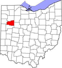 | |
| Villages | ||
| Townships | ||
| Unincorporated communities | ||
| Footnotes | ‡This populated place also has portions in an adjacent county or counties | |