Delphos, Ohio
| Delphos, Ohio | |
|---|---|
| City | |
|
St. John's Catholic Church, a city landmark | |
| Motto: "America"s Friendliest City" | |
 Location of Delphos, Ohio | |
 Location of Delphos in Allen County | |
| Coordinates: 40°50′40″N 84°20′22″W / 40.84444°N 84.33944°WCoordinates: 40°50′40″N 84°20′22″W / 40.84444°N 84.33944°W | |
| Country | United States |
| State | Ohio |
| Counties | Allen, Van Wert |
| Townships | Marion, Washington |
| Government | |
| • Mayor | Michael Gallmeier |
| Area[1] | |
| • Total | 3.48 sq mi (9.01 km2) |
| • Land | 3.44 sq mi (8.91 km2) |
| • Water | 0.04 sq mi (0.10 km2) |
| Elevation[2] | 774 ft (236 m) |
| Population (2010)[3] | |
| • Total | 7,101 |
| • Estimate (2012[4]) | 7,094 |
| • Density | 2,064.2/sq mi (797.0/km2) |
| Time zone | Eastern (EST) (UTC-5) |
| • Summer (DST) | EDT (UTC-4) |
| ZIP code | 45833 |
| Area code(s) | 419 |
| FIPS code | 39-21602[5] |
| GNIS feature ID | 1056973[2] |
| Website | http://www.cityofdelphos.com/ |

Delphos is a city in Allen and Van Wert counties in the U.S. state of Ohio. The population was 7,101 at the 2010 census.
The Allen County portion of Delphos is part of the Lima Metropolitan Statistical Area, while the Van Wert County portion is part of the Van Wert Micropolitan Statistical Area.
Geography
Delphos is located at 40°50′40″N 84°20′22″W / 40.84444°N 84.33944°W (40.844441, -84.339360).[6]
According to the United States Census Bureau, the city has a total area of 3.48 square miles (9.01 km2), of which 3.44 square miles (8.91 km2) is land and 0.04 square miles (0.10 km2) is water.[1]
Demographics
| Historical population | |||
|---|---|---|---|
| Census | Pop. | %± | |
| 1850 | 374 | — | |
| 1860 | 425 | 13.6% | |
| 1870 | 1,667 | 292.2% | |
| 1880 | 3,814 | 128.8% | |
| 1890 | 4,516 | 18.4% | |
| 1900 | 4,517 | 0.0% | |
| 1910 | 5,038 | 11.5% | |
| 1920 | 5,745 | 14.0% | |
| 1930 | 5,672 | −1.3% | |
| 1940 | 5,746 | 1.3% | |
| 1950 | 6,220 | 8.2% | |
| 1960 | 6,961 | 11.9% | |
| 1970 | 7,608 | 9.3% | |
| 1980 | 7,314 | −3.9% | |
| 1990 | 7,093 | −3.0% | |
| 2000 | 6,944 | −2.1% | |
| 2010 | 7,101 | 2.3% | |
| Est. 2015 | 7,023 | [7] | −1.1% |
| Sources:[5][8][9][10][11][12][13][14] | |||
2010 census
As of the census[3] of 2010, there were 7,101 people, 2,893 households, and 1,865 families residing in the city. The population density was 2,064.2 inhabitants per square mile (797.0/km2). There were 3,137 housing units at an average density of 911.9 per square mile (352.1/km2). The racial makeup of the city was 97.5% White, 0.4% African American, 0.2% Native American, 0.2% Asian, 0.4% from other races, and 1.3% from two or more races. Hispanic or Latino of any race were 1.8% of the population.
There were 2,893 households of which 31.2% had children under the age of 18 living with them, 48.3% were married couples living together, 11.0% had a female householder with no husband present, 5.2% had a male householder with no wife present, and 35.5% were non-families. 29.9% of all households were made up of individuals and 13.8% had someone living alone who was 65 years of age or older. The average household size was 2.41 and the average family size was 3.00.
The median age in the city was 38.6 years. 24.6% of residents were under the age of 18; 8.8% were between the ages of 18 and 24; 23.8% were from 25 to 44; 25.5% were from 45 to 64; and 17.1% were 65 years of age or older. The gender makeup of the city was 48.6% male and 51.4% female.
2000 census
As of the census[5] of 2000, there were 6,944 people, 2,717 households, and 1,880 families residing in the city. The population density was 2,391.9 people per square mile (924.5/km²). There were 2,906 housing units at an average density of 1,001.0 per square mile (386.9/km²). The racial makeup of the city was 98.63% White, 0.27% African American, 0.14% Native American, 0.19% Asian, 0.24% from other races, and 0.52% from two or more races. Hispanic or Latino of any race were 0.76% of the population.
There were 2,717 households out of which 33.8% had children under the age of 18 living with them, 55.2% were married couples living together, 9.9% had a female householder with no husband present, and 30.8% were non-families. 27.2% of all households were made up of individuals and 13.8% had someone living alone who was 65 years of age or older. The average household size was 2.52 and the average family size was 3.08.
In the city the population was spread out with 26.8% under the age of 18, 9.6% from 18 to 24, 27.6% from 25 to 44, 19.6% from 45 to 64, and 16.4% who were 65 years of age or older. The median age was 36 years. For every 100 females there were 95.9 males. For every 100 females age 18 and over, there were 88.6 males.
The median income for a household in the city was $35,817, and the median income for a family was $44,385. Males had a median income of $32,917 versus $21,124 for females. The per capita income for the city was $16,380. About 5.6% of families and 6.8% of the population were below the poverty line, including 7.5% of those under age 18 and 6.6% of those age 65 or over.
Schools
Delphos City Schools include Jefferson High School, Jefferson Middle School, Franklin Elementary School, and Landeck Elementary School. Jefferson High School sports participate in the Northwest Conference, an athletic body sanctioned by the Ohio High School Athletic Association (OHSAA); their mascot is the Wildcat and their colors are red and white. Franklin Elementary and Landeck Elementary buildings are located in Allen County, and The Middle School (former High School) and the High School buildings are located in Van Wert County.
Delphos St. John's, the city's Roman Catholic High School, and St. John's Elementary school are both part of St. John's Catholic Church and the Roman Catholic Diocese of Toledo. St. John's High School participates in the Midwest Athletic Conference, sanctioned by the OHSAA. Their mascot is the Bluejay and their colors are blue and gold. Both the high school and elementary buildings are located in Allen County.
History

Delphos had its start in the early 1850s when the neighboring rival towns of East Bredeick and Howard merged.[15] The city's name is derived from the Greek god Delphus.[16]
Three Delphos buildings are listed on the National Register of Historic Places: the Marks-Family House and St. John's Catholic Church on the Allen County side of the city, and the Bredeick-Lang House on the Van Wert County side.[17]
Notable people
- Zane Grey - author
- Bill Lange - American football player
- Clara Chipman Newton - 19th century china painter
- Leslie Peltier - astronomer and prolific discoverer of comets and variable stars.
References
- 1 2 "US Gazetteer files 2010". United States Census Bureau. Retrieved 2013-01-06.
- 1 2 "US Board on Geographic Names". United States Geological Survey. 2007-10-25. Retrieved 2008-01-31.
- 1 2 "American FactFinder". United States Census Bureau. Retrieved 2013-01-06.
- ↑ "Population Estimates". United States Census Bureau. Retrieved 2013-06-17.
- 1 2 3 "American FactFinder". United States Census Bureau. Retrieved 2008-01-31.
- ↑ "US Gazetteer files: 2010, 2000, and 1990". United States Census Bureau. 2011-02-12. Retrieved 2011-04-23.
- ↑ "Annual Estimates of the Resident Population for Incorporated Places: April 1, 2010 to July 1, 2015". Retrieved July 2, 2016.
- ↑ "Population of Civil Divisions Less than Counties" (PDF). Statistics of the Population of the United States at the Tenth Census. U.S. Census Bureau. Retrieved 28 November 2013.
- ↑ "Population of Civil Divisions Less than Counties" (PDF). Statistics of the Population of the United States at the Tenth Census. U.S. Census Bureau. Retrieved 28 November 2013.
- ↑ "Population: Ohio" (PDF). 1910 U.S. Census. U.S. Census Bureau. Retrieved 28 November 2013.
- ↑ "Population: Ohio" (PDF). 1930 US Census. U.S. Census Bureau. Retrieved 28 November 2013.
- ↑ "Number of Inhabitants: Ohio" (PDF). 18th Census of the United States. U.S. Census Bureau. Retrieved 22 November 2013.
- ↑ "Ohio: Population and Housing Unit Counts" (PDF). U.S. Census Bureau. Retrieved 22 November 2013.
- ↑ "Incorporated Places and Minor Civil Divisions Datasets: Subcounty Population Estimates: April 1, 2010 to July 1, 2012". U.S. Census Bureau. Retrieved 25 November 2013.
- ↑ Overman, William Daniel (1958). Ohio Town Names. Akron, OH: Atlantic Press. p. 37.
- ↑ Gannett, Henry (1905). The Origin of Certain Place Names in the United States. Govt. Print. Off. p. 103.
- ↑ National Park Service (2009-03-13). "National Register Information System". National Register of Historic Places. National Park Service.
External links
| Wikimedia Commons has media related to Delphos, Ohio. |
- City website
- Chamber of Commerce
- Delphos Public Library
- Delphos Herald
- WDOH 107.1
- Ohio Lincoln Highway Historic Byway
Municipalities and communities of Allen County, Ohio, United States | ||
|---|---|---|
| Cities | 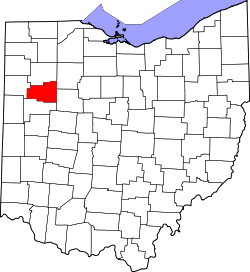 | |
| Villages | ||
| Townships | ||
| Unincorporated communities | ||
| Footnotes | ‡This populated place also has portions in an adjacent county or counties | |
Municipalities and communities of Van Wert County, Ohio, United States | ||
|---|---|---|
| Cities | 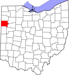 | |
| Villages | ||
| Townships | ||
| Unincorporated communities | ||
| Footnotes | ‡This populated place also has portions in an adjacent county or counties | |