Chesterfield Township, Michigan
| Chesterfield Charter Township, Michigan | |
|---|---|
| Charter township | |
| Motto: "the gateway to Anchor Bay..." [1] | |
 Chesterfield Charter Township, Michigan Location within the state of Michigan | |
| Coordinates: 42°40′15″N 82°48′34″W / 42.67083°N 82.80944°WCoordinates: 42°40′15″N 82°48′34″W / 42.67083°N 82.80944°W | |
| Country | United States |
| State | Michigan |
| County | Macomb |
| Area | |
| • Total | 30.7 sq mi (79.4 km2) |
| • Land | 27.9 sq mi (72.2 km2) |
| • Water | 2.8 sq mi (7.2 km2) |
| Elevation | 591 ft (180 m) |
| Population (2010) | |
| • Total | 43,381 |
| • Density | 1,341.7/sq mi (518.0/km2) |
| Time zone | Eastern (EST) (UTC-5) |
| • Summer (DST) | EDT (UTC-4) |
| ZIP codes | 48047, 48051 |
| Area code(s) | 586 |
| FIPS code[2] | 26-15340 |
| GNIS ID[3] | 1626074 |
| Website |
chesterfieldtwp |
Chesterfield Charter Township is a charter township of Macomb County in the U.S. state of Michigan. As of the 2000 census, the township population was 37,405. The 2010 Census places the population at 43,381.[4] The township was organized in 1842, formed out of a portion of Macomb Township. The Township is part of Metro Detroit.[5]
History
Chesterfield Township was originally established as a general law township in 1842, and became a Charter Township in 1989.[1]
In the past there was a hamlet here called Chesterfield. It was first settled in 1830. When the Grand Trunk Railroad came through in 1865 it began to have businesses. It had a post office from 1875 until 1907 but has since lost its specific identity.[6]
Geography
According to the United States Census Bureau, the township has a total area of 30.7 square miles (80 km2), of which 27.9 square miles (72 km2) is land and 2.8 square miles (7.3 km2) (9.07%) is water.
In the first decade of the 21st century, much of Chesterfield Township is dominated by subdivisions, shopping developments, and an increasingly diverse population, in contrast to previous decades when the community was considerably more rural and overwhelmingly white. With 89% of the population being non-Hispanic whites at the 2010 census the demographic changes in the population had clearly not been as great as some might suggest. The far northern end of the township is still largely rural. Anchor Bay influences the southeastern part of the community, where many pleasure boats, docks, and marine-related businesses can be found.
Chesterfield Township is bordered on the north by Lenox Township and the village of New Haven; on the east by Ira Township and New Baltimore; on the southeast by Anchor Bay, which is a part of Lake Saint Clair; on the south by Harrison Township; and on the west by Macomb Township.
Communities
There are no incorporated villages and nine unincorporated communities in the township:
- Anchor Bay Gardens is located off Jefferson Avenue at Sunrise Street and Jans Drive (42°38′34″N 82°48′45″W / 42.64278°N 82.81250°W; Elevation: 571 ft./174 m.).[7]
- Anchor Bay Harbor is located on Jefferson Avenue south of Anchor Bay Gardens between Sugerbush and Cotton roads (42°39′19.1″N 82°47′56.7″W / 42.655306°N 82.799083°W; Elevation: 577 ft./176 m.).[8]
- Anchor Bay Shores is located off Jefferson Avenue, south of Anchor Bay Harbor between William P. Rosso Highway and 21 Mile Road (42°38′08″N 82°49′00″W / 42.63556°N 82.81667°W; Elevation: 581 ft./177 m.) [9]
- Chesterfield is located on M-3 from 23 Mile Road to 22 Mile Road. (42°39′46″N 82°50′33″W / 42.66278°N 82.84250°W; Elevation: 607 ft./185 m.)[10]
- Chesterfield Shores is near the border with City of New Baltimore north of Jefferson Avenue and south of M-29/23 Mile Road (42°40′12″N 82°45′41″W / 42.67000°N 82.76139°W ; Elevation: 587 ft./179 m.).[11]
- Fairchild was located in the southern portion of the township. It had a post office starting in 1906.[12]
- Lottivue is located between Jefferson Avenue, Lake Saint Clair, Brandenburg Park and Schneider Road (42°39′34″N 82°45′43″W / 42.65944°N 82.76194°W ; Elevation: 577 ft./176 m.).[13]
- Milton is located at Gratiot Avenue and 24 Mile Road (42°41′21″N 82°49′19″W / 42.68917°N 82.82194°W; Elevation: 607 ft./185 m.)[14] and once was a station on the Grand Trunk Railroad. The first post office in the township was established here in 1837 in the house of Robert O. Milton, with the name of "New Haven Post Office". This was moved to New Haven and Alfred D. Rice established another post office in Milton.[5] That post office closed at some point and another was reopened in January 1856 with Edmund Matthews as postmaster. This office operated until July 1904.[15] Milton was home to a school, three churches, a doctor, a blacksmith, and a couple of saloons. The last saloon survived until 2004 when it was torn down, at that time it was known as the "Teddy Bear Bar." The school, known as Milton School, was incorporated into another building which was torn down in 2002.[16]
- Point Lakeview is located southwest of Lottivue between the Salt River and Lake Saint Clair.[17]
- Sebille Manor is located northwest of Anchor Bay Harbor between Sugarbush and Donner roads (42°39′40″N 82°48′44″W / 42.66111°N 82.81222°W; Elevation: 587 ft./179 m.).[18]
Demographics
As of the 2010 census Chesterfield Township had a population of 43,381. The racial and ethnic composition of the population was 89.5% non-Hispanic white, 5.3% African American, 0.4% Native American, 1.0% Asian, 0.1% non-Hispanics from some other race, 1.8% from two or more races and 2.4% Hispanic or Latino.[19]
As of the census[2] of 2000, there were 37,405 people, 13,347 households, and 10,076 families residing in the township. The population density was 1,341.7 per square mile (518.0/km²). There were 13,967 housing units at an average density of 501.0 per square mile (193.4/km²). The racial makeup of the township was 93.43% White, 2.97% African American, 0.40% Native American, 0.76% Asian, 0.02% Pacific Islander, 0.87% from other races, and 1.56% from two or more races. Hispanic or Latino of any race were 2.52% of the population.
There were 13,347 households out of which 43.1% had children under the age of 18 living with them, 62.1% were married couples living together, 9.5% had a female householder with no husband present, and 24.5% were non-families. 19.2% of all households were made up of individuals and 4.7% had someone living alone who was 65 years of age or older. The average household size was 2.78 and the average family size was 3.22.
In the township the population was spread out with 29.8% under the age of 18, 7.9% from 18 to 24, 36.4% from 25 to 44, 19.3% from 45 to 64, and 6.6% who were 65 years of age or older. The median age was 33 years. For every 100 females there were 98.5 males. For every 100 females age 18 and over, there were 95.6 males.
The median income for a household in the township was $61,630, and the median income for a family was $69,554. Males had a median income of $50,834 versus $30,275 for females. The per capita income for the township was $24,410. About 3.9% of families and 4.7% of the population were below the poverty line, including 6.8% of those under age 18 and 3.8% of those age 65 or over.
Economy
Chesterfield Township is home to Lionel, LLC; maker of Lionel Trains. In 2002 they moved their manufacturing out of the United States to China, however Chesterfield continues to the location of their corporate offices, and non-manufacturing support functions.
Government
The township is governed by a board of trustees and a township supervisor.
Fire Department
Chesterfield Township is served by 19 career Firefighters and 6 Paid-on-Call Firefighters with one full-time Chief and one Administrative assistant. The Department currently staffs three stations 24/7.
Education
Chesterfield Township is covered by two primary and secondary school districts, the Anchor Bay School District,[20] and L’Anse Creuse Public Schools.[21]
References
Notes
- 1 2 "Chesterfield Township, Michigan". Chesterfield Township, Michigan. Retrieved August 25, 2012.
- 1 2 "American FactFinder". United States Census Bureau. Archived from the original on 2013-09-11. Retrieved 2008-01-31.
- ↑ "Township of Chesterfield". Geographic Names Information System. United States Geological Survey.
- ↑ "Chesterfield Township Statistics". United States Census Bureau. Retrieved 2009-08-03.
- 1 2 Leeson, Michael A. (comp.) (2005) [1882]. "Chesterfield Township". History of Macomb County, Michigan. Ann Arbor, Mich.: University of Michigan Library. pp. 900 ff. Retrieved 2006-12-17.
- ↑ Romig 1986, p. 114.
- ↑ "Anchor Bay Gardens, Michigan". Geographic Names Information System. United States Geological Survey. & GNIS in Google Map
- ↑ "Anchor Bay Harbor, Michigan". Geographic Names Information System. United States Geological Survey. & GNIS in Google Map
- ↑ "Anchor Bay Shores, Michigan". Geographic Names Information System. United States Geological Survey. & GNIS in Google Map
- ↑ "Chesterfield, Michigan". Geographic Names Information System. United States Geological Survey. & GNIS in Google Map
- ↑ "Chesterfield Shores, Michigan". Geographic Names Information System. United States Geological Survey. & GNIS in Google Map
- ↑ Romig 1986, p. 189.
- ↑ "Lottivue, Michigan". Geographic Names Information System. United States Geological Survey. & GNIS in Google Map
- ↑ "Milton, Michigan". Geographic Names Information System. United States Geological Survey.
- ↑ Romig 1986, pp. 114, 189.
- ↑ Local History Tales Archive, Macomb County Historical Commission, Alan Naldrett
- ↑ "Point Lakeview, Michigan". Geographic Names Information System. United States Geological Survey. & GNIS in Google Map
- ↑ "Sebille Manor, Michigan". Geographic Names Information System. United States Geological Survey. & GNIS in Google Map
- ↑ 2010 census data for Chesterfield Township
- ↑ "Anchor Bay School District". Anchor Bay School District. Archived from the original on July 29, 2012. Retrieved August 24, 2012.
- ↑ "L'Anse Creuse Public Schools". L’Anse Creuse Public Schools. Retrieved August 24, 2012.
Sources
- Romig, Walter (October 1, 1986) [1973]. Michigan Place Names: The History of the Founding and the Naming of More Than Five Thousand Past and Present Michigan Communities. Great Lakes Books Series (Paperback). Detroit, Michigan: Wayne State University Press. ISBN 081431838X. ISBN 978-0814318386.
External links
- Official Website of the Charter Township of Chesterfield
- Official Website of the Chesterfield Township Fire Department
- Chesterfield Township historical society.
- Tachyon Corporation - Chesterfield based company serving the machine tool industry
- Lionel Trains Website
- Chesterfield Library
 |
Ray Township | Lenox Township | Casco Township | |
| Macomb Township | |
Ira Township New Baltimore | ||
| ||||
| | ||||
| Clinton Township | Harrison Township | Lake St. Clair / Clay Township |
Municipalities and communities of Macomb County, Michigan, United States | ||
|---|---|---|
| Cities | 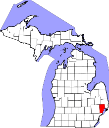 | |
| Villages | ||
| Charter townships | ||
| General law townships | ||
| Unincorporated community |
| |
| Footnotes | ‡This populated place also has portions in an adjacent county or counties | |
