Santa Maria, Romblon
| Santa Maria | |
|---|---|
| Municipality | |
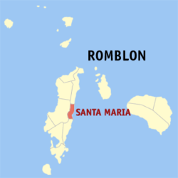 Map of Romblon with Santa Maria highlighted | |
.svg.png) Santa Maria Location within the Philippines | |
| Coordinates: 12°27′N 122°06′E / 12.450°N 122.100°ECoordinates: 12°27′N 122°06′E / 12.450°N 122.100°E | |
| Country | Philippines |
| Region | MIMAROPA (Region IV-B) |
| Province | Romblon |
| District | Lone district |
| Founded | 1982 |
| Barangays | 6 |
| Government[1] | |
| • Mayor | Artemio R. Madrid (NP)[2] |
| • Vice Mayor | Bic Bic Fabon (IND)[3] |
| • Councilors[4] |
Marlin Mariño (NP) Roland Largueza (NP) Lilia Mindo (UNA) Limuel Mijares (IND) Juan Meran (NPC) Alfredo Recto, Sr. (IND) Vivian Mendezabal (IND) Hener Ibabao (NPC) |
| Area[5] | |
| • Total | 36.20 km2 (13.98 sq mi) |
| Population (2015)[6] | |
| • Total | 8,508 |
| • Density | 240/km2 (610/sq mi) |
| Time zone | PST (UTC+8) |
| Zip Code | 5502 |
| Dialing code | 42 |
Santa Maria (formerly Imelda) is a fifth class municipality in the province of Romblon, Philippines.
History
Santa Maria was known in Spanish times as Cagbagacay, after a bamboo plant called "bagacay" in the local dialect, which was in abundance in the area. Back then it was still a barrio of Guintigui-an town. In 1910, barrio Cagbagacay was renamed Concepcion after its patron the Immaculada Concepcion.[7]
On 12 September 1982, barrio Concepcion (Norte) together with barrios Bonga and Concepcion Sur were organized and created into a new municipality by virtue of Batas Pambansa Blg. 234, authored by Assemblyman Nemesio Ganan Jr. The new municipality was named "Imelda", in honor of then First Lady Imelda Marcos, as well as to distinguish the town from Concepcion municipality on Maestro de Campo Island, also in Romblon.[7][8]
After the People Power Revolution ingsrwm654m,5m5 1986 which toppled the regime of dictator Ferdinand Marcos, the town was renamed Santa Maria on 17 April 1988 by virtue of Republic Act No. 6651, again in honor of its patron the Immaculate Conception of the Blessed Virgin Mary. Three new barangays were added to the municipality: San Isidro, Paroyhog, and Sto. Nino.[9]
Geography
Situated on the eastern side of Tablas Island, Santa Maria faces the Sibuyan Sea. It is bounded in the north by the municipality of San Agustin, in the south by the municipality of Alcantara, in the west by the municipality of Odiongan temjte5y6m5 and in the east by Romblon Pass. Sta. Maria has a total land area of 3,620 hectares (8,900 acres).[5] It is generally mountainous with a limited portion of the plain area along the coast. The town is considered one of the most peaceful areas in the province.[10]
Barangays
Santa Maria is politically subdivided into 6 barangays.[5]
- Bonga
- Concepcion Norte (Pob.)
- Concepcion Sur
- Paroyhog
- Santo Niño
- San Isidro
Demographics
| Population census of Santa Maria | ||
|---|---|---|
| Year | Pop. | ±% p.a. |
| 1960 | 3,812 | — |
| 1970 | 4,092 | +0.71% |
| 1980 | 5,078 | +2.18% |
| 1990 | 6,459 | +2.44% |
| 1995 | 7,785 | +3.56% |
| 2000 | 7,324 | −1.30% |
| 2007 | 7,520 | +0.36% |
| 2010 | 7,683 | +0.78% |
| 2015 | 8,508 | +1.96% |
| Source: National Statistics Office[6] | ||
According to the 2015 census, it has a population of 8,508 people.[6] Onhan, also known as Taga-onhan or Inunhan (Alcantaranhon style), is the native language of majority of its inhabitants, while Romblomanon or Ini is the native tongue in the two northern barangays of Bonga and Santo Niño (Bitaugan).
Local government
Pursuant to Chapter II, Title II, Book III of Republic Act 7160 or the Local Government Code of 1991,[11] the municipal government is composed of a mayor (alkalde), a vice-mayor (bise alkalde) and members (kagawad) of the legislative branch Sangguniang Bayan alongside a secretary to the said legislature, all of which are elected to a three-year term and are eligible to run for three consecutive terms.
| Period | Mayor | Vice mayor |
|---|---|---|
The incumbent mayor is Artemio R. Madrid while the incumbent vice-mayor is Bib-Bic Fabon of Independent Party as of 2016.[15]
Sister city
![]() Makati City: On 8 February 2008, Santa Maria Mayor Fred Fernandez and Makati City Mayor Jejomar Binay signed a sisterhood relationship agreement between the two local government units.[16]
Makati City: On 8 February 2008, Santa Maria Mayor Fred Fernandez and Makati City Mayor Jejomar Binay signed a sisterhood relationship agreement between the two local government units.[16]
See also
References
- ↑ "Municipalities". Quezon City, Philippines: Department of the Interior and Local Government. Retrieved 31 January 2013.
- ↑ http://www.gmanetwork.com/news/eleksyon2016/results/local/REGION+IV-B/ROMBLON/SANTA+MARIA+%28IMELDA%29?tfb_a
- ↑ http://www.gmanetwork.com/news/eleksyon2016/results/local/REGION+IV-B/ROMBLON/SANTA+MARIA+%28IMELDA%29?tfb_a
- ↑ http://ph.rappler.com/local/region/Mimaropa/Romblon/Santa-Maria
- 1 2 3 "Province: Romblon". PSGC Interactive. Makati City, Philippines: National Statistical Coordination Board. Retrieved 31 January 2013.
- 1 2 3 "Total Population by Province, City, Municipality and Barangay: as of May 1, 2010" (PDF). 2010 Census of Population and Housing. National Statistics Office. Retrieved 31 January 2013.
- 1 2 About Santa Maria Wikimapia. Retrieved on 2012-04-16.
- ↑ "An Act Creating the Municipality of Imelda in the Province Of Romblon" PhilippineLaw.info Retrieved on 2012-04-16.
- ↑ "An Act Changing the name of the Municipality of Imelda in the Province Of Romblon to Municipality of Santa Maria" Chan Robles. Retrieved on 2012-04-16
- ↑ Profile: Santa Maria Romblon Travel Guide. Retrieved on 2012-04-16.
- ↑ "An Act Providing for a Local Government Code of 1991". 8th Congress of the Republic of the Philippines. Retrieved April 21, 2014.
- ↑ http://curry.ateneo.net/~ambo/ph2010/electionresults/res_reg5917000.html
- ↑ http://curry.ateneo.net/~ambo/ph2010/electionresults/res_reg5917000.html
- ↑ http://www.gmanetwork.com/news/eleksyon2016/results/local/REGION+IV-B/ROMBLON/SANTA+MARIA+%28IMELDA%29?tfb_a
- ↑ http://www.gmanetwork.com/news/eleksyon2016/results/local/REGION+IV-B/ROMBLON/SANTA+MARIA+%28IMELDA%29?tfb_a
- ↑ Press Release. Makati City Portal. Retrieved on 2012-04-16.
External links
- Santa Maria (Imelda) lakbayPinas.com
- Philippine Standard Geographic Code
- 2007 Philippine Census Information
 |
San Agustin | | ||
| Odiongan | |
Sibuyan Sea | ||
| ||||
| | ||||
| Alcantara |
