Salt Point, New York
| Salt Point, New York | |
|---|---|
| Census-designated place | |
 Location of Salt Point, New York | |
| Coordinates: 41°48′22″N 73°47′41″W / 41.80611°N 73.79472°WCoordinates: 41°48′22″N 73°47′41″W / 41.80611°N 73.79472°W | |
| Country | United States |
| State | New York |
| County | Dutchess County |
| Town | Pleasant Valley |
| Area | |
| • Total | 0.83 sq mi (2.16 km2) |
| • Land | 0.83 sq mi (2.15 km2) |
| • Water | 0.004 sq mi (0.01 km2) |
| Elevation | 250 ft (80 m) |
| Population (2010) | |
| • Total | 190 |
| • Density | 229/sq mi (88.4/km2) |
| Time zone | EST (UTC-5) |
Salt Point is a hamlet and census-designated place (CDP) in Dutchess County, New York, United States. As of the 2010 census it had a population of 190.[1] It lies northeast of Poughkeepsie following New York Route 115, the Salt Point Turnpike. East of Salt Point, the Taconic State Parkway allows for access to many of the surrounding towns and communities, with easy travel to New York City. The area code is 845 and the exchange is COlfax6.
Parks and recreation
The following parks are located within the general Salt Point area:
- Helen Aldrich Park, part of the Pleasant Valley town recreation system of parks
- Frances J. Mark Memorial Park, located in Clinton
- Friends' Park, also in Clinton
Communities and locations around Salt Point
- Netherwood—A location southwest of Salt Point.
- Pleasant Valley—A hamlet southwest of Salt Point.
- Washington Hollow—A hamlet near the southeast town line. It was the former location of the Dutchess County Fair.
- Hibernia—A location east of Salt Point.
| Northwest: Pleasant Plains |
North: Clinton Hollow |
Northeast: Clinton Corners |
| West: Netherwood |
Salt Point | East: Hibernia |
| Southwest: Pleasant Valley |
South: Lagrange & Freedom Plains |
Southeast: Millbrook & Washington Hollow |
References
- ↑ "Geographic Identifiers: 2010 Demographic Profile Data (G001): Salt Point CDP, New York". U.S. Census Bureau, American Factfinder. Retrieved November 20, 2015.
External links
- History of Salt Point, town of Pleasant Valley website
Municipalities and communities of Dutchess County, New York, United States | ||
|---|---|---|
| Cities | 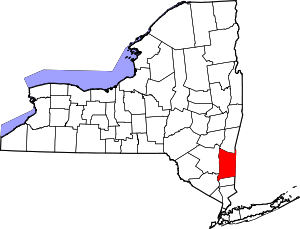 | |
| Towns | ||
| Villages | ||
| CDPs | ||
| Other hamlets | ||
| Footnotes | ‡This populated place also has portions in an adjacent county or counties | |
This article is issued from Wikipedia - version of the 7/2/2016. The text is available under the Creative Commons Attribution/Share Alike but additional terms may apply for the media files.
