Saint Mary's Wilderness
| Saint Mary's Wilderness | |
| Part of George Washington National Forest | |
| Wilderness Area | |
| Country | United States |
|---|---|
| State | Virginia |
| County | Augusta |
| Elevation | 3,400 ft (1,036.3 m) |
| Coordinates | 37°55′29″N 79°08′07″W / 37.92472°N 79.13528°WCoordinates: 37°55′29″N 79°08′07″W / 37.92472°N 79.13528°W |
| Highest point | |
| - elevation | 3,640 ft (1,109.5 m) |
| Lowest point | |
| - elevation | 1,780 ft (542.5 m) |
| Area | 35,864 acres (14,513.6 ha) [1] |
| Established | 1984 |
| Management | George Washington and Jefferson National Forests |
| Owner | USDA Forest Service |
| IUCN category | Ib - Wilderness Area |
| Nearest city | Steele's Tavern, Virginia |
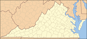 Location of Saint Mary's Wilderness in Virginia | |
| Website: George Washington and Jefferson National Forests - Saint Mary's Wilderness Area | |
Saint Mary's Wilderness is a U.S. Wilderness Area in the George Washington and Jefferson National Forests. The wilderness area is located next to the Blue Ridge Parkway near the Parkway's northern terminus and consists of 35,864 acres (145.14 km2). Saint Mary's Wilderness is the largest Virginia Wilderness on national forest land,.[2] Saint Mary's Wilderness ranges in elevation from about 1,780 feet (543 m) to 3,640 feet (1,109 m). The area has about 27 miles (43 km) of hiking trails within or near its boundaries.
Saint Mary's Wilderness includes the drainages of Cellar Hollow, Spy Run, and the upper part of the Saint Mary's River. Each waterway is a tributary of the South River; via the Maury and James Rivers, which is part of the Chesapeake Bay watershed.
History
The Saint Mary's River gorge was mined for manganese ore and iron ore from the early 1900s until the mines were abandoned in the 1950s. Scattered remains of the mining operations are still evident. Saint Mary's was designated a Wilderness as a part of the Virginia Wilderness Act of 1984.[3]
Recreation
Saint Mary's Wilderness is particularly popular during summer due to a large number of waterfalls within its boundaries. See Saint Marys Waterfalls Photo Album. Fishermen can take native trout from the Saint Mary's River.[4]
There is an extensive network of hiking trails. Trails include:
- Saint Mary's River Trail
- Saint Mary's Waterfall Trail
- Mine Bank Trail
- Cellar Mountain Trail
- Cold Springs Trail
See also
References
External links
- National Forest Web site
- Hiking Upward website account of Saint Mary's hike
- Wilderness.net
- TopoQuest topographic map
- Saint Mary's Hike detail
- Details of a joint Forest Service/James Madison University project to lime streams in Saint Mary's Wilderness