Saint-Grégoire, Ille-et-Vilaine
| Saint-Grégoire Sant-Gregor | |
|---|---|
|
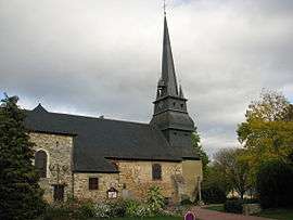
The church of Saint-Grégoire | |
 Saint-Grégoire | |
|
Location within Brittany region  Saint-Grégoire | |
| Coordinates: 48°09′06″N 1°41′06″W / 48.1517°N 1.6850°WCoordinates: 48°09′06″N 1°41′06″W / 48.1517°N 1.6850°W | |
| Country | France |
| Region | Brittany |
| Department | Ille-et-Vilaine |
| Arrondissement | Rennes |
| Canton | Betton |
| Intercommunality | Rennes Métropole |
| Government | |
| • Mayor (2014–2020) | Pierre Breteau |
| Area1 | 17.30 km2 (6.68 sq mi) |
| Population (2009)2 | 8,333 |
| • Density | 480/km2 (1,200/sq mi) |
| Time zone | CET (UTC+1) |
| • Summer (DST) | CEST (UTC+2) |
| INSEE/Postal code | 35278 / 35760 |
| Elevation | 25–92 m (82–302 ft) |
|
1 French Land Register data, which excludes lakes, ponds, glaciers > 1 km² (0.386 sq mi or 247 acres) and river estuaries. 2 Population without double counting: residents of multiple communes (e.g., students and military personnel) only counted once. | |
Saint-Grégoire (Breton: Sant-Gregor) is a commune in the Ille-et-Vilaine department of Brittany in northwestern France.
Population
Inhabitants of Saint-Grégoire are called grégoriens in French.
| Historical population | ||
|---|---|---|
| Year | Pop. | ±% |
| 1962 | 1,462 | — |
| 1968 | 2,086 | +42.7% |
| 1975 | 2,461 | +18.0% |
| 1982 | 3,856 | +56.7% |
| 1990 | 5,816 | +50.8% |
| 1999 | 7,977 | +37.2% |
| 2009 | 8,333 | +4.5% |
See also
References
External links
| Wikimedia Commons has media related to Saint-Grégoire (Ille-et-Vilaine). |
This article is issued from Wikipedia - version of the 12/23/2015. The text is available under the Creative Commons Attribution/Share Alike but additional terms may apply for the media files.
