Sława
| Sława | ||
|---|---|---|
|
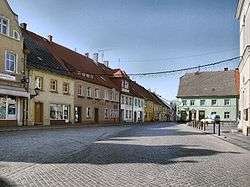
The marketplace | ||
| ||
 Sława | ||
| Coordinates: 51°53′N 16°5′E / 51.883°N 16.083°E | ||
| Country |
| |
| Voivodeship | Lubusz | |
| County | Wschowa | |
| Gmina | Sława | |
| Area | ||
| • Total | 14.31 km2 (5.53 sq mi) | |
| Population (2006) | ||
| • Total | 3,893 | |
| • Density | 270/km2 (700/sq mi) | |
| Postal code | 67-410 | |
| Climate | Dfb | |
| Website | http://www.slawa.pl | |

Sława [ˈswava] (German: Schlesiersee; until 1937: Schlawa) is a town in Wschowa County, Lubusz Voivodeship, Poland, with 3,960 inhabitants (2004).
Before 1945 the town was part of Germany. After World War II and the subsequent border shift, the region was placed under Polish administration and ethnically cleansed according to the post-war Potsdam Agreement. The native German populace was expelled and replaced with Poles, Before 1945 the village was part of Germany. After World War II and the subsequent border shift, the region was placed under Polish administration and ethnically cleansed according to the post-war Potsdam Agreement. The native German populace was expelled and replaced with Poles expelled from Polish Eastern territories, Kresy, annected by Soviet Union according to German-Soviet agreement from 1939.
| Wikimedia Commons has media related to Sława. |
Coordinates: 51°53′N 16°05′E / 51.883°N 16.083°E