Jaunjelgava
| Jaunjelgava Friedrichstadt | ||
|---|---|---|
| Town | ||
 | ||
| ||
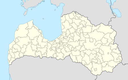 Jaunjelgava Location in Latvia | ||
| Coordinates: 56°36′N 25°5′E / 56.600°N 25.083°E | ||
| Country |
| |
| District | Jaunjelgava municipality | |
| Town rights | 1647 | |
| Area | ||
| • Total | 6.1 km2 (2.4 sq mi) | |
| • Rural territory | 5.1 km2 (2.0 sq mi) | |
| Population | ||
| • Total | 2,245 | |
| • Density | 440/km2 (1,100/sq mi) | |
| Time zone | EET (UTC+2) | |
| • Summer (DST) | EEST (UTC+3) | |
| Postal code | LV-5134 | |
| Calling code | +371 651 | |
| Number of city council members | 9 | |
| Website | http://www.jaunjelgava.lv | |

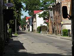
Jaunjelgava (![]() pronunciation German: Friedrichstadt) is a town in Latvia on the left bank of the Daugava River about 80 km southeast of Riga.
pronunciation German: Friedrichstadt) is a town in Latvia on the left bank of the Daugava River about 80 km southeast of Riga.
It was a fortress in Selonia which was levelled in the 13th century by Crusaders. A country estate and a settlement were formed around 1450. In 1590 Duke Friedrich Kettler founded the town market. At that time about 60 families lived at the market. The town was devastated in 1621, during the Polish-Swedish war, and was re-established as a city in 1646. In 1710 the plague, and 1831 and 1848 cholera, raged. In addition, there were several large fires in the town. Nevertheless, the town grew and was the district seat from 1795 on. After the opening of the Riga-Daugavpils railway line in 1861, the Daugava River waterway, and thus the city, lost its importance.
Shtetl
Jaunjelgava was one of many shtetls which once existed in the Pale of Settlement. Its Jewish community was established toward the close of the seventeenth century. In 1897, 3,800 of its population of 5,223 were Jews.[1]
Jaunjelgava municipality
In 2009 the city joined six surrounding communities to form a local government district. (See also: Administrative divisions of Latvia)
Selected publications
- Heinz zur Mühlen: Baltisches historisches Ortslexikon, Tl. 2, Lettland (Südlivland und Kurland), ISBN 978-3-41206-889-9
- Latvijas Pagastu Enciklopēdeija, 2002, ISBN 9984-00-436-8
- Friedrichstadt entry in the Jewish Encyclopedia
See also
Photo gallery
 Jaunjelgava town hall
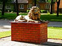 Sculpture of a lion, the symbol of Jaunjelgava
 Daugava River
 Jaunjelgava's Orthodox church
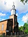 Jaunjelgava's Catholic church
 Bus stop
References
- ↑ Friedrichstadt entry in the Jewish Encyclopedia