Roneys Point, West Virginia
| Roneys Point | |
|---|---|
| Unincorporated community | |
|
Stone Tavern at Roney's Point, early nineteenth century | |
 Roneys Point  Roneys Point Location within the state of West Virginia | |
| Coordinates: 40°4′25″N 80°35′59″W / 40.07361°N 80.59972°WCoordinates: 40°4′25″N 80°35′59″W / 40.07361°N 80.59972°W | |
| Country | United States |
| State | West Virginia |
| County | Ohio |
| Time zone | Eastern (EST) (UTC-5) |
| • Summer (DST) | EDT (UTC-4) |
| GNIS feature ID | 1560599[1] |

Roneys Point is an unincorporated community in Ohio County, West Virginia, United States. Roneys Point is located along Little Wheeling Creek on the National Road (U.S. Route 40) between Point Mills and Valley Camp. It is part of the Wheeling, West Virginia Metropolitan Statistical Area.
Roney's point most likely was named for an early settler with the surname Roney (first name unknown).[2]
References
- ↑ U.S. Geological Survey Geographic Names Information System: Roneys Point, West Virginia
- ↑ Kenny, Hamill (1945). West Virginia Place Names: Their Origin and Meaning, Including the Nomenclature of the Streams and Mountains. Piedmont, WV: The Place Name Press. p. 541.
Municipalities and communities of Ohio County, West Virginia, United States | ||
|---|---|---|
| City | 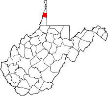 | |
| Towns | ||
| Villages | ||
| Unincorporated communities | ||
| Ghost town | ||
| Footnotes | ‡This populated place also has portions in an adjacent county or counties | |
This article is issued from Wikipedia - version of the 8/10/2016. The text is available under the Creative Commons Attribution/Share Alike but additional terms may apply for the media files.