Rockwood, Pennsylvania
| Rockwood, Pennsylvania previously Mineral Point (c. 1857) | |
|---|---|
| Borough | |
|
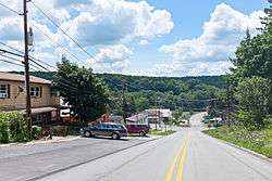
View down Bridge St. | |
 | |
| Coordinates: 39°54′58″N 79°09′21″W / 39.91611°N 79.15583°WCoordinates: 39°54′58″N 79°09′21″W / 39.91611°N 79.15583°W | |
| Country | United States |
| State | Pennsylvania |
| County | Somerset |
| Settled | 1857 |
| Incorporated | 1885 |
| Government | |
| • Type | Borough Council |
| Area | |
| • Total | 0.3 sq mi (0.8 km2) |
| Elevation | 1,837 ft (560 m) |
| Population (2000) | |
| • Total | 954 |
| • Density | 3,053.4/sq mi (1,178.9/km2) |
| Time zone | Eastern (EST) (UTC-5) |
| • Summer (DST) | EDT (UTC-4) |
| Zip code | 15557 |
| Area code(s) | 814 |
Rockwood is a borough in Somerset County, Pennsylvania, United States. The population was 954 at the 2000 census. It is part of the Johnstown, Pennsylvania Metropolitan Statistical Area, and located due North of Pennsylvania's highest peak, Mount Davis, which significantly constricts land travel routing south of the municipality.
History
The Penrose Wolf Building was added to the National Register of Historic Places in 2002.[1] The town sits astride the historic Baltimore and Ohio railway right of way as it bent northerly in a long bow about the roots of Mount Davis, now owned and operated by CSX, with daily Amtrak express trains between Pittsburgh and Cumberland, MD passing through the town and the nearby Cumberland Narrows. It is situated near and below the West slope-side summit-point of both the Nemacolin Trail and Braddock's Road, as well as the railway as each ascended past the crest up through the Cumberland Narrows pass from the forks of the Potomac at Harper's Ferry. The town was thus an important stop over point in the post-American Revolution westward migration into the Ohio Country and via the river boats built in Brownsville.
Geography
Rockwood is located at 39°54′58″N 79°9′21″W / 39.91611°N 79.15583°W (39.916222, -79.155808).[2] It is situated near and below the West-side crest of the Eastern Continental Divide separating the Potomac-Mississippi riverine systems along the north bank of the Casselman River—whose head waters are to the south in nearby Western Maryland—and just west of its confluence with Coxes Creek.
According to the United States Census Bureau, the borough has a total area of 0.3 square miles (0.78 km2), all of it land.
Demographics
| Historical population | |||
|---|---|---|---|
| Census | Pop. | %± | |
| 1880 | 331 | — | |
| 1890 | 553 | 67.1% | |
| 1900 | 685 | 23.9% | |
| 1910 | 1,300 | 89.8% | |
| 1920 | 1,362 | 4.8% | |
| 1930 | 1,176 | −13.7% | |
| 1940 | 1,375 | 16.9% | |
| 1950 | 1,237 | −10.0% | |
| 1960 | 1,101 | −11.0% | |
| 1970 | 1,051 | −4.5% | |
| 1980 | 1,058 | 0.7% | |
| 1990 | 1,014 | −4.2% | |
| 2000 | 954 | −5.9% | |
| 2010 | 890 | −6.7% | |
| Est. 2015 | 854 | [3] | −4.0% |
| Sources:[4][5][6] | |||
As of the census[5] of 2000, there were 954 people, 406 households, and 272 families residing in the borough. The population density was 3,053.4 people per square mile (1,188.2/km²). There were 421 housing units at an average density of 1,347.4 per square mile (524.4/km²). The racial makeup of the borough was 99.58% White, 0.10% Native American, 0.10% Asian, and 0.21% from two or more races.
There were 406 households out of which 29.8% had children under the age of 18 living with them, 51.2% were married couples living together, 11.6% had a female householder with no husband present, and 33.0% were non-families. 29.1% of all households were made up of individuals and 11.8% had someone living alone who was 65 years of age or older. The average household size was 2.28 and the average family size was 2.79.
In the borough the population was spread out with 22.0% under the age of 18, 8.4% from 18 to 24, 27.7% from 25 to 44, 23.8% from 45 to 64, and 18.1% who were 65 years of age or older. The median age was 39 years. For every 100 females there were 92.3 males. For every 100 females age 18 and over, there were 92.7 males.
The median income for a household in the borough was $25,139, and the median income for a family was $31,023. Males had a median income of $26,500 versus $20,066 for females. The per capita income for the borough was $13,687. About 12.3% of families and 15.1% of the population were below the poverty line, including 13.7% of those under age 18 and 9.3% of those age 65 or over.
Schools
Both the Rockwood Area Elementary School and the Rockwood Area Junior/Senior High School are located within the Borough of Rockwood. A second elementary school within the Rockwood School District is the Kingwood Elementary School, however this elementary school is not within the Borough of Rockwood. It is closed now, and was sold to the Kingwood Church of God.
Typically, Rockwood High School graduates 65 - 80 students per year.[7]
Transportation
PA 653 runs through Rockwood. The nearest limited-access freeway is the Pennsylvania Turnpike at Somerset, 10 miles (16 km) to the north.
Up until April 30, 1971, Rockwood was a stop on the Baltimore & Ohio's daily Washington—Akron passenger train. Since 1981 Amtrak's Capitol Limited (Chicago—Washington) has passed through Rockwood without stopping. Since 1990 local officials have lobbied for Rockwood to be added as a stop, and in October 2009 Amtrak released a feasibility study which placed the cost of a new station at $2.2 million.[8][9]
References
- ↑ National Park Service (2010-07-09). "National Register Information System". National Register of Historic Places. National Park Service.
- ↑ "US Gazetteer files: 2010, 2000, and 1990". United States Census Bureau. 2011-02-12. Retrieved 2011-04-23.
- ↑ "Annual Estimates of the Resident Population for Incorporated Places: April 1, 2010 to July 1, 2015". Retrieved July 2, 2016.
- ↑ "Census of Population and Housing". U.S. Census Bureau. Retrieved 11 December 2013.
- 1 2 "American FactFinder". United States Census Bureau. Retrieved 2008-01-31.
- ↑ "Incorporated Places and Minor Civil Divisions Datasets: Subcounty Resident Population Estimates: April 1, 2010 to July 1, 2012". Population Estimates. U.S. Census Bureau. Retrieved 11 December 2013.
- ↑ Public Schools Report http://schools.publicschoolsreport.com/Pennsylvania/Rockwood/RockwoodAreaJshs.html
- ↑ Rock, Vicki (June 24, 2008). "Chamber lobbies for Rockwood Amtrak stop". Daily American. Retrieved 2009-12-18.
- ↑ Amtrak (October 16, 2009). "P.R.I.I.A. Section 224: Pennsylvania Feasibility: Studies Report" (PDF). Retrieved 2009-12-18.
Municipalities and communities of Somerset County, Pennsylvania, United States | ||
|---|---|---|
| Boroughs |  | |
| Townships | ||
| CDPs | ||
| Unincorporated communities | ||
| Footnotes | ‡This populated place also has portions in an adjacent county or counties | |