Rockport, Kentucky
| Rockport, Kentucky | |
|---|---|
| City | |
 Location of Rockport, Kentucky | |
| Coordinates: 37°20′11″N 86°59′34″W / 37.33639°N 86.99278°WCoordinates: 37°20′11″N 86°59′34″W / 37.33639°N 86.99278°W | |
| Country | United States |
| State | Kentucky |
| County | Ohio |
| Area | |
| • Total | 0.8 sq mi (2.1 km2) |
| • Land | 0.8 sq mi (2.0 km2) |
| • Water | 0.0 sq mi (0.1 km2) |
| Elevation | 436 ft (133 m) |
| Population (2000) | |
| • Total | 334 |
| • Density | 439.9/sq mi (169.9/km2) |
| Time zone | Central (CST) (UTC-6) |
| • Summer (DST) | CDT (UTC-5) |
| ZIP code | 42369 |
| Area code(s) | 270 |
| FIPS code | 21-66216 |
| GNIS feature ID | 0502221 |
Rockport is a city in Ohio County, Kentucky, United States. The population was 334 at the 2000 census. The city is descriptively named for the large rocks on a nearby river bank.[1]
Geography
Rockport is located at 37°20′11″N 86°59′34″W / 37.33639°N 86.99278°W (37.336428, −86.992778).[2]
According to the United States Census Bureau, the city has a total area of 0.8 square miles (2.1 km2), of which 0.8 square miles (2.1 km2) is land and 0.04 square miles (0.10 km2) (5.00%) is water.
Demographics
| Historical population | |||
|---|---|---|---|
| Census | Pop. | %± | |
| 1870 | 173 | — | |
| 1880 | 390 | 125.4% | |
| 1890 | 435 | 11.5% | |
| 1900 | 525 | 20.7% | |
| 1910 | 658 | 25.3% | |
| 1920 | 950 | 44.4% | |
| 1930 | 671 | −29.4% | |
| 1940 | 501 | −25.3% | |
| 1950 | 450 | −10.2% | |
| 1960 | 396 | −12.0% | |
| 1970 | 377 | −4.8% | |
| 1980 | 511 | 35.5% | |
| 1990 | 385 | −24.7% | |
| 2000 | 334 | −13.2% | |
| 2010 | 266 | −20.4% | |
| Est. 2015 | 269 | [3] | 1.1% |
As of the census[5] of 2000, there were 334 people, 133 households, and 104 families residing in the city. The population density was 439.9 people per square mile (169.7/km²). There were 152 housing units at an average density of 200.2 per square mile (77.2/km²). The racial makeup of the city was 99.40% White, and 0.60% from two or more races.
There were 133 households out of which 27.1% had children under the age of 18 living with them, 65.4% were married couples living together, 10.5% had a female householder with no husband present, and 21.1% were non-families. 19.5% of all households were made up of individuals and 10.5% had someone living alone who was 65 years of age or older. The average household size was 2.51 and the average family size was 2.85.
In the city the population was spread out with 20.1% under the age of 18, 9.3% from 18 to 24, 24.3% from 25 to 44, 29.9% from 45 to 64, and 16.5% who were 65 years of age or older. The median age was 42 years. For every 100 females there were 98.8 males. For every 100 females age 18 and over, there were 97.8 males.
The median income for a household in the city was $28,889, and the median income for a family was $32,500. Males had a median income of $42,188 versus $16,750 for females. The per capita income for the city was $13,184. About 22.4% of families and 26.1% of the population were below the poverty line, including 38.4% of those under age 18 and 14.6% of those age 65 or over.
References
- ↑ Rennick, Robert M. Kentucky Place Names. University Press of Kentucky. p. 254. ISBN 0-8131-2631-2.
- ↑ "US Gazetteer files: 2010, 2000, and 1990". United States Census Bureau. 2011-02-12. Retrieved 2011-04-23.
- ↑ "Annual Estimates of the Resident Population for Incorporated Places: April 1, 2010 to July 1, 2015". Retrieved July 2, 2016.
- ↑ "Census of Population and Housing". Census.gov. Retrieved June 4, 2015.
- ↑ "American FactFinder". United States Census Bureau. Retrieved 2008-01-31.
Municipalities and communities of Ohio County, Kentucky, United States | ||
|---|---|---|
| Cities | 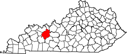 | |
| CDP | ||
| Other unincorporated communities | ||