Roca Colom
| Roca Colom | |
|---|---|
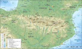 Roca Colom Location in the Pyrenees | |
| Highest point | |
| Elevation | 2,506 m (8,222 ft) |
| Prominence | 124 m (407 ft) |
| Coordinates | 42°25′30″N 02°19′07″E / 42.42500°N 2.31861°ECoordinates: 42°25′30″N 02°19′07″E / 42.42500°N 2.31861°E |
| Geography | |
| Location |
Ripollès, Vallespir, Conflent Catalonia |
| Parent range | Pyrenees |
| Climbing | |
| First ascent | Unknown |
| Easiest route | From Vallter 2000 ski resort |
Roca Colom (in Catalan) or Roc Colom (in French) is a mountain of Catalonia. It is located in the Pyrenees, at the border between Spain and France in the area of the Circ del Concròs in the Mentet, Setcases and Prats de Molló municipal terms. The mountain has an elevation of 2,506 metres above sea level.[1]
The name of the mountain means "Pigeon Rock" in the Catalan language.
See also
References
- ↑ "Mapa Topogràfic de Catalunya". Institut Cartogràfic de Catalunya. Retrieved May 22, 2010..
This article is issued from Wikipedia - version of the 6/2/2013. The text is available under the Creative Commons Attribution/Share Alike but additional terms may apply for the media files.