Reydon, Oklahoma
| Reydon, Oklahoma | |
|---|---|
| Town | |
 Location of Reydon, Oklahoma | |
| Coordinates: 35°39′10″N 99°55′17″W / 35.65278°N 99.92139°WCoordinates: 35°39′10″N 99°55′17″W / 35.65278°N 99.92139°W | |
| Country | United States |
| State | Oklahoma |
| County | Roger Mills |
| Area | |
| • Total | 0.4 sq mi (1.1 km2) |
| • Land | 0.4 sq mi (1.1 km2) |
| • Water | 0.0 sq mi (0.0 km2) |
| Elevation | 2,283 ft (696 m) |
| Population (2010) | |
| • Total | 210 |
| • Density | 530/sq mi (190/km2) |
| Time zone | Central (CST) (UTC-6) |
| • Summer (DST) | CDT (UTC-5) |
| ZIP code | 73660 |
| Area code(s) | 580 |
| FIPS code | 40-63100[1] |
| GNIS feature ID | 1101623[2] |
Reydon is a town in Roger Mills County, Oklahoma, United States. The population was 210 at the 2010 census.
Geography
Reydon is located at 35°39′10″N 99°55′17″W / 35.65278°N 99.92139°W (35.652899, -99.921304).[3] According to the United States Census Bureau, the town has a total area of 0.4 square miles (1.0 km2), all of it land.
Reydon is located at the northern intersection of State Highway 30 and State Highway 47.
Demographics
| Historical population | |||
|---|---|---|---|
| Census | Pop. | %± | |
| 1930 | 216 | — | |
| 1940 | 311 | 44.0% | |
| 1950 | 331 | 6.4% | |
| 1960 | 183 | −44.7% | |
| 1970 | 215 | 17.5% | |
| 1980 | 252 | 17.2% | |
| 1990 | 200 | −20.6% | |
| 2000 | 177 | −11.5% | |
| 2010 | 210 | 18.6% | |
| Est. 2015 | 219 | [4] | 4.3% |
As of the census[1] of 2000, there were 177 people, 77 households, and 46 families residing in the town. The population density was 398.9 people per square mile (155.3/km²). There were 102 housing units at an average density of 229.9 per square mile (89.5/km²). The racial makeup of the town was 98.31% White, 0.56% African American, 0.56% Native American, and 0.56% from two or more races. Hispanic or Latino of any race were 3.95% of the population.
There were 77 households out of which 32.5% had children under the age of 18 living with them, 46.8% were married couples living together, 11.7% had a female householder with no husband present, and 39.0% were non-families. 37.7% of all households were made up of individuals and 23.4% had someone living alone who was 65 years of age or older. The average household size was 2.30 and the average family size was 3.02.
In the town the population was spread out with 27.7% under the age of 18, 6.2% from 18 to 24, 24.9% from 25 to 44, 27.1% from 45 to 64, and 14.1% who were 65 years of age or older. The median age was 39 years. For every 100 females there were 84.4 males. For every 100 females age 18 and over, there were 80.3 males.
The median income for a household in the town was $25,750, and the median income for a family was $30,000. Males had a median income of $19,583 versus $23,438 for females. The per capita income for the town was $16,721. None of the families and 11.2% of the population were living below the poverty line, including no under eighteens and 36.0% of those over 64.
References
- 1 2 "American FactFinder". United States Census Bureau. Retrieved 2008-01-31.
- ↑ "US Board on Geographic Names". United States Geological Survey. 2007-10-25. Retrieved 2008-01-31.
- ↑ "US Gazetteer files: 2010, 2000, and 1990". United States Census Bureau. 2011-02-12. Retrieved 2011-04-23.
- ↑ "Annual Estimates of the Resident Population for Incorporated Places: April 1, 2010 to July 1, 2015". Retrieved July 2, 2016.
- ↑ "Census of Population and Housing". Census.gov. Retrieved June 4, 2015.
Municipalities and communities of Roger Mills County, Oklahoma, United States | ||
|---|---|---|
| Towns | 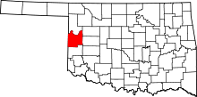 | |
| Unincorporated communities | ||
| Footnotes | ‡This populated place also has portions in an adjacent county or counties | |