Reserve, New Mexico
| Reserve, New Mexico | |
|---|---|
| Village | |
 Location of Reserve, New Mexico | |
 Reserve, New Mexico Location in the United States | |
| Coordinates: 33°42′31″N 108°45′39″W / 33.70861°N 108.76083°WCoordinates: 33°42′31″N 108°45′39″W / 33.70861°N 108.76083°W | |
| Country | United States |
| State | New Mexico |
| County | Catron |
| Area | |
| • Total | 0.5 sq mi (1.4 km2) |
| • Land | 0.5 sq mi (1.4 km2) |
| • Water | 0.0 sq mi (0.0 km2) |
| Elevation | 5,774 ft (1,760 m) |
| Population (2010) | |
| • Total | 289 |
| • Density | 524/sq mi (202.3/km2) |
| Time zone | Mountain (MST) (UTC-7) |
| • Summer (DST) | MDT (UTC-6) |
| ZIP code | 87830 |
| Area code(s) | 575 |
| FIPS code | 35-62620 |
| GNIS feature ID | 0923657 |
Reserve is a village in Catron County, New Mexico, United States. The population was 289 as of the 2010 census,[1] down from 387 at the 2000 census. It is the county seat of Catron County.[2] Currently the village has two grocery stores, a hardware store, a bar, fairgrounds, and a health clinic. It is the site where Elfego Baca held off a gang of Texan cowboys who wanted to kill him for arresting cowboy Charles McCarty.
About
Reserve is situated in the Gila National Forest about 12 miles (19 km) east of the Arizona/New Mexico border. It is the county seat of Catron County, the state's largest and least densely populated county. The area includes ruins from the Mogollon and Anasazi tribes, as well as petroglyphs and historic Old West sites.
Catron became a county in 1921. It was named after a famous attorney and political leader from Santa Fe, Thomas B. Catron.[3]
History

In the 1860s, Mexican-Americans established a string of villages along the river, naming them the Upper, Lower, and Middle San Francisco Plazas. In the late 1870s Anglo settlers began arriving. They renamed Upper Frisco Plaza as Milligan's Plaza, naming it after a merchant and saloon owner.
Milligan's Plaza was the site of the legendary Frisco Shootout of Elfego Baca. In 1882, or perhaps 1884, the nineteen-year-old Baca apparently appointed himself deputy sheriff and rode 130 miles (210 km) from Socorro to the Plaza. There he set about bringing justice to the Mexican-American community which had been beset by drunken cowboys.
Outnumbered by 80 Texans, Baca holed up in a jacal, the flimsiest kind of hut, and was besieged by the mob. Bullets and dynamite could not dislodge him, and in a gun battle lasting 33 hours, he inflicted death and grievous injury on some of his adversaries without being injured himself.[4]
Geography
Reserve is located in western Catron County at 33°42′31″N 108°45′39″W / 33.70861°N 108.76083°W (33.708493, -108.760822),[5] in the valley of the San Francisco River. New Mexico State Road 12 passes through the village, leading west 7 miles (11 km) to U.S. Route 180 near Reserve Airport and northeast 67 miles (108 km) to U.S. Route 60 at Datil. NM 435 leads south through the communities of San Francisco Plaza and Lower San Francisco Plaza before ending 5 miles (8 km) south of Reserve.
According to the United States Census Bureau, the village has a total area of 0.54 square miles (1.4 km2), all of it land.[1]
 Catron County Courthouse
 Main square
 Main square
 Main square
Demographics
| Historical population | |||
|---|---|---|---|
| Census | Pop. | %± | |
| 1980 | 439 | — | |
| 1990 | 319 | −27.3% | |
| 2000 | 387 | 21.3% | |
| 2010 | 289 | −25.3% | |
| Est. 2015 | 272 | [6] | −5.9% |
As of the census[8] of 2000, there were 387 people, 177 households, and 103 families residing in the village. The population density was 696.2 people per square mile (266.8/km²). There were 238 housing units at an average density of 428.2 per square mile (164.1/km²). The racial makeup of the village was 80.10% White, 0.52% African American, 0.52% Native American, 13.95% from other races, and 4.91% from two or more races. Hispanic or Latino of any race were 40.57% of the population.
There were 177 households out of which 25.4% had children under the age of 18 living with them, 41.8% were married couples living together, 14.1% had a female householder with no husband present, and 41.8% were non-families. 39.0% of all households were made up of individuals and 16.4% had someone living alone who was 65 years of age or older. The average household size was 2.14 and the average family size was 2.84.
In the village the population was spread out with 24.5% under the age of 18, 7.5% from 18 to 24, 20.9% from 25 to 44, 28.2% from 45 to 64, and 18.9% who were 65 years of age or older. The median age was 43 years. For every 100 females there were 95.5 males. For every 100 females age 18 and over, there were 89.6 males.
The median income for a household in the village was $24,750, and the median income for a family was $30,536. Males had a median income of $30,833 versus $16,000 for females. The per capita income for the village was $14,612. About 14.2% of families and 17.8% of the population were below the poverty line, including 22.6% of those under age 18 and 9.1% of those age 65 or over.
Education
The city is served by the Reserve Independent School District.[9]
Reserve Black on White prehistoric pottery

This Ancestral Pueblo pottery type was named for the Reserve area, where it was first found, and is a major subdiviosion of the Cibola Whiteware group. Common designs are opposed solid and hatched motifs that are interlocked with each other. Usually the hatching is diagonal, but parallel hatching in late examples occurs as well. Squiggle hatching may occur on some early examples. Usually the hatched motifs average two to four times as wide as the solid motifs but occasionally approach the same size. Framing and hatching lines are usually the same width. "Bulls eyes" are common in Reserve Black-on-White.[10]
References
- 1 2 "Geographic Identifiers: 2010 Demographic Profile Data (G001): Reserve village, New Mexico". U.S. Census Bureau, American Factfinder. Retrieved October 16, 2014.
- ↑ "Find a County". National Association of Counties. Retrieved 2011-06-07.
- ↑ Collier, H.P. (1936) San Francisco Plaza, Catron County: Brief history. Workers Progress Administration. Retrieved 6/12/07.
- ↑ French, Capt. William: Recollections of a Western Ranchman
- ↑ "US Gazetteer files: 2010, 2000, and 1990". United States Census Bureau. 2011-02-12. Retrieved 2011-04-23.
- ↑ "Annual Estimates of the Resident Population for Incorporated Places: April 1, 2010 to July 1, 2015". Retrieved July 2, 2016.
- ↑ "Census of Population and Housing". Census.gov. Retrieved June 4, 2015.
- ↑ "American FactFinder". United States Census Bureau. Retrieved 2008-01-31.
- ↑ "Contact Info." Reserve Independent School District. Retrieved on September 27, 2009.
- ↑ Reserve Black-on-White, Pottery guide and photo index
| Wikimedia Commons has media related to Reserve, New Mexico. |
Municipalities and communities of Catron County, New Mexico, United States | ||
|---|---|---|
| Village | 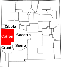 | |
| CDPs | ||
| Other unincorporated communities | ||
| Ghost towns |
| |
