Red Rock, Yavapai County, Arizona
| Red Rock, Arizona | |
|---|---|
| Unincorporated community | |
|
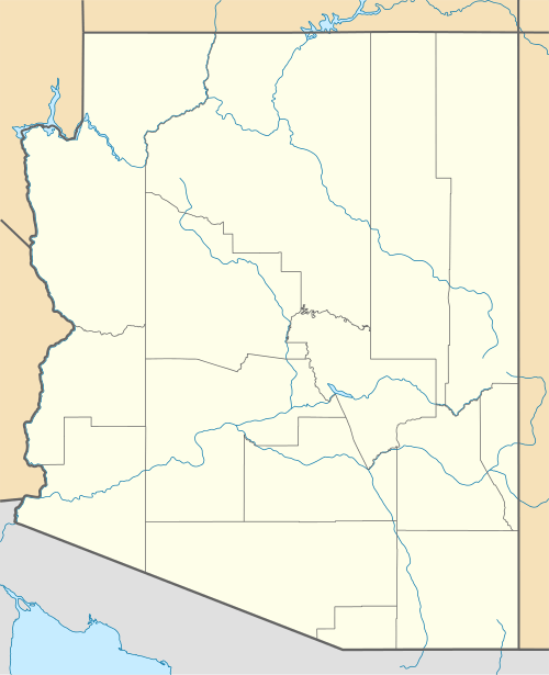
Red Rock Crossing in 1959 | |
 Red Rock, Arizona  Red Rock, Arizona | |
| Coordinates: 34°49′32″N 111°49′00″W / 34.82556°N 111.81667°WCoordinates: 34°49′32″N 111°49′00″W / 34.82556°N 111.81667°W | |
| Country | United States |
| State | Arizona |
| County | Yavapai |
| Elevation | 3,976 ft (1,212 m) |
| Time zone | Mountain (MST) (UTC-7) |
| Area code(s) | 928 |
| GNIS feature ID | 33497[1] |
Red Rock is an unincorporated community in Yavapai County, Arizona, United States. Red Rock is 4.5 miles (7.2 km) southwest of Sedona. In the late 19th century, Red Rock was the principal settlement in the Oak Creek Canyon area. Red Rock is now an upscale suburb of Sedona.
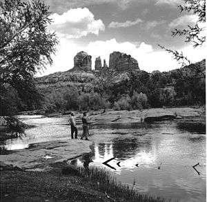
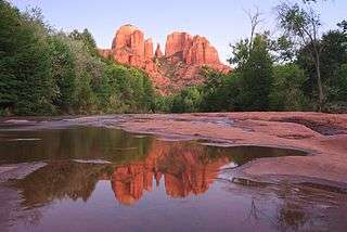
Red Rock Crossing is a scenic former ford across Oak Creek, with photogenic views of Cathedral Rock. The crossing was washed out in a flood in 1978,[2] and there are no current plans to reopen it to automobile traffic. Past proposals to build a bridge at Red Rock Crossing met vociferous opposition.[3] Most of the crossing is included in the Coconino National Forest's Crescent Moon Ranch recreation area.
References
External links
- Crescent Moon Picnic Area at Coconino National Forest
- Red Rock Crossing, information and history, bridge proposal, photo gallery
Cathedral Rock at Red Rock Crossing, 2009

Cathedral Rock over the old mill at Crescent Moon picnic area

This article is issued from Wikipedia - version of the 8/7/2016. The text is available under the Creative Commons Attribution/Share Alike but additional terms may apply for the media files.