Puerto López, Meta
| Puerto López, Meta | |||
|---|---|---|---|
| Municipality and town | |||
 | |||
| |||
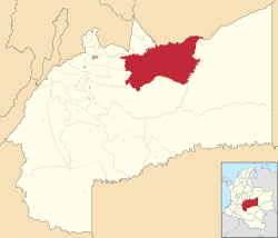 Location of the municipality and town of Puerto López, Meta in the Meta Department of Colombia. | |||
| Country |
| ||
| Department | Meta Department | ||
| Elevation | 365 m (1,198 ft) | ||
| Time zone | Colombia Standard Time (UTC-5) | ||


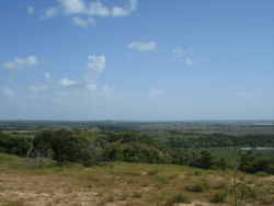
Puerto Alfonso López (Spanish pronunciation: [ˈpweɾto ˈlopes]) is a small town and municipality in the Orinoquía Region (Los Llanos region) of Meta Department, Colombia. It is known as Puerto López ,and this is a port on the Meta river. Apart from being a port, this is located approximately 100 kilometers east of the town of Villavicencio. Its main industries are agriculture and cattle.
Puerto Lopez has been said to be the "belly button",[1] or geographical center, of Colombia. Nearby is the Obelisco del Alto de Menegua, a 30 meter tall[1] obelisk that marks the intersection of 4 degrees north latitude and 72 degrees west longitude.[2]
History
The town was established on 1 May 1935. It was centered on the river port and pre-existing village. On 3 May 1937, the Intendencia for Meta Department ordered the creation of the Yacuana District (corregimiento) which capital is Puerto Alfonso Lopez. The municipality was established on 3 July 1955, in accordance with the National Decree No. 2543 of 1945.
Notes
- 1 2 Porup, Jens and Kohn, Michael (2010). Lonely Planet Colombia (Country Guide). Footscray, Victoria, Australia: Lonely Planet. p. 135. ISBN 978-1-74104-827-8.
- ↑ "Emisión: "4-72, La Red Postal de Colombia"" (in Spanish). Amigos de la Filatelia Temática en Colombia (Friends of Thematic Philately in Colombia). 29 May 2008.
External links
- (Spanish) Puerto Lopez official website
Coordinates: 4°05′N 72°58′W / 4.083°N 72.967°W