Prince Rupert, British Columbia
| Prince Rupert | ||
|---|---|---|
| City | ||
| City of Prince Rupert | ||
|
Aerial view of Prince Rupert | ||
| ||
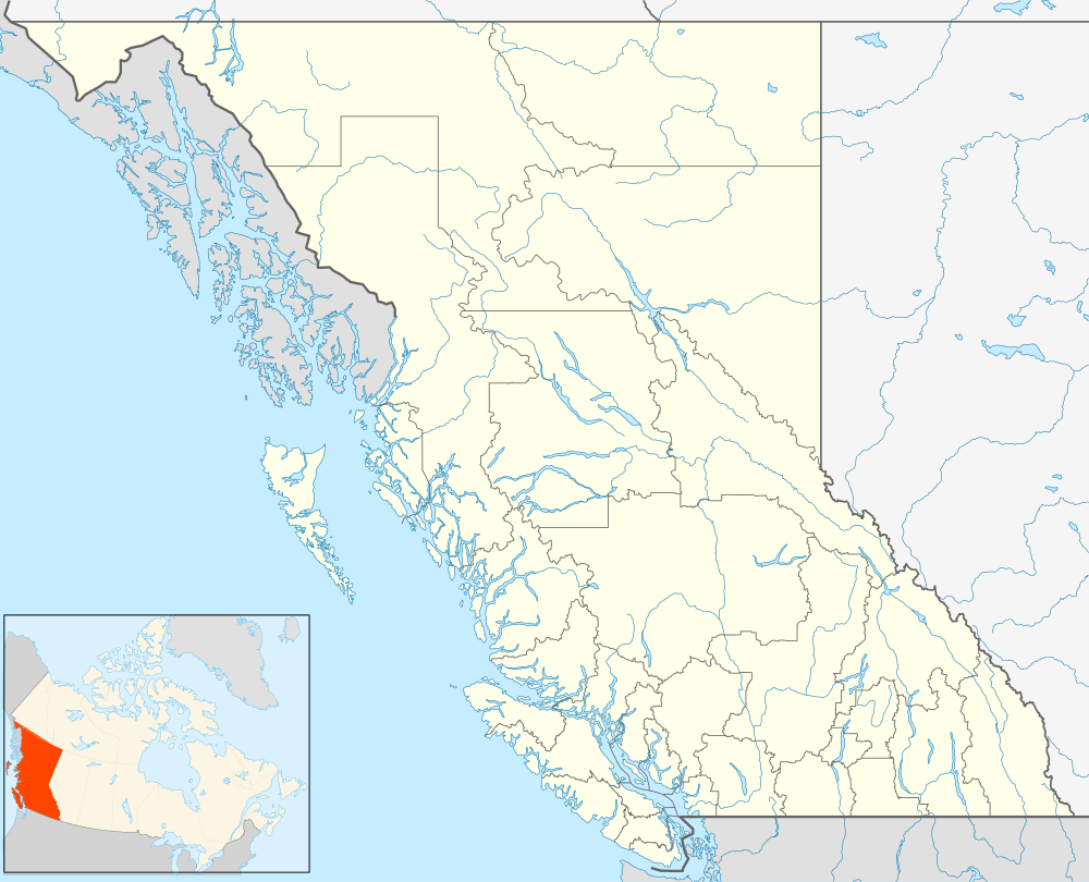 Prince Rupert Location of Prince Rupert in British Columbia | ||
| Coordinates: 54°18′44″N 130°19′38″W / 54.31222°N 130.32722°W | ||
| Country |
| |
| Province |
| |
| Regional District | Skeena-Queen Charlotte | |
| Incorporated | March 10, 1910 | |
| Government | ||
| • Mayor | Lee Brain | |
| • Governing Body | Prince Rupert City Council | |
| • MP | Nathan Cullen (NDP) | |
| • MLA | Jennifer Rice (NDP) | |
| Area | ||
| • City | 54.93 km2 (21.21 sq mi) | |
| • Metro | 222.94 km2 (86.08 sq mi) | |
| Elevation | 40 m (130 ft) | |
| Population (2011) | ||
| • City | 12,508 | |
| • Density | 227.7/km2 (590/sq mi) | |
| • Metro | 13,052 | |
| • Metro density | 58.5/km2 (152/sq mi) | |
| Time zone | Pacific Time Zone (UTC-8) | |
| • Summer (DST) | Pacific Daylight Time (UTC-7) | |
| Postal code span | V8J | |
| Area code(s) | 250 / 778 / 236 | |
| Highways |
| |
| Website | Prince Rupert.ca | |


Prince Rupert is a port city in the province of British Columbia, Canada. Located on Kaien Island, Prince Rupert is the land, air, and water transportation hub of British Columbia's North Coast, and has a population of 12,508 people (Statistics Canada, 2011).
History


Prince Rupert was incorporated on March 10, 1910. It was named for Prince Rupert of the Rhine, who was first Governor of the Hudson's Bay Company, as the result of an open competition held by the Grand Trunk Railway, the prize for which was $250.[1] Prior to the opening of the GTP, the business centre on the North Coast was Port Essington on the Skeena River. After the founding of Prince Rupert at the western terminus for the Grand Trunk Pacific Railway, Port Essington returned to being a fishing community.
Charles Hays had many grand ideas for Prince Rupert including berthing facilities for large passenger ships and the development of a major tourism industry. These plans fell through when Charles Hays perished on the RMS Titanic in April 1912. Mount Hays, the larger of two mountains on Kaien Island, is named in his honour, as is a local high school, Charles Hays Secondary School.
Local politicians used the promise of a highway connected to the mainland as an incentive and the city grew over the next several decades. American troops finally completed the 100 mile stretch of road between Prince Rupert and Terrace during World War II to facilitate the movement of thousands of allied troops to the Aleutian Islands and the Pacific. Several forts were built to protect the city at Barrett Point and Fredrick Point. Following World War II, the fishing industry, particularly salmon and halibut, and forestry became the city's major industries. Prince Rupert was the Halibut Capital of the World until the early 1980s. A long-standing dispute over fishing rights in the Dixon Entrance to the Hecate Strait (pronounced as "hekk-et") between American and Canadian fisherman led to the formation of the 54-40 or Fight Society. The United States Coast Guard maintains a base in nearby Ketchikan, Alaska.
In 1946, the Government of Canada, through an Order-in-Council, granted the Joint Chiefs of Staff the power to administer and maintain facilities to collect data in support of Communications Research. The Royal Canadian Navy were allotted forty positions, seven of which were located in Prince Rupert. In either 1948 or 1949, Prince Rupert ceased operations and the positions were relocated to RCAF Whitehorse, Yukon. The 1949 Queen Charlotte earthquake with a Richter Scale magnitude of 8.1 broke windows and swayed buildings on August 22.
Prince Rupert endured in Summer 1958 a riot over racial discrimination. Ongoing discontent with heavy-handed police practices towards natives escalated to rioting during a Port Days celebration following the arrest of an aboriginal couple. As many as 1,000 people (one tenth of the city's population at the time) began smashing windows and skirmishing with police. The Riot Act was read for only the second time since Confederation.[2][3]
Over the years, hundreds of students were said to have largely paid their way through school by working in the then lucrative fishing industry. Construction of a pulp mill began in 1947 and was operating by 1951. The construction of coal and grain shipping terminals followed. The 1960s, 1970s and 1980s saw the construction of many amenities including a civic centre, swimming pool, public library, golf course and performing arts centre (recently renamed "The Lester Centre of the Arts"), developments that mark the town's evolution from a fishing and mill town to a small city.
In the 1990s, both the fishing and forest industries experienced a significant downturn in economic activity. In July, 1997, Canadian fishermen blockaded the Alaska Marine Highway ferry M/V Malaspina, keeping it in the port as a protest in the salmon fishing rights dispute between Alaska and British Columbia. The forest industry declined when the softwood lumber dispute arose between Canada and the U.S. After the pulp mill closed down, many people were unemployed, and a significant amount of top-of-the-line machinery was left dormant. After reaching a peak of about 18,000 in the early 1990s, Prince Rupert's population began to decline as people left in search of work.
The period from 1996 to 2004 saw difficult times for Prince Rupert, including closure of the pulp mill, the burning down of a fish plant and a significant population decline. 2005 may be viewed as a critical turning point though. The announcement of the construction of a container port in April 2005, combined with new ownership of the pulp mill, the 2004 opening of a new cruise ship dock, the resurgence of coal and grain shipping, and the prospects of increased heavy industry and tourism possibly foretell a bright future for the area.
Prince Rupert was ranked 193rd out of the 200 Canadian cities in MoneySense Magazine's Best Places 2013, the lowest rank of any city in British Columbia [4]
Geography


Prince Rupert is situated on Kaien Island (approximately 770 km (480 mi) northwest of Vancouver), just north of the mouth of Skeena River, and linked by a short bridge to the mainland. The city is located along the island's northwestern shore, fronting on Prince Rupert Harbour.
At the western terminus of Trans-Canada Highway 16 (the Yellowhead Highway), Prince Rupert is approximately 16 km west of Port Edward, 144 km west of Terrace, and 715 km west of Prince George.
Climate
Prince Rupert has an oceanic climate (Köppen Cfb) and is also located in a temperate rainforest. Prince Rupert is known as “The City of Rainbows”, as it is Canada’s wettest city, with 2,590 millimetres (102 in) of annual precipitation on average, 2,470 millimetres (97.2 in) of that total being rain; in addition, 240 days per year receive at least some measurable precipitation, and there are only 1230 hours of sunshine per year, so it is regarded as the municipality in Canada which receives the lowest amount of sunshine annually. Tourist brochures boast about Prince Rupert’s “100 days of sunshine”. Out of Canada's 100 largest cities, Prince Rupert had the coolest summer with an average high of 15.67 °C (60.2 °F).[5] Winters in Prince Rupert are mild by Canadian standards, with the average afternoon temperature in December, January and February being 5.2 °C (41.4 °F) which is the tenth warmest in Canada, only being surpassed by other British Columbia cities.[6]
Summers are mild and comparatively less rainy, with an August daily mean of 13.5 °C (56.3 °F). Spring and autumn are not particularly well-defined; rainfall nevertheless peaks in the autumn months. Winters are chilly and damp, but warmer than most locations at a similar latitude, due to Pacific moderation: the January daily mean is 1.3 °C (34.3 °F), although frosts and blasts of cold Arctic air from the northeast are not uncommon.
Snow amounts are moderate for Canadian standards, averaging 126 centimetres (50 in) and occurring mostly from December to March. Snowfall in Prince Rupert is rare and normally melts within a few days, although individual snowstorms may bring copious amounts of snow. Wind speeds are relatively strong, with prevailing winds blowing from the southeast.
The highest temperature ever recorded in Prince Rupert was 32.2 °C (90 °F) on 6 June 1958.[7] The lowest temperature ever recorded was −24.4 °C (−12 °F) on 4 January 1965.[8]
| Climate data for Prince Rupert Airport, 1981–2010 normals, extremes 1908–present[lower-alpha 1] | |||||||||||||
|---|---|---|---|---|---|---|---|---|---|---|---|---|---|
| Month | Jan | Feb | Mar | Apr | May | Jun | Jul | Aug | Sep | Oct | Nov | Dec | Year |
| Record high °C (°F) | 17.8 (64) |
18.9 (66) |
20.0 (68) |
25.5 (77.9) |
29.4 (84.9) |
32.2 (90) |
30.6 (87.1) |
30.0 (86) |
27.0 (80.6) |
21.7 (71.1) |
20.0 (68) |
18.9 (66) |
32.2 (90) |
| Average high °C (°F) | 5.6 (42.1) |
6.1 (43) |
7.7 (45.9) |
10.2 (50.4) |
12.6 (54.7) |
14.7 (58.5) |
16.2 (61.2) |
17.0 (62.6) |
14.9 (58.8) |
11.1 (52) |
7.3 (45.1) |
5.5 (41.9) |
10.8 (51.4) |
| Daily mean °C (°F) | 2.4 (36.3) |
2.7 (36.9) |
4.2 (39.6) |
6.4 (43.5) |
9.0 (48.2) |
11.6 (52.9) |
13.4 (56.1) |
13.8 (56.8) |
11.5 (52.7) |
8.0 (46.4) |
4.3 (39.7) |
2.7 (36.9) |
7.5 (45.5) |
| Average low °C (°F) | −0.8 (30.6) |
−0.7 (30.7) |
0.6 (33.1) |
2.5 (36.5) |
5.4 (41.7) |
8.4 (47.1) |
10.5 (50.9) |
10.6 (51.1) |
8.0 (46.4) |
4.9 (40.8) |
1.3 (34.3) |
−0.2 (31.6) |
4.2 (39.6) |
| Record low °C (°F) | −24.4 (−11.9) |
−18.1 (−0.6) |
−17.2 (1) |
−7.1 (19.2) |
−3.7 (25.3) |
1.1 (34) |
0.6 (33.1) |
2.8 (37) |
−2.2 (28) |
−11.3 (11.7) |
−20.6 (−5.1) |
−22.8 (−9) |
−24.4 (−11.9) |
| Average precipitation mm (inches) | 276.3 (10.878) |
185.6 (7.307) |
199.6 (7.858) |
172.4 (6.787) |
137.6 (5.417) |
108.8 (4.283) |
118.7 (4.673) |
169.1 (6.657) |
266.3 (10.484) |
373.6 (14.709) |
317.0 (12.48) |
294.2 (11.583) |
2,619.1 (103.114) |
| Average rainfall mm (inches) | 252.9 (9.957) |
167.1 (6.579) |
188.4 (7.417) |
169.6 (6.677) |
137.5 (5.413) |
108.7 (4.28) |
118.7 (4.673) |
169.1 (6.657) |
266.3 (10.484) |
373.4 (14.701) |
306.9 (12.083) |
271.7 (10.697) |
2,530.4 (99.622) |
| Average snowfall cm (inches) | 25.6 (10.08) |
19.3 (7.6) |
11.8 (4.65) |
2.8 (1.1) |
0.1 (0.04) |
0.0 (0) |
0.0 (0) |
0.0 (0) |
0.0 (0) |
0.3 (0.12) |
9.7 (3.82) |
22.8 (8.98) |
92.4 (36.38) |
| Average precipitation days (≥ 0.2 mm) | 22.5 | 18.5 | 21.7 | 19.6 | 18.3 | 17.3 | 17.5 | 17.5 | 19.8 | 24.2 | 23.8 | 22.8 | 243.5 |
| Average rainy days (≥ 0.2 mm) | 20.4 | 16.4 | 20.3 | 19.4 | 18.3 | 17.3 | 17.5 | 17.5 | 19.8 | 24.2 | 23.4 | 21.5 | 235.9 |
| Average snowy days (≥ 0.2 cm) | 5.0 | 4.2 | 3.6 | 1.2 | 0.08 | 0.0 | 0.0 | 0.0 | 0.04 | 0.20 | 2.9 | 4.6 | 21.7 |
| Average relative humidity (%) (at 3pm) | 78.5 | 71.5 | 68.1 | 67.7 | 71.2 | 75.0 | 77.6 | 77.7 | 76.1 | 77.5 | 77.6 | 80.2 | 74.9 |
| Mean monthly sunshine hours | 40.1 | 65.2 | 103.0 | 145.8 | 171.1 | 154.5 | 149.7 | 149.7 | 115.7 | 72.4 | 43.0 | 32.1 | 1,242.1 |
| Percent possible sunshine | 16.2 | 23.8 | 28.1 | 34.6 | 34.5 | 30.1 | 29.1 | 32.4 | 30.2 | 22.1 | 16.7 | 13.9 | 26.0 |
| Source: Environment Canada[7][8][9][10][11][12][13][14][15] | |||||||||||||
Demographics
| City | ||
|---|---|---|
| Year | Pop. | ±% |
| 1911 | 4,184 | — |
| 1921 | 6,393 | +52.8% |
| 1931 | 6,350 | −0.7% |
| 1941 | 6,714 | +5.7% |
| 1951 | 8,546 | +27.3% |
| 1956 | 10,498 | +22.8% |
| 1961 | 11,987 | +14.2% |
| 1966 | 14,389 | +20.0% |
| 1971 | 15,747 | +9.4% |
| 1976 | 14,754 | −6.3% |
| 1981 | 16,197 | +9.8% |
| 1986 | 15,755 | −2.7% |
| 1991 | 16,620 | +5.5% |
| 1996 | 16,714 | +0.6% |
| 2001 | 14,643 | −12.4% |
| 2006 | 12,815 | −12.5% |
| 2011 | 12,508 | −2.4% |
| [16][17][18][19][20][21][22] | ||
| Census agglomeration | ||
|---|---|---|
| Year | Pop. | ±% |
| 1991 | 17,359 | — |
| 1996 | 17,414 | +0.3% |
| 2001 | 15,302 | −12.1% |
| 2006 | 13,392 | −12.5% |
| 2011 | 13,052 | −2.5% |
| Canada 2011 Census | Population | % of Total Population | |
|---|---|---|---|
| Visible minority group Source:[23] | South Asian | 410 | 3.3% |
| Chinese | 190 | 1.5% | |
| Black | 90 | 0.7% | |
| Filipino | 210 | 1.7% | |
| Latin American | 0 | 0% | |
| Arab | 0 | 0% | |
| Southeast Asian | 360 | 2.9% | |
| West Asian | 0 | 0% | |
| Korean | 0 | 0% | |
| Japanese | 125 | 1% | |
| Other visible minority | 0 | 0% | |
| Mixed visible minority | 20 | 0.2% | |
| Total visible minority population | 1,425 | 11.5% | |
| Aboriginal group Source:[24] | First Nations | 4,290 | 34.7% |
| Métis | 350 | 2.8% | |
| Inuit | 0 | 0% | |
| Total Aboriginal population | 4,745 | 38.4% | |
| White | 6,190 | 50.1% | |
| Total population | 12,360 | 100% | |
- Population by Age Group 2001
- Age Group = Population (% Distribution)
- Under 18 years = 4,320 (28.2%)
- 18 – 34 years = 3,370 (22.0%)
- 35 – 54 years = 5,020 (32.8%)
- 55 – 74 years = 2,075 (13.6%)
- 75 years and over = 515 (3.4%)
- Total - Age Groups = 15,300 (100.0%)
- Median Age = 34.8
- Source: BC Stats Population Estimates, 2004.
Prince Rupert has the highest First Nations population percentage of any municipality with a population of 5,000 or more in Canada.
Government


The current mayor of Prince Rupert is Lee Brain. The current councillors of Prince Rupert are Nelson Kinney, Joy Thorkelson, Barry Cunningham, Blair Mirau, Wade Niesh, and Gurvinder Randhawa.
Prince Rupert is part of the Skeena—Bulkley Valley federal riding (electoral district). Nathan Cullen is the current Member of Parliament for the riding, and is a member of the New Democratic Party.
In the Legislative Assembly of British Columbia, Prince Rupert is a large portion of the North Coast riding. Jennifer Rice is the current Member of the Legislative Assembly. She is a member of the New Democratic Party of British Columbia. The NDP traditionally has strong support in the region.
Notable residents
After 1908, Thomas Dufferin "Duff" Pattullo became mayor of Prince Rupert. He went on to become the Premier of British Columbia from 1933 to 1941, as a member of the Liberal Party.
Alexander Malcolm Manson, the first lawyer in Prince Rupert, was elected to the BC Legislature in the riding of Omineca in 1916 as a Liberal. He became Speaker of the House in 1921 and the following year was appointed as both Attorney-General and Minister of Labour, serving in both capacities for six years. He was later appointed to the BC Supreme Court.
Iona Campagnolo began her political career when she was elected to Prince Rupert City Council in 1966. In 1974, she successfully ran for the Liberal Party in the federal riding of Skeena. In 1976 she was appointed Minister of Amateur Sports. She became president of the Liberal Party of Canada in 1982. She served as British Columbia's Lieutenant-Governor from 2001 to 2007.
In 1986, NDP candidate Dan Miller was elected to the Prince Rupert Electoral District and from August 1999 through February 2000 was Premier.
Peter James Lester was elected to Prince Rupert council in 1955, and to the position of Mayor on December 12, 1957, a post he held for the next 36 years, continuously through 17 terms of office. He was awarded the Order of British Columbia in 1994. Lester was the President of the North Central Municipal Association for the 1972-1973 term. Peter Lester died Honourable Iona Campagnola, Lieutenant Governor noted the passing of former Mayor Peter Lester
Frederick Peters, former Premier of Prince Edward Island and legal partner of Sir Charles Hibbert Tupper, served as City Solicitor from 1911 to 1919.
Rod Brind'Amour, former captain of the NHL's Carolina Hurricanes
Lisa Walters, LPGA golf champion.
Paul Wong (Artist), Canadian Video Artist, now based in Vancouver, British Columbia.
Sid Dickens, an artist, now based in Vancouver, British Columbia.
Gloria Macarenko, Canadian Journalist, co-anchor CBC Vancouver, born and raised in Prince Rupert.
Shane Woodford, Canadian Journalist, reporter, anchor, and talk show host on CKNW News Talk 980, born in Prince Rupert.
Takao Tanabe, CM, OBC is a Canadian painter, born in Prince Rupert.
Tara Jean Stevens (n. Wilkin), actress, playwright, and radio-broadcaster, formerly of the Vancouver-based radio show Kiah & Tara Jean.
Bernice Liu, is a Chinese Canadian actress and singer, born and raised in Prince Rupert.
Industry
Prince Rupert currently relies on the fishing industry, port, and tourism.
Transport
Seaport

Prince Rupert's sheltered harbour is the deepest ice-free natural harbour in North America, and the 3rd deepest natural harbour in the world.[25] Situated at 54° North, the harbour is the northwestern most port in North America linked to the continent's railway network. The port is the first inbound and last outbound port of call for cargo ships travelling between eastern Asia and western North America.
Passenger ferries operating from Prince Rupert include BC Ferries' service to the Haida Gwaii and to Port Hardy on Vancouver Island, and Alaska Marine Highway ferries to Ketchikan, Juneau and Sitka and many other ports along Alaska's Inside Passage. The Prince Rupert Ferry Terminal is co-located with the Prince Rupert railway station, from which Via Rail offers a thrice-weekly Jasper – Prince Rupert train, connecting to Prince George and Jasper, and through a connection with The Canadian, to the rest of the continental passenger rail network.
The Prince Rupert Port Authority is responsible for the port's operation.
Much of the harbour is formed by the shelter provided by Digby Island, which lies windward of the city and contains the Prince Rupert Airport. The city is located on Kaien Island and the harbour also includes Tuck Inlet, Morse Basin, Wainwright Basin, and Porpoise Harbour, as well as part of the waters of Chatham Sound which takes in Ridley Island.
Port facilities

Prince Rupert is ideally located for a port, having the deepest natural harbour depths on the continent.[26][27] The city's port capacity is comparable with the Port of Vancouver's. Unlike most west coast ports, there is very little traffic congestion at Prince Rupert. Finally, the extremely mountainous nature and narrow channels of the surrounding area leaves Prince Rupert as the only suitable port location in the inland passage region.
The Prince Rupert Port Authority (PRPA) is a federally appointed agency which administers and operates various port properties on the harbour. Previously run by the National Harbours Board and subsequently the Prince Rupert Port Corporation, the PRPA is now a locally run organization.
PRPA port facilities include:
- Atlin Terminal [28]
- Northlands Terminal [29]
- Lightening Dock
- Ocean Dock
- Westview Dock
- Fairview Terminal [30]
- Prince Rupert Grain [31]
- Ridley Terminals [32]
- Sulphur Corporation
All PRPA facilities are serviced by CN Rail.
The Canadian Coast Guard maintains CCG Base Seal Cove on Prince Rupert Harbour where vessels are homeported for search and rescue and maintenance of aids to navigation throughout the north coast. CCG also bases helicopters at Prince Rupert for servicing remote locations with aids to navigation, as well as operating a Marine Communications Centre, covering a large Vessel Traffic Services zone from Port Hardy at the northern tip of Vancouver Island to the International Boundary north of Prince Rupert.
Both BC Ferries and the Alaska Marine Highway operate ferries which call at Prince Rupert, with destinations in the Alaska Panhandle, the Haida Gwaii, and isolated communities along the central coast to the south.
Airport
Prince Rupert Airport (YPR/CYPR) is located on Digby Island. Its position is 54°17′10″N 130°26′41″W / 54.28611°N 130.44472°W, and its elevation is 35 m (116 ft[33]) above sea level. The airport consists of one runway, one passenger terminal, and two aircraft stands. Access to the airport is typically achieved by a bus connection that departs from one location in downtown Prince Rupert (Highliner Hotel) and travels to Digby Island by ferry. The airport is served by Air Canada and Hawkair from Vancouver International Airport (YVR).
Prince Rupert is also served by the Prince Rupert/Seal Cove Water Aerodrome, a seaplane facility with regularly scheduled, as well as chartered, flights to nearby villages and remote locations.
Railway
CN Rail has a mainline that runs to Prince Rupert from Valemount, British Columbia. At Valemount, the Prince Rupert mainline joins the CN mainline from Vancouver. Freight traffic on the Prince Rupert mainline consists primarily of grain, coal, wood products, chemicals, and as of 2007, containers. As the renovations at the Port of Prince Rupert continue, traffic on CN will steadily rise in future years.
In addition, a three times weekly Jasper – Prince Rupert train operated by Via Rail connects Prince Rupert with Prince George and Jasper. Running during daylight hours to allow passengers to be able to see the scenery along the entire route; the service takes two days and requires an overnight hotel stay in Prince George. The route ends in Jasper and connects passengers with Via's The Canadian, which runs between Toronto and Vancouver.
Communications
Telephone, mobile, and Internet service are provided by CityWest (formerly CityTel). CityWest is owned by the City of Prince Rupert. CityWest provides long-distance telephone service, as does Telus.
In September 2005, the city changed CityTel from a city department into an independent corporation named CityWest. The new corporation immediately purchased the local cable company, Monarch Cablesystems, expanding CityWest's customer base to other northwest British Columbia communities.
Since January 2008, Rogers Communications has offered GSM and EDGE service in the area—the first real competition to CityWest's virtual monopoly. Rogers offers local numbers based in Port Edward (prefix 600), which is in the local calling zone for the Prince Rupert area. The introduction of Rogers service forced Citywest to form a partnership with Bell Canada to bring digital services to Citywest Mobility, using CDMA.
In December 2013, CityWest and TELUS announced it was transitioning out of the cellular business over 2014 and would partner with TELUS to bring CityWest wireless customers onto TELUS' 4G wireless network.[34]
Media
Radio
- AM 860 - CFPR, CBC Radio One
- FM 98.1 - VF2119, classic rock (repeats CFNR-FM, Terrace)
- FM 99.1 - CHTK-FM, EZ Rock 99.1
- FM 100.7 - CIAJ-FM, Christian programming
- FM 101.9 - CJFW-FM-2, country music (repeats CJFW-FM, Terrace)
Television
- Channel 6 - CFTK-TV-1, CBC Television private affiliate (repeats CFTK-TV, Terrace)
Newspapers
- Prince Rupert Daily News, daily newspaper, (1911–2010)
- The Northern View, local weekly newspaper, 2006–present, owned by Black Press
- The Northern Connector, regional weekly newspaper covering Prince Rupert, Kitimat and Terrace areas, 2006–present, owned by Black Press
Tourist attractions

Prince Rupert is a central point on the Inside Passage, a route of relatively sheltered waters running along the Pacific coast from Vancouver, British Columbia to Skagway, Alaska. It is visited by many cruise ships during the summer en route between Alaska to the north and Vancouver and the Lower 48 to the south.
Prince Rupert is also the starting point for many wildlife viewing trips including whales, eagles, salmon and grizzly bears. The Khutzeymateen Grizzly Bear sanctuary features one of the densest remaining populations in North America; tours can be arranged by water, air (using float planes) or land departing from Prince Rupert.
Neighbouring communities
By virtue of location, Prince Rupert is the gateway to many destinations:
- Dodge Cove (1 km, 0.6 mi, west)
- Metlakatla (5 km, 3 mi, west)
- Port Edward (15 km, 9 mi, south)
- Lax Kw'alaams (Port Simpson) (30 km, 19 mi, northwest)
- Oona River (43 km, 27 mi, southwest)
- Kitkatla (65 km, 40 mi, south)
- Kisumkalum (140 km, 87 mi, east)
- Kitselas (142 km, 88 mi, east)
- Terrace (146 km, 87 mi, east)
- Hartley Bay (157 km, 98 mi, southeast)
The Haida Gwaii are to the west of Prince Rupert, across the Hecate Strait. Alaska is 49 nautical miles (90 km, 56 mi) north of Prince Rupert.
Citations
The book Unmarked: Landscapes Along Highway 16, written by Sarah de Leeuw, includes an essay about Prince Rupert entitled "Highway of Monsters".
Ra McGuire of the band Trooper wrote the hit song "Santa Maria" on a boat in Prince Rupert's Harbour. Says McGuire, "The boat was called The Lucky Lady. We sailed from Prince Rupert onto an island [35] off the coast with an awful lot of alcohol and some salmon to barbecue. Many of the lines in the song are direct quotes from the skipper. He actually said 'Okay, there's only fear and good judgment holding us back.' On the way back he said 'Does somebody know how to drive this thing?' I actually wrote these down in a little notepad as we went." [36]
Amuro Ray, the protagonist of the anime series Mobile Suit Gundam, was born and raised in Prince Rupert.[37]
See also
Notes
- ↑ Talbot, "The Making of a Great Canadian Railway...The Grand Trunk Pacific Railway," (1912, The Musson Book Co.), at p. 318-19; BC Names entry "Prince Rupert (city)"
- ↑ canada.com: "Black Day in July" 21 Jul 2007 (Ottawa Citizen)
- ↑ princerupertlibrary.ca: "Prince Rupert Fire Museum"
- ↑ MoneySense Magazine. "Best Places 2013".
- ↑ "Coolest summer". Environment Canada. Retrieved 2013-01-06.
- ↑ "Mildest winter". Environment Canada. Retrieved 2013-01-06.
- 1 2 "June 1958". Canadian Climate Data. Environment Canada. Retrieved 17 June 2016.
- 1 2 "Prince Rupert A". Canadian Climate Normals 1981–2010. Environment Canada. Retrieved 27 August 2015.
- ↑ "January 1958". Canadian Climate Data. Environment Canada. Retrieved 17 June 2016.
- ↑ "March 1926". Canadian Climate Data. Environment Canada. Retrieved 17 June 2016.
- ↑ "May 1912". Canadian Climate Data. Environment Canada. Retrieved 17 June 2016.
- ↑ "July 1952". Canadian Climate Data. Environment Canada. Retrieved 17 June 2016.
- ↑ "July 1949". Canadian Climate Data. Environment Canada. Retrieved 17 June 2016.
- ↑ "August 1916". Canadian Climate Data. Environment Canada. Retrieved 17 June 2016.
- ↑ "November 1949". Canadian Climate Data. Environment Canada. Retrieved 17 June 2016.
- ↑ , Censuses 1871–1931
- ↑ , Census 1941–1951
- ↑ , Census 1961
- ↑ , Canada Year Book 1974: Censuses 1966, 1971
- ↑ , Canada Year Book 1988: Censuses 1981, 1986
- ↑ Columbia.html, Census 1991–2006
- ↑ , A Demographic Profile of Prince Rupert
- ↑ "Community Profiles from the 2011 Census, Statistics Canada - Census Subdivision". 2.statcan.gc.ca. 2010-12-06. Retrieved 2013-04-13.
- ↑ "Aboriginal Peoples - Data table". 2.statcan.ca. 2010-10-06. Retrieved 2013-04-13.
- ↑ Prince Rupert www.vancouverisland.com
- ↑ "Major Investment in Prince Rupert Port Expansion" - Industry Canada - April 15, 2005
- ↑ "Prince Rupert Container Terminal Opening New World of Opportunities" - Western Economic Diversification Canada - September 12, 2007
- ↑ Atlin Terminal | Prince Rupert Port Authority. Rupertport.com. Retrieved on 2013-07-26.
- ↑ Northland Cruise Terminal | Prince Rupert Port Authority. Rupertport.com. Retrieved on 2013-07-26.
- ↑ Prince Rupert Container Terminal | Prince Rupert Port Authority. Rupertport.com (2007-10-31). Retrieved on 2013-07-26.
- ↑ Prince Rupert Grain | Prince Rupert Port Authority. Rupertport.com. Retrieved on 2013-07-26.
- ↑ Ridley Terminals | Prince Rupert Port Authority. Rupertport.com. Retrieved on 2013-07-26.
- ↑ This is a measured value in feet
- ↑ http://about.telus.com/community/english/news_centre/news_releases/blog/2013/12/13/telus-and-citywest-partner-to-bring-world-class-wireless-service-to-prince-rupert
- ↑ "Lucy Island Lighthouse". fogwhistle.ca. Retrieved 2014-12-05.
- ↑ "Trooper Official Site - Canadian rock band -". trooper.ca. Retrieved 2014-12-05.
- ↑ Dynasty Warriors Gundam 2, file 1 of Personal History, "Born in Prince Rupert, West Coast of North America"
- ↑ Climate data was recorded in Prince Rupert from August 1908 to December 1962 and at Prince Rupert Airport from May 1962 to present.
External links
| Wikimedia Commons has media related to Prince Rupert, British Columbia. |
| Wikivoyage has a travel guide for Prince Rupert. |
- City of Prince Rupert
- Prince Rupert City and Regional Archives
- Prince Rupert & District Chamber of Commerce
- Skeena-Queen Charlotte Regional District
- Prince Rupert Port Authority
- Prince Rupert Airport
- Northwest Community College (Prince Rupert Campus)
- School District 52 (Prince Rupert)
- Prince Rupert Secondary School
- Charles Hays Secondary School
- Prince Rupert Library
- Prince Rupert Economic Development Corporation
- Tourism Prince Rupert
| Subdivisions |  | |
|---|---|---|
| Communities | ||
| Metro areas and agglomerations | ||
| Cities |
| |
| ||
Coordinates: 54°18′43.9″N 130°19′37.5″W / 54.312194°N 130.327083°W
