Presque Isle, Wisconsin
| Presque Isle, Wisconsin | |
|---|---|
| Town | |
 Location of Presque Isle, Wisconsin | |
| Coordinates: 46°12′49″N 89°42′4″W / 46.21361°N 89.70111°W | |
| Country | United States |
| State | Wisconsin |
| County | Vilas |
| Government | |
| • Town Chairman | Jack Harrison |
| • Supervisor | Adam Johnson |
| • Supervisor | Karen Swenson |
| Area | |
| • Total | 74.4 sq mi (192.8 km2) |
| • Land | 61.7 sq mi (159.8 km2) |
| • Water | 12.7 sq mi (33.0 km2) |
| Elevation[1] | 1,680 ft (512 m) |
| Population (2010) | |
| • Total | 616 |
| • Density | 8.3/sq mi (3.2/km2) |
| Time zone | Central (CST) (UTC-6) |
| • Summer (DST) | CDT (UTC-5) |
| Area code(s) | 715 & 534 |
| FIPS code | 55-65425[2] |
| GNIS feature ID | 1583981[1] |
| Website | http://www.piwi.us |
Presque Isle is a town in Vilas County, Wisconsin, United States. The population was 616 at the 2010 census. The unincorporated communities of Presque Isle and Katinka Village are located in the town.
Name
The name is a corruption of the French language, presqu'ile meaning a peninsula.
Demographics
As of the census[2] of 2000, there were 513 people, 241 households, and 176 families residing in the town. The population density was 8.3 people per square mile (3.2/km²). There were 1,216 housing units at an average density of 19.7 per square mile (7.6/km²). The racial makeup of the town was 99.81% White and 0.19% Asian. Hispanic or Latino of any race were 0.58% of the population.
There were 241 households out of which 15.4% had children under the age of 18 living with them, 69.3% were married couples living together, 2.9% had a female householder with no husband present, and 26.6% were non-families. 20.7% of all households were made up of individuals and 11.6% had someone living alone who was 65 years of age or older. The average household size was 2.13 and the average family size was 2.42.
In the town the population was spread out with 13.8% under the age of 18, 1.9% from 18 to 24, 16.8% from 25 to 44, 36.5% from 45 to 64, and 31.0% who were 65 years of age or older. The median age was 56 years. For every 100 females there were 101.2 males. For every 100 females age 18 and over, there were 103.7 males.
The median income for a household in the town was $41,250, and the median income for a family was $43,438. Males had a median income of $35,000 versus $29,000 for females. The per capita income for the town was $25,798. About 5.7% of families and 9.4% of the population were below the poverty line, including 23.4% of those under age 18 and 3.2% of those age 65 or over.
Government
The town is represented by a Town Chairman and two Town Supervisors. It is located in Vilas County Supervisory District 2, Wisconsin State Assembly District 34, Wisconsin Senate District 12, and Wisconsin's Seventh Congressional District.[3] The Presque Isle Community Center, Presque Isle Community Library, and Presque Isle Fire Department are located in the village of Presque Isle.
Transportation
The town is served by four Vilas County Trunk Highways and a Michigan State Highway. CTH W leads west and south through Winchester and Manitowish Waters to a connection with USH 51. CTH B runs east-west through the town and connects with M-64 about 1 mile (1.6 km) north of the village of Presque Isle, to the east it connects with USH 45 and STH 32 at Land o' Lakes. CTH P serves the western part of the town and provides access to North Lakeland Elementary School. CTH M begins at a junction with CTH B near Natural Lakes Private Preserve in the eastern part of the town, and provides access to Boulder Junction and eventually USH 51.
Geography
The Town of Presque Isle is located in northwest Vilas County, Wisconsin in the Lake Superior snowbelt region. The area contains many lakes, and included the headwaters of the Presque Isle River. According to the United States Census Bureau, the town has a total area of 74.4 square miles (192.8 km²), of which, 61.7 square miles (159.8 km²) of it is land and 12.7 square miles (33.0 km²) of it (17.10%) is water.
 |
Bessemer Township | Marenisco Township | | |
| Town of Winchester | |
Town of Land o' Lakes | ||
| ||||
| | ||||
| Town of Manitowish Waters | Town of Boulder Junction |
References
- 1 2 "US Board on Geographic Names". United States Geological Survey. 2007-10-25. Retrieved 2008-01-31.
- 1 2 "American FactFinder". United States Census Bureau. Retrieved 2008-01-31.
- ↑ http://www.piwi.us Accessed 2/11/2011
External links
Municipalities and communities of Vilas County, Wisconsin, United States | ||
|---|---|---|
| City | 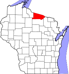 | |
| Towns | ||
| CDPs | ||
| Unincorporated communities | ||
| Indian reservations | ||
| Footnotes | ‡This populated place also has portions in an adjacent county or counties | |
Coordinates: 46°14′50″N 89°43′46″W / 46.24722°N 89.72944°W