Poinsett Bridge
| Poinsett Bridge | |
|---|---|
 Poinsett Bridge in South Carolina | |
| Crosses | Little Gap Creek |
| Locale | Greenville County, South Carolina |
| Characteristics | |
| Total length | 130 feet (40 m) |
| Clearance above | 15 feet (5 m) |
| Statistics | |
| Toll | |
|
Poinsett Bridge | |
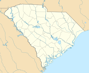  | |
| Nearest city | Tigerville, South Carolina |
| Coordinates | 35°07′46.1″N 82°23′03.4″W / 35.129472°N 82.384278°WCoordinates: 35°07′46.1″N 82°23′03.4″W / 35.129472°N 82.384278°W |
| Area | 6 acres (2.4 ha) |
| Built | 1820 |
| NRHP Reference # | 70000590[1] |
| Added to NRHP | October 22, 1970 |
.jpg)
Gothic arch of the Poinsett Bridge
Poinsett Bridge is the oldest bridge in South Carolina and perhaps in the entire southeastern United States.[2][3] Named for Joel Roberts Poinsett, it was built in 1820 as part of a road from Columbia, South Carolina to Saluda Mountain.[4][5] The stone bridge, which includes a 14-foot Gothic arch and stretches 130 feet over Little Gap Creek, may have been designed by Robert Mills, architect of the Washington Monument.[6] Though no longer in use, the bridge remains largely intact [7] and is part of the 120-acre (48.6 ha) Poinsett Bridge Heritage Preserve. There is a nature trail a few hundred yards from the bridge.[8] The bridge was named to the National Register of Historic Places in 1970.[1][9]
References
- 1 2 National Park Service (2010-07-09). "National Register Information System". National Register of Historic Places. National Park Service.
- ↑ Travelers Rest, SC website.
- ↑ Charles Sowell, "Poinsett Bridge is always worth the trip," Greenville News, March 6, 2015, eGreenville, 23.
- ↑ Schuette, Mary (August 29, 1970). "Poinsett Bridge" (pdf). National Register of Historic Places - Nomination and Inventory. Retrieved 7 July 2012.
- ↑ "Poinsett Bridge, Greenville County (S.C. Sec. Rd. 42, Tigerville vicinity)". National Register Properties in South Carolina. South Carolina Department of Archives and History. Retrieved 7 July 2012.
- ↑ Greenville County Recreation District. The Tulane University library has a brush drawing by Mill of a similar bridge, lending credence to the belief that Mills designed it.
- ↑ Edgar, Walter, ed. The South Carolina Encyclopedia, University of South Carolina Press, 2006 ISBN 1-57003-598-9, pp. 739-740.
- ↑ South Carolina Department of Natural Resources website; Sowell, 23.. The bridge is off U.S. Highway 25 north of Greenville, South Carolina. After passing South Carolina Highway 11, turn right onto Old US 25. Then turn right onto Callahan Mountain Road near North Saluda Reservoir. Poinsett Bridge is on the left side of Callahan Mountain Road.
- ↑ Additional pictures and information about the bridge is available from the Historic American Engineering Record at the Library of Congress.HAER photos of Poinsett Bridge
| Topics |   | |
|---|---|---|
| Lists by county |
| |
| Lists by city | ||
| Other lists | ||
This article is issued from Wikipedia - version of the 11/25/2016. The text is available under the Creative Commons Attribution/Share Alike but additional terms may apply for the media files.