Pine Point, South Australia
| Pine Point South Australia | |||||||||||||
|---|---|---|---|---|---|---|---|---|---|---|---|---|---|
|
Beachside shacks at Pine Point | |||||||||||||
 Pine Point | |||||||||||||
| Coordinates | 34°34′05″S 137°52′56″E / 34.5681°S 137.8822°ECoordinates: 34°34′05″S 137°52′56″E / 34.5681°S 137.8822°E | ||||||||||||
| Established | 1884[1] | ||||||||||||
| Postcode(s) | 5571 | ||||||||||||
| Location | 17 km (11 mi) S of Ardrossan | ||||||||||||
| LGA(s) | Yorke Peninsula Council | ||||||||||||
| State electorate(s) | Goyder[2] | ||||||||||||
| Federal Division(s) | Grey[3] | ||||||||||||
| |||||||||||||
| Footnotes | Adjoining localities[1] | ||||||||||||
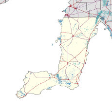
Pine Point (formerly Muloowurtie) is a locality in the Australian state of South Australia on the east side of Yorke Peninsula adjacent to Gulf St Vincent. It was surveyed as a government town in 1883 and proclaimed under the name of Muloowurtie on 24 January 1884. The name was changed to Pine Point in 1940. The boundaries of the locality were created in May 1999 in respect to the “long established name” and includes both “the Pine Point Shack Site” and " the Government Town of Pine Point."[1][4]
See also
References
- 1 2 3 "Search result for " Pine Point (LOCB)" (Record no SA0055369) with the following layers selected - "Suburbs and Localities" and " Place names (gazetteer)"". Property Location Browser. Government of South Australia. Retrieved 7 November 2016.
- ↑ "Goyder electorate boundaries as of 2014". ELECTORAL COMMISSION SA. Retrieved 23 July 2015.
- ↑ "Federal electoral division of Grey" (PDF). Australian Electoral Commission. Retrieved 24 July 2015.
- ↑ "NEW TOWN NAMES APPROVED". Chronicle. LXXXIII, (4,728). South Australia. 1 August 1940. p. 13. Retrieved 31 August 2016 – via National Library of Australia.
External links
![]() Media related to Pine Point, South Australia at Wikimedia Commons
Media related to Pine Point, South Australia at Wikimedia Commons
This article is issued from Wikipedia - version of the 11/6/2016. The text is available under the Creative Commons Attribution/Share Alike but additional terms may apply for the media files.