Pinardville, New Hampshire
| Pinardville, New Hampshire | |
|---|---|
| Census-designated place | |
 | |
 Pinardville  Pinardville | |
| Coordinates: 42°59′42″N 71°30′31″W / 42.99500°N 71.50861°WCoordinates: 42°59′42″N 71°30′31″W / 42.99500°N 71.50861°W | |
| Country | United States |
| State | New Hampshire |
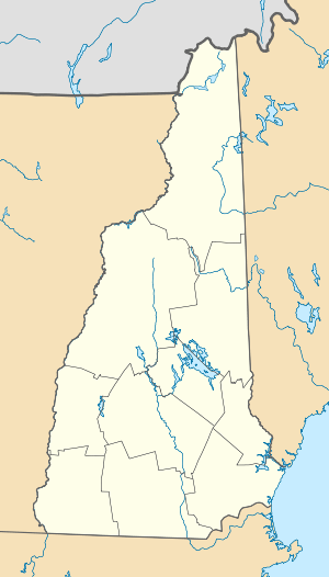
| County | Hillsborough |
| Town | Goffstown |
| Area | |
| • Total | 1.8 sq mi (4.7 km2) |
| • Land | 1.7 sq mi (4.3 km2) |
| • Water | 0.2 sq mi (0.4 km2) |
| Elevation | 266 ft (81 m) |
| Population (2010) | |
| • Total | 4,780 |
| • Density | 2,874/sq mi (1,109.8/km2) |
| Time zone | Eastern (EST) (UTC-5) |
| • Summer (DST) | EDT (UTC-4) |
| ZIP code | 03102 |
| Area code(s) | 603 |
| FIPS code | 33-61220 |
| GNIS feature ID | 0869156 |
Pinardville is a census-designated place (CDP) in the town of Goffstown in Hillsborough County, New Hampshire, United States. The population was 4,780 at the 2010 census.[1] Pinardville has existed since 1906.
Geography
Pinardville is located in the southeastern part of Goffstown at 42°59′47″N 71°30′30″W / 42.99639°N 71.50833°W (42.996283, -71.508452).[2] It is bordered to the east by the city of Manchester and to the north by the Piscataquog River.
According to the United States Census Bureau, the CDP has a total area of 1.8 square miles (4.7 km2), of which 1.7 sq mi (4.3 km2) is land and 0.15 sq mi (0.4 km2), or 8.72%, is water.[1]
History
In 1906, Edmond Pinard, a grocer by trade, developed real-estate holdings on the Manchester/Goffstown town line. Pinard was a French Canadian man who brought many French Canadians to the area. The area was known at the time as Pinards Ville. It has grown substantially since then, but many of the original families still live in the area.
Demographics
As of the census[3] of 2000, there were 5,779 people, 1,932 households, and 1,234 families residing in the CDP. The population density was 3,499.2 people per square mile (1,352.3/km²). There were 1,969 housing units at an average density of 1,192.3 per square mile (460.7/km²). The racial makeup of the CDP was 97.49% White, 0.22% African American, 0.26% Native American, 0.61% Asian, 0.02% Pacific Islander, 0.48% from other races, and 0.92% from two or more races. Hispanic or Latino of any race were 1.11% of the population.
There were 1,932 households out of which 27.8% had children under the age of 18 living with them, 50.2% were married couples living together, 9.6% had a female householder with no husband present, and 36.1% were non-families. 25.8% of all households were made up of individuals and 10.7% had someone living alone who was 65 years of age or older. The average household size was 2.44 and the average family size was 2.91.
In the CDP the population was spread out with 17.2% under the age of 18, 25.2% from 18 to 24, 26.8% from 25 to 44, 19.9% from 45 to 64, and 10.9% who were 65 years of age or older. The median age was 32 years. For every 100 females there were 93.2 males. For every 100 females age 18 and over, there were 92.0 males.
The median income for a household in the CDP was $49,640, and the median income for a family was $54,955. Males had a median income of $34,590 versus $25,687 for females. The per capita income for the CDP was $18,011. About 4.3% of families and 7.2% of the population were below the poverty line, including 7.2% of those under age 18 and 7.4% of those age 65 or over.
References
- 1 2 "Geographic Identifiers: 2010 Demographic Profile Data (G001): Pinardville CDP, New Hampshire". U.S. Census Bureau, American Factfinder. Retrieved December 9, 2013.
- ↑ "US Gazetteer files: 2010, 2000, and 1990". United States Census Bureau. 2011-02-12. Retrieved 2011-04-23.
- ↑ "American FactFinder". United States Census Bureau. Retrieved 2008-01-31.
External links
Municipalities and communities of Hillsborough County, New Hampshire, United States | ||
|---|---|---|
| Cities | 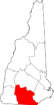 | |
| Towns | ||
| CDPs | ||
| Other villages | ||