Pierson, Michigan
| Pierson, Michigan | |
|---|---|
| Village | |
 Location of Pierson within Montcalm County, Michigan | |
| Coordinates: 43°19′11″N 85°29′52″W / 43.31972°N 85.49778°WCoordinates: 43°19′11″N 85°29′52″W / 43.31972°N 85.49778°W | |
| Country | United States |
| State | Michigan |
| County | Montcalm |
| Area[1] | |
| • Total | 0.25 sq mi (0.65 km2) |
| • Land | 0.25 sq mi (0.65 km2) |
| • Water | 0 sq mi (0 km2) |
| Elevation | 909 ft (277 m) |
| Population (2010)[2] | |
| • Total | 172 |
| • Estimate (2012[3]) | 172 |
| • Density | 688.0/sq mi (265.6/km2) |
| Time zone | Eastern (EST) (UTC-5) |
| • Summer (DST) | EDT (UTC-4) |
| ZIP code | 49339 |
| Area code(s) | 616 |
| FIPS code | 26-64020[4] |
| GNIS feature ID | 0634840[5] |
Pierson is a village in Montcalm County of the U.S. state of Michigan. The population was 172 at the 2010 census. The village is within Pierson Township.
In 1856, David S. Pierson acquired forty acres of land here. With Dexter Clark and John L. Shar, Pierson founded the community while it was still part of Mecosta County. Pierson opened the first post office in his home on January 29, 1857. It was platted in 1870 and incorporated as a village in 1873.[6]
Geography
According to the United States Census Bureau, the village has a total area of 0.25 square miles (0.65 km2), all land.[1]
The Pierson post office, with ZIP code 49339, also serves most of Pierson Township, as well as portions of Maple Valley Township to the east.[7]
Demographics
| Historical population | |||
|---|---|---|---|
| Census | Pop. | %± | |
| 1880 | 372 | — | |
| 1890 | 215 | −42.2% | |
| 1900 | 215 | 0.0% | |
| 1910 | 183 | −14.9% | |
| 1920 | 164 | −10.4% | |
| 1930 | 144 | −12.2% | |
| 1940 | 147 | 2.1% | |
| 1950 | 169 | 15.0% | |
| 1960 | 219 | 29.6% | |
| 1970 | 193 | −11.9% | |
| 1980 | 216 | 11.9% | |
| 1990 | 207 | −4.2% | |
| 2000 | 185 | −10.6% | |
| 2010 | 172 | −7.0% | |
| Est. 2015 | 173 | [8] | 0.6% |
2010 census
As of the census[2] of 2010, there were 172 people, 62 households, and 45 families residing in the village. The population density was 688.0 inhabitants per square mile (265.6/km2). There were 73 housing units at an average density of 292.0 per square mile (112.7/km2). The racial makeup of the village was 98.3% White, 0.6% African American, and 1.2% from other races. Hispanic or Latino of any race were 1.7% of the population.
There were 62 households of which 43.5% had children under the age of 18 living with them, 45.2% were married couples living together, 12.9% had a female householder with no husband present, 14.5% had a male householder with no wife present, and 27.4% were non-families. 19.4% of all households were made up of individuals and 4.8% had someone living alone who was 65 years of age or older. The average household size was 2.77 and the average family size was 3.16.
The median age in the village was 30.3 years. 29.1% of residents were under the age of 18; 10.5% were between the ages of 18 and 24; 31.9% were from 25 to 44; 21.5% were from 45 to 64; and 7% were 65 years of age or older. The gender makeup of the village was 56.4% male and 43.6% female.
2000 census
As of the census[4] of 2000, there were 185 people, 62 households, and 46 families residing in the village. The population density was 730.2 per square mile (285.7/km²). There were 73 housing units at an average density of 288.1 per square mile (112.7/km²). The racial makeup of the village was 96.22% White, 1.62% Native American, 0.54% from other races, and 1.62% from two or more races. Hispanic or Latino of any race were 2.16% of the population.
There were 62 households out of which 41.9% had children under the age of 18 living with them, 59.7% were married couples living together, 6.5% had a female householder with no husband present, and 24.2% were non-families. 16.1% of all households were made up of individuals and 9.7% had someone living alone who was 65 years of age or older. The average household size was 2.98 and the average family size was 3.38.
In the village the population was spread out with 31.4% under the age of 18, 14.1% from 18 to 24, 32.4% from 25 to 44, 15.1% from 45 to 64, and 7.0% who were 65 years of age or older. The median age was 27 years. For every 100 females there were 103.3 males. For every 100 females age 18 and over, there were 108.2 males.
The median income for a household in the village was $37,500, and the median income for a family was $39,000. Males had a median income of $29,063 versus $17,500 for females. The per capita income for the village was $10,456. About 8.7% of families and 11.8% of the population were below the poverty line, including 10.5% of those under the age of eighteen and 12.5% of those sixty five or over.
References
- 1 2 "US Gazetteer files 2010". United States Census Bureau. Retrieved 2012-11-25.
- 1 2 "American FactFinder". United States Census Bureau. Retrieved 2012-11-25.
- ↑ "Population Estimates". United States Census Bureau. Retrieved 2013-06-03.
- 1 2 "American FactFinder". United States Census Bureau. Retrieved 2008-01-31.
- ↑ U.S. Geological Survey Geographic Names Information System: Pierson, Michigan
- ↑ Romig, Walter (1986) [1973]. Michigan Place Names. Detroit, Michigan: Wayne State University Press. ISBN 0-8143-1838-X.
- ↑ ZCTA Reference Map for 49339, U.S. Census Bureau, 2000 census
- ↑ "Annual Estimates of the Resident Population for Incorporated Places: April 1, 2010 to July 1, 2015". Retrieved July 2, 2016.
- ↑ "Census of Population and Housing". Census.gov. Retrieved June 4, 2015.
Municipalities and communities of Montcalm County, Michigan, United States | ||
|---|---|---|
| Cities | 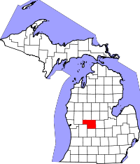 | |
| Villages | ||
| Charter township | ||
| General law townships | ||