Peewee, West Virginia
| Peewee | |
|---|---|
| Unincorporated community | |
 Peewee  Peewee Location within the state of West Virginia | |
| Coordinates: 38°57′45″N 81°29′29″W / 38.96250°N 81.49139°WCoordinates: 38°57′45″N 81°29′29″W / 38.96250°N 81.49139°W | |
| Country | United States |
| State | West Virginia |
| County | Wirt |
| Time zone | Eastern (EST) (UTC-5) |
| • Summer (DST) | EDT (UTC-4) |
| GNIS feature ID | 1549870[1] |
Peewee (also Pee Wee) is an unincorporated community in southwestern Wirt County, West Virginia, United States. It lies along local roads southwest of the town of Elizabeth, the county seat of Wirt County.[2] Its elevation is 679 feet (207 m).[3] Right Reedy Creek is formed at Peewee by the confluence of Enoch Fork and Fulls Fork.[4]
References
- ↑ U.S. Geological Survey Geographic Names Information System: Peewee, West Virginia
- ↑ Rand McNally. The Road Atlas '08. Chicago: Rand McNally, 2008, p. 112.
- ↑ U.S. Geological Survey Geographic Names Information System: Peewee, West Virginia, Geographic Names Information System, 1980-06-27. Accessed 2008-04-30.
- ↑ West Virginia Atlas & Gazetteer. Yarmouth, Me.: DeLorme. 1997. p. 33. ISBN 0-89933-246-3.
Municipalities and communities of Wirt County, West Virginia, United States | ||
|---|---|---|
| Town | 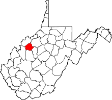 | |
| Unincorporated communities | ||
| Ghost towns | ||
This article is issued from Wikipedia - version of the 7/28/2016. The text is available under the Creative Commons Attribution/Share Alike but additional terms may apply for the media files.