Pecan Island, Louisiana
Pecan Island (French: La Pacanière) is an unincorporated community with a population of about 300 located in Vermilion Parish, Louisiana. It is located right under the southern peak of White Lake and two ridges comprise the island, which are actually cheniers or "ridges of high ground"[1] in the coast marsh. There is minimal land in the region, with the island being "an old Gulf beach, composed of crushed shells and sand".[2]
It is located in the prairie-marsh region of southern Louisiana, approximately ten miles from the Gulf of Mexico. The town is inhabited largely by persons of cajun ancestry, and has a Catholic Mission church, Sacred Heart, a Baptist church and, a Methodist church. Since Hurricane Rita occurred only one store exists, which sells fuel, groceries and, hunting supplies. Common family names in the area include Veazey, Stelly, Guidry, Choate, Winch, Broussard, Morgan, Dyson, White, Lege, Harrington, Lee, and Miller. The town had been previously ravaged by Hurricane Audrey in 1957.
Pecan Island is part of the Abbeville Micropolitan Statistical Area.
Hurricane Rita
Most residents evacuated under the threat of Hurricane Rita, which obliterated most of the homes there and forced the closure of the community's school - Pecan Island High School. As with most Gulf coastal towns, future growth will be regulated by FEMA construction guidelines following the 2005 hurricanes, meaning new homes will be somewhat more expensive to construct, due to the increased elevation requirement.[3]
Local events
It has a Mardi Gras and is bustling with duck hunters in the winter months. In the summer, they have a Jaboodee festival, in which locals worship the band Jaboodee. This festival includes the "throwing of the fish" and a game of naked tag.
Morgan effigy
Native Americans, including the Atakapa-Ishak Nation, used the island as their hunting and ceremonial grounds and it is in one of these ceremonial mounds on the island in 1986 the Morgan Effigy,[4] a human death figure carved from a deer antler by Native Americans (ca. 1000) was found.[5]
References
- ↑ The Louisiana Journey By Terry L. Jones - Gibbs Smith, Jun 5, 2006 - p.10
- ↑ Louisiana: A Guide to the State By Federal Writers' Project - US History Publishers, 1947 - p.443
- ↑ Hurricane Rita Surge Inundation and Advisory Base Flood Elevation Maps - Federal Emergency Management Agency
- ↑ Historical Images - Vermilion Historical Society - Abbeville Louisiana
- ↑ The Morgan Effigy - by Gary E. Theall - Vermilion Historical Society - Abbeville Louisiana
External links
Coordinates: 29°38′48″N 92°27′11″W / 29.64667°N 92.45306°W
Municipalities and communities of Vermilion Parish, Louisiana, United States | ||
|---|---|---|
| Cities | 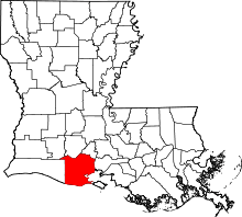 | |
| Town | ||
| Village | ||
| Unincorporated communities | ||
| Footnotes | ‡This populated place also has portions in an adjacent parish or parishes | |