Orovada, Nevada
| Orovada, Nevada | |
|---|---|
| Census-designated place | |
 | |
 Orovada Location within the state of Nevada | |
| Coordinates: 41°34′12″N 117°47′2″W / 41.57000°N 117.78389°WCoordinates: 41°34′12″N 117°47′2″W / 41.57000°N 117.78389°W | |
| Country | United States |
| State | Nevada |
| County | Humboldt |
| Area | |
| • Total | 45.3 sq mi (117.3 km2) |
| • Land | 45.3 sq mi (117.3 km2) |
| • Water | 0 sq mi (0 km2) |
| Population (2010) | |
| • Total | 155 |
| • Density | 3.4/sq mi (1.3/km2) |
| Time zone | Pacific (PST) (UTC-8) |
| • Summer (DST) | PDT (UTC-7) |
| FIPS code | 32-53000 |
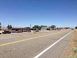
Orovada is a census-designated place in Humboldt County, Nevada. The population was 155 at the 2010 census.[1]
Rodeo announcer Bob Tallman lived on a ranch near Orovada during his early childhood.[2]
Education
The Humboldt County School District operates schools serving areas with Orovada addresses. Some areas are zoned to Orovada School, a K-8 school. Other areas are zoned to Kings River School, a K-8 school.
Geography
According to the United States Census Bureau, the Orovada CDP has an area of 45.3 square miles (117.3 km2), all land.[1] U.S. Route 95 runs through the CDP, leading south 43 miles (69 km) to Winnemucca and north 30 miles (48 km) to the Oregon state line at McDermitt.
References
- 1 2 "Geographic Identifiers: 2010 Demographic Profile Data (G001): Orovada CDP, Nevada". U.S. Census Bureau, American Factfinder. Retrieved January 24, 2013.
- ↑ "Kristen Tribe, "The Voice of Rodeo"". americanprofile.com. Retrieved April 4, 2010.
| Wikimedia Commons has media related to Orovada, Nevada. |
Municipalities and communities of Humboldt County, Nevada, United States | ||
|---|---|---|
| City | 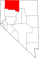 | |
| CDPs | ||
| Unincorporated community | ||
| Indian Colony | ||
| Indian Reservation | ||
| Ghost towns |
| |
This article is issued from Wikipedia - version of the 3/10/2016. The text is available under the Creative Commons Attribution/Share Alike but additional terms may apply for the media files.
