Old Ottawa East
| Ottawa East / Ottawa Est | |
|---|---|
| Neighbourhood | |
|
Main Street | |
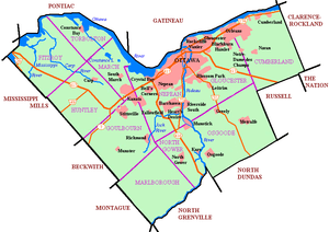 Ottawa East / Ottawa Est Location in Ottawa | |
| Coordinates: 45°24′45″N 75°40′35″W / 45.41250°N 75.67639°W | |
| Country | Canada |
| Province | Ontario |
| City | Ottawa |
| Established | Archville |
| Incorporated | 1888 (Village of Ottawa East) |
| Annexation | 1907 (City of Ottawa) |
| Government | |
| • Mayor | Jim Watson |
| • MPs | Catherine McKenna |
| • MPPs | Yasir Naqvi |
| • Councillors | David Chernushenko |
| Elevation | 70 m (230 ft) |
| Population (2011) | |
| • Total | 7,279 |
| Canada 2011 Census | |
| Time zone | Eastern (EST) (UTC-5) |
| • Summer (DST) | EDT (UTC-4) |
| Forward sortation area | K1S |

Old Ottawa East or just Ottawa East (Vieil Ottawa Est in French) is a neighbourhood in Capital Ward in central Ottawa, Canada. It is located south of Nicholas Street and between the Rideau Canal and the Rideau River. The southern border is Avenue Road.[1] To the south is the neighbourhood of Old Ottawa South to the northwest is Sandy Hill. Old Ottawa East includes the Lees Avenue area.
According to the Canada 2011 Census, the population of the neighbourhood was 7,279 [2]
This small neighbourhood was originally the suburban community of Archville that was incorporated as the village of Ottawa East in 1888. In 1907 it was amalgamated with the growing community of Ottawa. Running through the centre of the neighbourhood is Main Street, which was the central road of Archville, but which is not particularly central to modern Ottawa. The neighbourhood is home to Saint Paul University, Lady Evelyn Alternative School, St. Nicholas Adult High School and Immaculata High School.
The southern part of the neighbourhood is sometimes referred to as Rideau Gardens.
Reeves:
- James Ballantyne
- Henry George Roche

See also
External links
| Wikimedia Commons has media related to Old Ottawa East. |
References
- ↑ http://www.capitalward.ca/en/about-capital-ward/54-old-ottawa-east
- ↑ Population calculated by combining Census Tract 5050015.00 with Dissemination Areas 35060280, 35061628, 35061623, 35061627, 35060282 while removing blocks 3506162704 3506162703 3506028206
 |
Centretown | Sandy Hill | | |
| |
Overbrook | |||
| ||||
| | ||||
| The Glebe | Old Ottawa South | Riverview |
