Okolona, Mississippi
| Okolona, Mississippi | |
|---|---|
| City | |
 Location of Okolona, Mississippi | |
 Okolona, Mississippi Location in the United States | |
| Coordinates: 34°0′21″N 88°45′2″W / 34.00583°N 88.75056°WCoordinates: 34°0′21″N 88°45′2″W / 34.00583°N 88.75056°W | |
| Country | United States |
| State | Mississippi |
| County | Chickasaw |
| Government | |
| • Mayor | Louise Cole |
| Area | |
| • Total | 6.66 sq mi (17.26 km2) |
| • Land | 6.64 sq mi (17.21 km2) |
| • Water | 0.02 sq mi (0.04 km2) |
| Elevation | 338 ft (103 m) |
| Population (2010)[1] | |
| • Total | 2,692 |
| • Density | 405/sq mi (156.4/km2) |
| Time zone | Central (CST) (UTC-6) |
| • Summer (DST) | CDT (UTC-5) |
| ZIP code | 38860 |
| Area code(s) | 662 |
| FIPS code | 28-53680 |
| GNIS feature ID | 0694253 |
| Website |
www |

Okolona is a city in and one of the two county seats of Chickasaw County, Mississippi, United States.[2] It is located near the eastern border of the county. The population was 2,692 at the 2010 census.[1]
History
Okolona was named as Rose Hill in 1845 early in its settlement, but residents later discovered that another location had this name. When a US post office was established here in 1850, a new name was needed to avoid confusion in mail delivery. According to the Okolona Area Chamber of Commerce, Colonel Josiah N. Walton, postmaster of nearby Aberdeen, remembered an encounter with a Chickasaw warrior years earlier. The man's name was Oka-laua, meaning peaceful, yellow, or blue water. Walton renamed Rose Hill as Okolona in his honor.
Due to the destruction brought to the area by the Civil War, few structures from the antebellum period remain. The Elliot Donaldson House, constructed in 1850, survives and was added to the National Register of Historic Places in 1980. A few other homes have also survived.
In the mid nineteenth century, Okolona and the surrounding Black Prairie, sometimes called the Black Belt or Prairie Belt, became what has been called the "Bread Basket of the Confederacy". The area was part of the original Cotton Belt of Mississippi well before the more famous Delta region gained fame for major cotton production.
The Mobile and Ohio Railroad completed its tracks though Okolona in 1859, making the town a center for the ginning of cotton and its shipment to markets. The town grew along Main Street as a result of the railroad. Most commercial buildings from this period, including the depot, were burned during the Civil War.
Civil War era
Five skirmishes or battles between Union and Confederate forces occurred in and around Okolona. The eponymous Battle of Okolona occurred in February 1864. In a running cavalry clash between Confederate General Nathan Bedford Forrest and Union General William Sooy Smith, the Federals were defeated just north and west of town. General Forrest's brother, Jeffery, was killed in the engagement.
Okolona College
Okolona College served African Americans. Today it is central to the Okolona College Historic District.
Geography
According to the United States Census Bureau, the city has a total area of 6.66 square miles (17.26 km2), of which 6.64 square miles (17.21 km2) is land and 0.02 square miles (0.04 km2), or 0.23%, is water.[1]
As highways were built, they passed through the city, connecting it with other towns. This is the location of the junction of former U.S. Route 45 Alternate (Church Street) and Mississippi Highway 32 (Monroe Avenue). US-45A now bypasses the town to the east as a four-lane divided highway.
Demographics
| Historical population | |||
|---|---|---|---|
| Census | Pop. | %± | |
| 1870 | 1,410 | — | |
| 1880 | 1,858 | 31.8% | |
| 1890 | 2,099 | 13.0% | |
| 1900 | 2,177 | 3.7% | |
| 1910 | 2,584 | 18.7% | |
| 1920 | 3,852 | 49.1% | |
| 1930 | 2,235 | −42.0% | |
| 1940 | 2,117 | −5.3% | |
| 1950 | 2,167 | 2.4% | |
| 1960 | 2,622 | 21.0% | |
| 1970 | 3,002 | 14.5% | |
| 1980 | 3,409 | 13.6% | |
| 1990 | 3,267 | −4.2% | |
| 2000 | 3,056 | −6.5% | |
| 2010 | 2,692 | −11.9% | |
| Est. 2015 | 2,638 | [3] | −2.0% |
As of the 2010 United States Census, there were 2,692 people residing in the city. 70.0% were African American, 27.9% White, 0.0% Native American, 0.1% Asian, 0.9% from some other race and 1.1% of two or more races. 1.3% were Hispanic or Latino of any race.
As of the census of 2000, there are 3,056 people, 1,177 households, and 786 families residing in the city. The population density is 481.8 people per square mile (186.1/km²). There are 1,315 housing units at an average density of 207.3 per square mile (80.1/km²). The racial makeup of the city is 39.40% White, 59.62% African American, 0.03% Native American, 0.13% Asian, 0.13% from other races, and 0.69% from two or more races. 1.05% of the population are Hispanic or Latino of any race.
There are 1,177 households out of which 33.8% have children under the age of 18 living with them, 35.6% are married couples living together, 28.1% have a female householder with no husband present, and 33.2% are non-families. 30.2% of all households are made up of individuals and 14.8% have someone living alone who is 65 years of age or older. The average household size is 2.54 and the average family size is 3.16.
In the city the population is spread out with 30.0% under the age of 18, 8.9% from 18 to 24, 24.7% from 25 to 44, 22.0% from 45 to 64, and 14.5% who are 65 years of age or older. The median age is 34 years. For every 100 females there are 77.2 males. For every 100 females age 18 and over, there are 71.6 males.
The median income for a household in the city is $20,000, and the median income for a family is $32,147. Males have a median income of $26,217 versus $17,276 for females. The per capita income for the city is $11,486. 35.4% of the population and 29.7% of families are below the poverty line. Out of the total people living in poverty, 55.4% are under the age of 18 and 20.9% are 65 or older.
Education
Okolona is served by the Okolona Municipal Separate School District. On February 19, 2010, the Mississippi State Board of Education voted unanimously to abolish the school district. State Superintendent of Education Tom Burnham said the conservator of the district will be Mike Vinson.[5]
Notable people
- Thomas Abernethy, former US Cogressman
- Tim Bowens, NFL player for the Miami Dolphins for 10 seasons
- DeVan Dallas, Mississippi state legislator
- Jack Gregory, NFL player; member, Mississippi Sports Hall of Fame
- William Raspberry, columnist[6]
- Milan Williams, keyboardist and composer for The Commodores
References
- 1 2 3 "Geographic Identifiers: 2010 Demographic Profile Data (G001): Okolona city, Mississippi". U.S. Census Bureau, American Factfinder. Retrieved October 3, 2014.
- ↑ "Find a County". National Association of Counties. Archived from the original on May 31, 2011. Retrieved 2011-06-07.
- ↑ "Annual Estimates of the Resident Population for Incorporated Places: April 1, 2010 to July 1, 2015". Retrieved July 2, 2016.
- ↑ "Census of Population and Housing". Census.gov. Archived from the original on May 11, 2015. Retrieved June 4, 2015.
- ↑
- ↑ Raspberry, William (December 26, 2005). "What I'll Do Next". The Washington Post. Retrieved 2007-03-14.
External links
Municipalities and communities of Chickasaw County, Mississippi, United States | ||
|---|---|---|
| Cities | 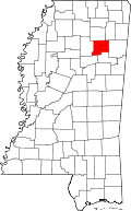 | |
| Town | ||
| Village | ||
| Unincorporated communities | ||
