North Okaw Township, Coles County, Illinois
| North Okaw Township | |
|---|---|
| Township | |
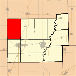 Location in Coles County | |
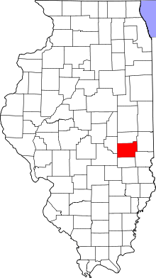 Coles County's location in Illinois | |
| Coordinates: 39°35′N 88°25′W / 39.583°N 88.417°WCoordinates: 39°35′N 88°25′W / 39.583°N 88.417°W | |
| Country | United States |
| State | Illinois |
| County | Coles |
| Established | November 8, 1859 |
| Area | |
| • Total | 54.41 sq mi (140.9 km2) |
| • Land | 54.37 sq mi (140.8 km2) |
| • Water | 0.04 sq mi (0.1 km2) 0.07% |
| Elevation | 653 ft (199 m) |
| Population (2010) | |
| • Total | 983 |
| • Density | 18.1/sq mi (7.0/km2) |
| Time zone | CST (UTC-6) |
| • Summer (DST) | CDT (UTC-5) |
| ZIP codes | 61910, 61911, 61931, 61938, 61951 |
| GNIS feature ID | 0429462 |
North Okaw Township is one of twelve townships in Coles County, Illinois, USA. As of the 2010 census, its population was 983 and it contained 377 housing units.[1] The Kaskaskia River flows through the township. The Cook Mills Consolidated oil field is within this township. The township changed its name from Okaw Township on May 7, 1860.
Geography
According to the 2010 census, the township has a total area of 54.41 square miles (140.9 km2), of which 54.37 square miles (140.8 km2) (or 99.93%) is land and 0.04 square miles (0.10 km2) (or 0.07%) is water.[1]
Unincorporated towns
(This list is based on USGS data and may include former settlements.)
Cemeteries
The township contains five cemeteries: Brann, Mount Zion, Pleasant Grove, Smith and Zoar.
Major highways
School districts
- Arcola Consolidated Unit School District 306
- Arthur Community Unit School District 305
- Mattoon Community Unit School District 2
- Sullivan Community Unit School District 300
Political districts
- Illinois' 15th congressional district
- State House District 110
- State Senate District 55
References
- "North Okaw Township, Coles County, Illinois". Geographic Names Information System. United States Geological Survey. Retrieved 2010-01-10.
- United States Census Bureau 2007 TIGER/Line Shapefiles
- United States National Atlas
- 1 2 "Population, Housing Units, Area, and Density: 2010 - County -- County Subdivision and Place -- 2010 Census Summary File 1". United States Census. Retrieved 2013-05-28.
External links
Adjacent townships

Municipalities and communities of Coles County, Illinois, United States | ||
|---|---|---|
| Cities | ||
| Villages | ||
| Townships | ||
| Unincorporated communities | ||
| Extinct communities |
| |
| Footnotes | ‡This populated place also has portions in an adjacent county or counties | |
This article is issued from Wikipedia - version of the 12/5/2013. The text is available under the Creative Commons Attribution/Share Alike but additional terms may apply for the media files.