North Carolina Highway 275
| ||||
|---|---|---|---|---|
 | ||||
| Route information | ||||
| Maintained by NCDOT | ||||
| Length: | 10.7 mi[1] (17.2 km) | |||
| Existed: | 1930 – present | |||
| Major junctions | ||||
| West end: |
| |||
|
| ||||
| East end: |
| |||
| Location | ||||
| Counties: | Gaston | |||
| Highway system | ||||
| ||||

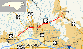
North Carolina Highway 275 (NC 275) is a primary state highway in the U.S. state of North Carolina. It connects the cities of Bessemer City, Dallas, and Stanley.
Route description

East NC 275 in Gastonia
History
The highway was established in 1930 as a new primary routing from U.S. Route 74 (US 74) and NC 20 (now NC 274) near Bessemer City to NC 27 in Stanley. The route has changed little since.[2]
Junction list
The entire route is in Gaston County.
| Location | mi[1] | km | Destinations | Notes | |
|---|---|---|---|---|---|
| Gastonia | 0.0 | 0.0 | |||
| Dallas | 3.0 | 4.8 | West end of NC 279 overlap | ||
| 3.7 | 6.0 | West end of US 321 Business overlap | |||
| 3.8 | 6.1 | Exit 12A–B (US 321); east end of US 321 Business overlap | |||
| 5.0 | 8.0 | East end of NC 279 overlap | |||
| Stanley | 10.7 | 17.2 | |||
1.000 mi = 1.609 km; 1.000 km = 0.621 mi
| |||||
References
| Wikimedia Commons has media related to North Carolina Highway 275. |
- 1 2 Google (2012-01-09). "North Carolina Highway 275" (Map). Google Maps. Google. Retrieved 2012-01-09.
- ↑ "NCRoads.com: N.C. 275". Retrieved 2012-01-09.
This article is issued from Wikipedia - version of the 11/12/2016. The text is available under the Creative Commons Attribution/Share Alike but additional terms may apply for the media files.