Nishi-Shinjuku-gochōme Station
Nishi Shinjuku Gochōme Station 西新宿五丁目駅 | |
|---|---|
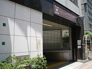 Entrance A1 | |
| Location |
Shinjuku, Tokyo, Tokyo Japan |
| Operated by | Tokyo Metropolitan Bureau of Transportation |
| Line(s) | Ōedo Line |
| Connections |
|
| Other information | |
| Station code | E-29 |
| History | |
| Opened | 1997 |
Nishi Shinjuku Gochome Station (西新宿五丁目駅 Nishishinjuku Gochōme-eki) is a train station on the Toei Oedo Line. It is operated by the Tokyo Metropolitan Bureau of Transportation.
Surrounding area
Nishi-Shinjuku Gochome is a residential area west of Shinjuku. The purpose of this station is to provide access to the Toho private schools. Toho has many schools within walking distance of the station. This station is at the heart of Nishi-Shinjuku's residential high rise area. Shinjuku Central park is a short walk east of the station. It is a beautiful park that is popular during the cherry blossom season. Nishi-Shinjuku Gochome also has a small commercial centre with all the major convenience stores and several small restaurants serving locals with a variety of delicious foods.
Station layout
Like most stations on the Oedo line, this station has a platform that runs between both trains. The elevator is located near the fifth car and two staircases and escalators are located at cars 2 and 7. There is only one ticket gate and three sets of ticket machines. Only one serves tickets in English. There are two exits to this station. They serve the north and south sides of Kita Dori. Yamate Dori lies just West of the station. There is also a lost and found office just inside the ticket gates.
Buses
Nishi-Shinjuku Gochome is served by the Keio Bus Company. Two bus lines pass through this station. All eastbound buses are bound for Shinjuku. Westbound, the 33 bus heads to Eifukucho and the 32 heads in a similar direction. West of the station at the Shimizubashi intersection, the 64 Keio bus heads North to Nakano Sakaue Station and Nakano Station while the southbound buses head to Shibuya Station.
Adjacent stations
| « | Service | » | ||
|---|---|---|---|---|
| Toei Oedo Line (E-29) | ||||
| Tochōmae (E-28) | Nakano-sakaue (E-30) | |||
Coordinates: 35°41′23″N 139°41′04″E / 35.6897°N 139.6844°E