Newhall, Derbyshire
| Newhall | |
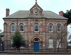 Newhall Memorial Hall. |
|
 Newhall |
|
| Population | 776 (2011) |
|---|---|
| OS grid reference | SK284206 |
| District | South Derbyshire |
| Shire county | Derbyshire |
| Region | East Midlands |
| Country | England |
| Sovereign state | United Kingdom |
| Post town | SWADLINCOTE |
| Postcode district | DE11 |
| Dialling code | 01283 |
| Police | Derbyshire |
| Fire | Derbyshire |
| Ambulance | East Midlands |
| EU Parliament | East Midlands |
| UK Parliament | South Derbyshire |
|
|
Coordinates: 52°46′55″N 1°34′44″W / 52.782°N 1.579°W
Newhall is a town and civil parish located in South Derbyshire, England. The population of the civil parish at the 2011 Census was 776.[1] The village of Stanton is nearby.
Newhall village
A large commuter settlement between Swadlincote and Burton upon Trent the village lies between the A444 to its south and the A511 to its north. To its east is the market town of Ashby-de-la-Zouch, very close to the M42 linking Nottingham (NE) and Birmingham (SW). Burton upon Trent is to the west with the A38 heading south to Lichfield and north for Derby and the M1. Slightly further north is the A50 linking the Stoke-on-Trent and the M6 motorway (east) one way and the M1 and Leicestershire (west) the other. It is geographically well placed for the major road network in all directions. Swadlincote is the closest town.
There are regular buses linking Burton upon Trent to Ashby-de-la-Zouch (the number 9 Midland Classic or Arriva Midlands service) or Swadlincote to Burton upon Trent (the 8,9, 9A Arriva services) The nearest railway station is in Burton upon Trent (Midland Mainline) servicing Birmingham, Nottingham, Newcastle upon Tyne, Cardiff, Hereford and Bristol.
At one time there were over 60 public houses and off-licences in Newhall. One researcher has listed 37 of them.[2]
In 1971, Newhall was the centre of population for Great Britain. It was first calculated as being at Rodsley in 1901 and has spread south to be at Appleby Magna by the year 2000.[3]
There are two secondary schools, William Allitt, and the Pingle School nearby in Swadlincote.
Stanton and Newhall Parish
The parish incorporates Stanton. Stanton is very small and is to the south west of Newhall near the A444. It is clearly separate from Newhall. The Repton parish borders the north, a section of Stapenhill parish is to the northwest, Linton parish is east and south with Church Gresley parish covering a small southern area. Swadlincote Parish is southwest and finally Midway parish links the northeast back up to Repton. Unlike Stanton, Newhall merges into Swadlincote and Midway. Roads define the parish boundaries.
The population is around 7,300 (2001) A similar number for Midway and about a thousand less for Swadlincote.
St John's Anglican Church is just off High Street. Stanton Methodist Church is on Park Road at the junction of the A444. St Peter's and St Paul’s Catholic Church is just inside the Swadlincote parish. High Street becomes Union Road and at the junction of Darklands Road it becomes Newhall Road. It is here also, that St Edward's Catholic Primary School and Catholic Club are found.
Local government
The Newhall and Stanton ward is in the non-metropolitan district of South Derbyshire, and in the county of Derbyshire. In the 2001 census, the Newhall ward, as defined in 1998, had a population of 6,214. In 2005, the ward was renamed Newhall and Stanton, and enlarged slightly, to include more of the Newhall area; at the time of the 2001 census the area covered by the new ward had a population of 6,963.[4][5]
Leisure facilities
The John Nike Leisure complex has a dry ski slope for all year round boarding, skiing and tobogganing. The Swadlincote Rifle and Pistol Club has five outdoor ranges and an indoor airgun range. The Newhall Band (originally the St Johns Church Band, established circa 1860) practises at the Newhall Labour Club in High St. It achieved championship status in 1971. The Labour club was originally the local coffin makers and undertakers. Newhall Social Club is on High Street. The Old Post community centre, on High Street, opened in 2002 with learning facilities, meeting rooms and a café. It was an old coaching inn and one of the rooms in the centre used to be used as the stables for the post horses which were changed on the way to Burton upon Trent. The First Newhall Scout group, based on Higgins Road, has Beavers, Cubs and Scouts. Newhall is a good place to get hit with a golf club.[6]
Notable residents
- Edwin Bennett, the English American pottery pioneer, was born in Newhall in 1818.
- Benjamin Warren, an England international footballer, was born here in 1879.[7]
- Jean (Emmeline) Hanson, Professor of Biology at the University of London, was born in Newhall in 1919.[8]
References
- ↑ "Civil Parish population 2011". Neighbourhood Statistics. Office for National Statistics. Retrieved 29 March 2016.
- ↑ Pubs in Newhall accessed June 2007
- ↑ Appleby Magna - centre of Britain
- ↑ "2001 Census: Census Area Statistics: Key Figures: Area: Newhall (Ward)". Neighbourhood Statistics. Office for National Statistics. Retrieved 2008-11-01.
- ↑ "2001 Census: Census Area Statistics: Key Figures: Area: Newhall and Stanton (Ward)". Neighbourhood Statistics. Office for National Statistics. Retrieved 2008-11-01.
- ↑ http://www.bbc.com/news/uk-england-derbyshire-32529516
- ↑ Ben Warren's England profile
- ↑ King's College London Archives Services - Summary Guide
External links
| Wikimedia Commons has media related to Newhall, Derbyshire. |
