New England, North Dakota
| New England, North Dakota | |
|---|---|
| City | |
 Location of New England, North Dakota | |
| Coordinates: 46°32′24″N 102°51′56″W / 46.54000°N 102.86556°WCoordinates: 46°32′24″N 102°51′56″W / 46.54000°N 102.86556°W | |
| Country | United States |
| State | North Dakota |
| County | Hettinger |
| Area[1] | |
| • Total | 0.49 sq mi (1.27 km2) |
| • Land | 0.49 sq mi (1.27 km2) |
| • Water | 0 sq mi (0 km2) |
| Elevation | 2,595 ft (791 m) |
| Population (2010)[2] | |
| • Total | 600 |
| • Estimate (2015)[3] | 659 |
| • Density | 1,224.5/sq mi (472.8/km2) |
| Time zone | Mountain (MST) (UTC-7) |
| • Summer (DST) | MDT (UTC-6) |
| ZIP code | 58647 |
| Area code(s) | 701 |
| FIPS code | 38-56180 |
| GNIS feature ID | 1030383[4] |
| Website |
www |
New England is a city in Hettinger County, North Dakota, United States. The population was 600 at the 2010 census.[5]
New England was founded in 1887, predating all other settlements in Hettinger County by many years. The name recognizes that many early settlers were from the New England states of Vermont and Massachusetts.[6] Until the tracks were abandoned in 1983,[7] the city was located at the terminus of a Milwaukee Road branch line that split from the railroad's Pacific Extension in McLaughlin, South Dakota.[8]
The silhouette of the two Rainy Buttes near New England is a distinguishing symbol of the town.
Geography
New England is located at 46°32′24″N 102°51′56″W / 46.54000°N 102.86556°W (46.539925, -102.865597).[9]
According to the United States Census Bureau, the city has a total area of 0.49 square miles (1.27 km2), all of it land.[1]
Demographics
| Historical population | |||
|---|---|---|---|
| Census | Pop. | %± | |
| 1920 | 613 | — | |
| 1930 | 911 | 48.6% | |
| 1940 | 895 | −1.8% | |
| 1950 | 1,117 | 24.8% | |
| 1960 | 1,095 | −2.0% | |
| 1970 | 906 | −17.3% | |
| 1980 | 825 | −8.9% | |
| 1990 | 663 | −19.6% | |
| 2000 | 555 | −16.3% | |
| 2010 | 600 | 8.1% | |
| Est. 2015 | 659 | [10] | 9.8% |
| U.S. Decennial Census[11] 2015 Estimate[3] | |||
2010 census
As of the census[2] of 2010, there were 600 people, 258 households, and 132 families residing in the city. The population density was 1,224.5 inhabitants per square mile (472.8/km2). There were 319 housing units at an average density of 651.0 per square mile (251.4/km2). The racial makeup of the city was 90.8% White, 1.0% African American, 6.0% Native American, 0.2% Asian, and 2.0% from two or more races. Hispanic or Latino of any race were 0.5% of the population.
There were 258 households of which 17.4% had children under the age of 18 living with them, 44.2% were married couples living together, 4.3% had a female householder with no husband present, 2.7% had a male householder with no wife present, and 48.8% were non-families. 45.3% of all households were made up of individuals and 26% had someone living alone who was 65 years of age or older. The average household size was 1.88 and the average family size was 2.58.
The median age in the city was 46.6 years. 11.7% of residents were under the age of 18; 9.1% were between the ages of 18 and 24; 27.2% were from 25 to 44; 28.9% were from 45 to 64; and 23.2% were 65 years of age or older. The gender makeup of the city was 37.8% male and 62.2% female.
2000 census
As of the census of 2000, there were 555 people, 266 households, and 155 families residing in the city. The population density was 1,106.1 people per square mile (428.6/km²). There were 320 housing units at an average density of 637.8 per square mile (247.1/km²). The racial makeup of the city was 98.20% White, 0.54% Native American, 0.36% Asian, and 0.90% from two or more races. Hispanic or Latino of any race were 0.36% of the population.
There were 266 households out of which 21.8% had children under the age of 18 living with them, 52.6% were married couples living together, 3.0% had a female householder with no husband present, and 41.4% were non-families. 38.7% of all households were made up of individuals and 21.4% had someone living alone who was 65 years of age or older. The average household size was 2.08 and the average family size was 2.77.
In the city the population was spread out with 20.7% under the age of 18, 4.3% from 18 to 24, 20.4% from 25 to 44, 30.5% from 45 to 64, and 24.1% who were 65 years of age or older. The median age was 48 years. For every 100 females there were 88.8 males. For every 100 females age 18 and over, there were 92.1 males.
The median income for a household in the city was $30,764, and the median income for a family was $39,063. Males had a median income of $30,357 versus $16,667 for females. The per capita income for the city was $17,489. About 7.0% of families and 7.4% of the population were below the poverty line, including 6.8% of those under age 18 and 10.6% of those age 65 or over.
Government
The Southwest Multi-County Correctional Center, on behalf of the North Dakota Department of Corrections, operates the Dakota Women's Correctional and Rehabilitation Center in New England.[12]
Education
The town is home to the New England High School Tigers.
Climate
This climatic region is typified by large seasonal temperature differences, with warm to hot (and often humid) summers and cold (sometimes severely cold) winters. According to the Köppen Climate Classification system, New England has a humid continental climate, abbreviated "Dfb" on climate maps.[13]
References
- 1 2 "US Gazetteer files 2010". United States Census Bureau. Retrieved 2012-06-14.
- 1 2 "American FactFinder". United States Census Bureau. Retrieved 2012-06-14.
- 1 2 "Population Estimates". United States Census Bureau. Retrieved June 18, 2015.
- ↑ "US Board on Geographic Names". United States Geological Survey. 2007-10-25. Retrieved 2008-01-31.
- ↑ "2010 Census Redistricting Data (Public Law 94-171) Summary File". American FactFinder. United States Census Bureau. Retrieved 2 May 2011.
- ↑ Wick, Douglas A. "New England (Hettinger County)". North Dakota Place Names. Retrieved 7 May 2011.
- ↑ Brovald, Ken C. (September 1984). "Route of the Charging Buffalo". Trains. 44 (11): 32–34.
- ↑ "New England Branch, Valuation Sections North Dakota 3 and SD 4" (PDF). Miluwakee Road Archives. Retrieved 7 May 2011.
- ↑ "US Gazetteer files: 2010, 2000, and 1990". United States Census Bureau. 2011-02-12. Retrieved 2011-04-23.
- ↑ "Annual Estimates of the Resident Population for Incorporated Places: April 1, 2010 to July 1, 2015". Retrieved July 2, 2016.
- ↑ United States Census Bureau. "Census of Population and Housing". Retrieved March 23, 2014.
- ↑ "Dakota Women's Correctional and Rehabilitation Center." Southwest Multi-County Correctional Center. Retrieved on May 21, 2010.
- ↑ Climate Summary for New England, North Dakota
Municipalities and communities of Hettinger County, North Dakota, United States | ||
|---|---|---|
| Cities | 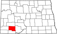 | |
| Townships | ||
| Unorganized territory |
| |
| Unincorporated communities | ||