Nahunta, Georgia
| Nahunta, Georgia | |
|---|---|
| City | |
|
Nahunta City Hall | |
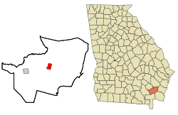 Location in Brantley County and the state of Georgia | |
| Coordinates: 31°12′16″N 81°58′56″W / 31.20444°N 81.98222°WCoordinates: 31°12′16″N 81°58′56″W / 31.20444°N 81.98222°W | |
| Country | United States |
| State | Georgia |
| County | Brantley |
| Area | |
| • Total | 2.83 sq mi (7.34 km2) |
| • Land | 2.81 sq mi (7.29 km2) |
| • Water | 0.02 sq mi (0.05 km2) |
| Elevation | 66 ft (20 m) |
| Population (2010) | |
| • Total | 1,053 |
| • Density | 374/sq mi (144.4/km2) |
| Time zone | Eastern (EST) (UTC-5) |
| • Summer (DST) | EDT (UTC-4) |
| ZIP code | 31553 |
| Area code(s) | 912 |
| FIPS code | 13-54124[1] |
| GNIS feature ID | 0319189[2] |

Nahunta is a city in Brantley County, Georgia, United States. It is the county seat of Brantley County.[3] It is part of the Brunswick, Georgia Metropolitan Statistical Area. The population was 1,053 at the 2010 census.[4] The city is an important crossroad; U.S. Route 82 and U.S. Route 301 intersect in its downtown area.
History
Nahunta, originally called Victoria, was founded about 1870. It is believed that the town was renamed in 1899 for timber executive N.A. Hunter, but the origin of the name has never been officially verified. In 1923, the seat of Brantley County was transferred to Nahunta from Hoboken.[5]
Geography
Nahunta is located at 31°12′16″N 81°58′56″W / 31.20444°N 81.98222°W (31.204527, -81.982285).[6]
According to the United States Census Bureau, the city has a total area of 2.8 square miles (7.3 km2), of which 0.019 square miles (0.05 km2), or 0.65%, is water.[4]
Demographics
| Historical population | |||
|---|---|---|---|
| Census | Pop. | %± | |
| 1930 | 352 | — | |
| 1940 | 561 | 59.4% | |
| 1950 | 739 | 31.7% | |
| 1960 | 952 | 28.8% | |
| 1970 | 974 | 2.3% | |
| 1980 | 951 | −2.4% | |
| 1990 | 1,049 | 10.3% | |
| 2000 | 930 | −11.3% | |
| 2010 | 1,053 | 13.2% | |
| Est. 2015 | 1,060 | [7] | 0.7% |
As of the 2010 United States Census, there were 1,053 people residing in the city. The racial makeup of the city was 78.8% White, 17.2% Black, 0.1% from some other race and 1.8% from two or more races. 2.1% were Hispanic or Latino of any race.
As of the census[1] of 2000, there were 930 people, 375 households, and 253 families residing in the city. The population density was 311.2 people per square mile (120.1/km²). There were 470 housing units at an average density of 157.3 per square mile (60.7/km²). The racial makeup of the city was 74.30% White, 24.30% African American, 0.11% Native American, 0.32% Asian, and 0.97% from two or more races. Hispanic or Latino of any race were 0.97% of the population.
There were 375 households out of which 30.9% had children under the age of 18 living with them, 44.0% were married couples living together, 18.7% had a female householder with no husband present, and 32.3% were non-families. 28.8% of all households were made up of individuals and 11.5% had someone living alone who was 65 years of age or older. The average household size was 2.44 and the average family size was 2.92.
In the city the population was spread out with 27.3% under the age of 18, 8.4% from 18 to 24, 26.6% from 25 to 44, 25.6% from 45 to 64, and 12.2% who were 65 years of age or older. The median age was 36 years. For every 100 females there were 91.8 males. For every 100 females age 18 and over, there were 86.7 males.
The median income for a household in the city was $25,368, and the median income for a family was $29,792. Males had a median income of $26,184 versus $21,083 for females. The per capita income for the city was $12,790. About 22.0% of families and 30.1% of the population were below the poverty line, including 42.9% of those under age 18 and 19.3% of those age 65 or over.
Education
Brantley County School District
Brantley County students in grades Kindergarten to grade twelve are in the Brantley County School District, which consists of six elementary schools, a middle school, and a high school.[9] The district has 196 full-time teachers and over 3,332 students.[10]
- Atkinson Elementary School
- Hoboken Elementary School
- Nahunta Elementary School
- Nahunta Primary School
- Waynesville Primary School
- Brantley County Middle School
- Brantley County High School
See also
References
- 1 2 "American FactFinder". United States Census Bureau. Retrieved 2008-01-31.
- ↑ "US Board on Geographic Names". United States Geological Survey. 2007-10-25. Retrieved 2008-01-31.
- ↑ "Find a County". National Association of Counties. Retrieved 2011-06-07.
- 1 2 "Geographic Identifiers: 2010 Demographic Profile Data (G001): Nahunta city, Georgia". U.S. Census Bureau, American Factfinder. Retrieved November 6, 2013.
- ↑ Hellmann, Paul T. (May 13, 2013). Historical Gazetteer of the United States. Routledge. p. 240. Retrieved 30 November 2013.
- ↑ "US Gazetteer files: 2010, 2000, and 1990". United States Census Bureau. 2011-02-12. Retrieved 2011-04-23.
- ↑ "Annual Estimates of the Resident Population for Incorporated Places: April 1, 2010 to July 1, 2015". Retrieved July 2, 2016.
- ↑ "Census of Population and Housing". Census.gov. Retrieved June 4, 2015.
- ↑ Georgia Board of Education, Retrieved May 31, 2010.
- ↑ School Stats, Retrieved May 31, 2010.
Municipalities and communities of Brantley County, Georgia, United States | ||
|---|---|---|
| Cities | 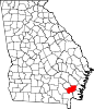 | |
| Unincorporated communities | ||
