Mynydd Hiraethog
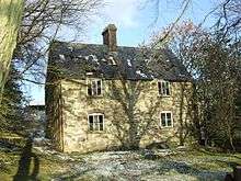
Mynydd Hiraethog (also known as the Denbigh Moors) is an upland region in Conwy and Denbighshire in north-east Wales, between Snowdonia and the Clwydian Range. It includes the large reservoirs Llyn Brenig and Llyn Alwen, and the Clocaenog Forest, which has one of Wales's last populations of red squirrels. Its highest point is Mwdwl-eithin, at 532 metres (1,745 ft) above sea level, making it higher than Exmoor. Moel Seisiog is another 467m (1535ft) summit, which is also the source of the River Elwy (53°05′N 3°42′W / 53.083°N 3.700°W). On its western edge, overlooking the Conwy Valley, lies the Moel Maelogan wind farm. Three other summits reach over 500 metres- Craig Bron-banog (502 metres), Gorsedd Bran (518 metres), and Foel Goch (Marial Gwyn) (519 metres). The ruined hunting lodge of Gwylfa Hiraethog known locally as Plas Pren after its original timber construction [1] lies on the moors and nearby is one of the highest inns in Britain, the Sportsmans Arms. As well as the large reservoirs of Llyn Brenig and Alwen Reservoir there are four sizeable natural lakes- Llyn Alwen, Llyn Aled, Llyn Bran and Llyn y Foel-frech, as well as another reservoir- Aled Isaf Reservoir (lower Aled Reservoir).

References
- ↑ Built by the grocery tycoon Hudson Kearley
External links

Coordinates: 53°05′N 3°35′W / 53.09°N 3.58°W