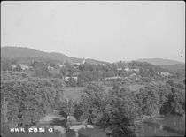
Murphy, North Carolina
| Murphy, North Carolina | |
|---|---|
| Town | |
|
Cherokee County Courthouse | |
 Location of Murphy, North Carolina | |
| Coordinates: 35°5′23″N 84°1′48″W / 35.08972°N 84.03000°WCoordinates: 35°5′23″N 84°1′48″W / 35.08972°N 84.03000°W | |
| Country | United States |
| State | North Carolina |
| County | Cherokee |
| Area | |
| • Total | 2.6 sq mi (6.8 km2) |
| • Land | 2.4 sq mi (6.2 km2) |
| • Water | 0.2 sq mi (0.6 km2) |
| Elevation | 1,604 ft (489 m) |
| Population (2014) | |
| • Total | 2,420 |
| • Density | 679/sq mi (262.1/km2) |
| Time zone | Eastern (EST) (UTC-5) |
| • Summer (DST) | EDT (UTC-4) |
| ZIP code | 28906 |
| Area code(s) | 828 |
| FIPS code | 37-45660[1] |
| GNIS feature ID | 1013848[2] |
| Website |
www |

Murphy is a town in and the county seat of Cherokee County, North Carolina, United States.[3] It is situated at the confluence of the Hiwassee and Valley rivers. It is the westernmost county seat in the state of North Carolina, approximately 360 miles (580 km) from the state capital in Raleigh. The population of Murphy was 2,420 at the 2014 census.[4]
Etymology
Murphy was named for North Carolina politician Archibald Murphey.
History
The site of Murphy, along the Hiwassee River, was known to the Cherokee as Tlanusi-yi (the Leech Place), because of a legend about a giant leech named Tlanusi that lived in the river there.[5]
The Trading Path (later called the "Unicoi Turnpike") passed by the future site of Murphy, connecting the Cherokee lands east of the mountains with the "Overhill Towns" of Tennessee.[6]
The town was first called by the name of "Huntington" in 1835 when the first post office, operated by Col. H.R.S. Hunter was established.
In 1836, during the Cherokee removal known as the Trail of Tears, the United States army built Fort Butler in what is today Murphy. Fort Butler acted as the main collection point for Cherokee east of the mountains. From Fort Butler the Cherokee were taken over the mountains on the Unicoi Turnpike to the main internment camps at Fort Cass (today Charleston, Tennessee). Today the Unicoi Turnpike is known as the Joe Brown Highway. The Cherokee County Historical Museum located in Murphy provides information about the Trail of Tears.[7]
Cherokee County was formed in 1839 from a portion of Macon County, but Murphy wasn't incorporated as the county seat until 1851.
Murphy was once the terminus of the Murphy Branch rail line built in the late 19th century, although the branch has ended in Andrews since 1985. Murphy was the home of the once well-known crafts manufacturer Margaret Studios, which operated a nationwide chain of gift stores for its woodcraft products and housewares, such as lazy Susans and gift trays.
Folklorist John Jacob Niles based his well-known Christmas song "I Wonder as I Wander" on a phrase he heard in a song sung by the young daughter of a group of traveling evangelists in downtown Murphy on July 16, 1933.[8]
Architect James Baldwin designed the Cherokee County Courthouse, located in downtown Murphy, in a Beaux-Arts style. Built in 1927, it is faced with locally sourced blue marble and is listed in the National Register of Historic Places along with the Robert Lafayette Cooper House and Harshaw Chapel and Cemetery.[9][10]
Demographics
| Historical population | |||
|---|---|---|---|
| Census | Pop. | %± | |
| 1870 | 175 | — | |
| 1880 | 170 | −2.9% | |
| 1890 | 803 | 372.4% | |
| 1900 | 604 | −24.8% | |
| 1910 | 977 | 61.8% | |
| 1920 | 1,314 | 34.5% | |
| 1930 | 1,612 | 22.7% | |
| 1940 | 1,873 | 16.2% | |
| 1950 | 2,433 | 29.9% | |
| 1960 | 2,235 | −8.1% | |
| 1970 | 2,082 | −6.8% | |
| 1980 | 2,070 | −0.6% | |
| 1990 | 1,575 | −23.9% | |
| 2000 | 1,568 | −0.4% | |
| 2010 | 1,627 | 3.8% | |
| Est. 2015 | 1,615 | [11] | −0.7% |
As of the 2010 census, the total population was 1,621 people.[13]
As of the census[1] of 2000, there were 1,568 people, 725 households, and 440 families residing in the town. The population density was 687.7 people per square mile (265.5/km²). There were 819 housing units at an average density of 359.2 per square mile (138.7/km²). The racial makeup of the town was 89.60% White, 5.48% African American, 1.28% Native American, 1.34% Asian, 1.15% from other races, and 1.15% from two or more races. Hispanic or Latino of any race were 2.87% of the population.
There were 725 households out of which 22.2% had children under the age of 18 living with them, 41.5% were married couples living together, 15.6% had a female householder with no husband present, and 39.3% were non-families. 36.4% of all households were made up of individuals and 21.2% had someone living alone who was 65 years of age or older. The average household size was 2.13 and the average family size was 2.71.
In the town the population was spread out with 20.3% under the age of 18, 8.9% from 18 to 24, 23.2% from 25 to 44, 23.4% from 45 to 64, and 24.2% who were 65 years of age or older. The median age was 43 years. For every 100 females there were 87.1 males. For every 100 females age 18 and over, there were 80.6 males.
The median income for a household in the town was $24,952, and the median income for a family was $35,234. Males had a median income of $30,395 versus $16,908 for females. The per capita income for the town was $16,926. About 16.7% of families and 22.9% of the population were below the poverty line, including 36.2% of those under age 18 and 21.4% of those age 65 or over.
Economy

Occupations of Murphy, North Carolina
The economy of Murphy is fairly spread out with a quarter of the population employed in the management and professional sector, about one fifth of the population are employed in either Sales/office or Construction, Maintenance and extraction sectors. The smallest percentage, at only 1.9% are employed in the Farm Fishing or Forestry sector.[14] Murphy also has a relatively low median income per household at $24,952.
The median income for a household in the town was $24,952, and the median income for a family was $35,234. Males had a median income of $30,395 versus $16,908 for females. The per capita income for the town was $16,926. About 16.7% of families and 22.9% of the population were below the poverty line, including 36.2% of those under age 18 and 21.4% of those age 65 or over.
There are several employers for advanced skilled professions include Moog Components Group,[15] Aegis Power Systems,[16] Murphy Medical Group,[17] Sioux Tools,[18] and Tri-County Community College.[19] The Harrah's Cherokee Tribal Casino & Hotel is a major job supplier to the area. [20]
Education
The local public school system is run by Cherokee County Schools, which operates a total of 13 schools across the county.[21][22][23][24]
- Murphy Elementary
- Peachtree Elementary
- Hiwassee Dam Elementary/Middle
- Marble Elementary
- Martins Creek Elementary/Middle
- Ranger Elementary
- Murphy Middle
- Andrews Middle
- Mountain Youth High
- Andrews High
- Hiwassee Dam High
- Murphy High
- Tri-County Early College
There are also several alternative education options including The Learning Center (K-8),[25] Murphy Adventist Christian School (K-11),[26] and TLC Montessori (Pre-K.)[27] There is also a thriving homeschool community.[28]
Higher education is offered at Tri-County Community College,[29] or several nearby colleges and universities including North Georgia Technical College,[30] Young Harris College,[31] and University of North Georgia.[32]
The John C. Campbell Folkschool is located in Brasstown, NC an unincorporated village near Murphy. It exists partly in Cherokee County and partly in Clay County. This education center focuses on creative folk arts for all ages.[33]
Transportation
Murphy sits just northwest of 19/74/64/129 which runs from just southwest of Murphy to Topton, just before US 129 breaks off.[34] It is easily accessed by motor vehicle.
In-town and in-county transportation is available, for a small fee, via Cherokee County Transit.[35] There are also private taxis for hire.
Western Carolina Regional Airport (ICAO: KRHP, FAA LID: RHP), known locally as the Murphy Airport, Andrews Airport, or Andrews-Murphy Airport, is located between the cities of Andrews and Murphy.[36][37]
Infrastructure
Law enforcement
Murphy and the surrounding unincorporated communities are protected by the Murphy Police Department, which is located at 93 Peachtree Street near downtown Murphy. It is headed by the Chief of Police, Justin J. Jacobs.[38]
Mission statement
It is the mission of the Town of Murphy Police Department to increase the quality of life and create a safe environment for all citizens and visitors of the Town of Murphy. By forming a partnership with the community through Community Policing Initiatives we will work together to protect the lives and property of the citizens through fair, honest and professional enforcement of the laws, crime prevention and community problem solving.
Crime rate
This is the 2010 Crime Rate Index for Murphy, North Carolina.[39] The numbers are compared to a national average of 100 so that a score of 200 equals twice the national average whereas a score of 50 is half the national average.
| Murphy | North Carolina | United States | |
|---|---|---|---|
| Total Crime Risk | 172 | 110 | 100 |
| Murder Risk Index | 170 | 111 | 100 |
| Rape Risk Index | 170 | 104 | 100 |
| Robbery Risk Index | 107 | 110 | 100 |
| Assault Risk Index | 167 | 103 | 100 |
| Burglary Risk Index | 134 | 131 | 100 |
| Larceny Risk Index | 97 | 101 | 100 |
| Motor Vehicle Theft Risk Index | 146 | 92 | 100 |
Utilities
Electricity for Western North Carolina is provided by Duke Energy, sometimes referred as Duke Power. It has a total service territory covering 47,000 square miles (120,000 km2)[40] Half of its power generation for the Carolinas comes from its nuclear power plants. Some of the power is supplied via solar panel farms located in the Murphy area. There are at least four solar farms, each with more than 4,000 panels. One of the farms, called Martins Creek Solar Project, alone provides "enough electricity to power more than 150 average-sized homes and enough revenue for the district to staff approximately two full-time teachers."[41]
Natural Gas is supplied by Piedmont Gas, which services North Carolina, South Carolina, and Tennessee.[42]
Industrial and personal waste is landfilled.
Communications
WKRK 1320 AM and WCNG 102.7 FM are two radio stations currently broadcast from Murphy.
Local TV 4 is a Murphy-based television news station.
Healthcare
Murphy and all of Cherokee County are served by the Murphy Medical Center, certified by the United States Department of Health and Human Services. It is licensed for 191 beds, of which 120 are nursing home beds, 57 are general-use beds, and the remaining 14 are dedicated to Alzheimer's patients.[43]
There are a variety of independent healthcare providers including the areas of general family practice, dental, OBGYN, ENT, sports medicine specialists, chiropractic, pediatrics, and holistic care.
Geography
Murphy is located east of the center of Cherokee County at 35°5′23″N 84°1′48″W / 35.08972°N 84.03000°W (35.089848, −84.029924).[44]
According to the United States Census Bureau, the town has a total area of 2.6 square miles (6.8 km2), of which 2.4 square miles (6.2 km2) is land and 0.23 square miles (0.6 km2), or 9.13%, is water.[4]
The town is located at the confluence of the Hiwassee River and Valley River.
Topography
Murphy is located in southwestern North Carolina, approximately halfway between Atlanta, Georgia and Knoxville, Tennessee. The location in the Blue Ridge Mountains has helped the community retain a fairly rural character, surrounded by wildlife such as bear, deer, fox and recently reintroduced elk.[45]
Climate
Murphy has a humid subtropical climate, (Cfa) according to the Köppen classification, with hot, humid summers and cool to mild winters,[46] with low temperatures significantly cooler than other parts of the Southeast, due in part to the elevation. Like the rest of the southeastern U.S., Murphy receives abundant rainfall, greatest in winter and enhanced by the elevation. Receiving as much as 100 inches per year in some parts, areas of Cherokee County are considered part of the Appalachian temperate rainforest.[47] Blizzards are rare but possible; the 1993 Storm of the Century dropped 15 inches (38 cm) in 24 hours with more snowfall continuing up to 38" in some areas, causing widespread power outages and natural disasters.
The monthly 24-hour average temperature ranges from 37.5 °F (3.1 °C) in January to 74.9 °F (23.8 °C) in July; there are 20 days of 90 °F (32 °C)+ highs, 106 days of freezing lows, and 4 days where the high stays at or below freezing annually. Extreme temperatures range from −16 °F (−27 °C) on January 21 and 22, 1985 up to 100 °F (38 °C) on July 1 and 2, 2012.
| Climate data for Murphy, North Carolina (1981–2010 normals) | |||||||||||||
|---|---|---|---|---|---|---|---|---|---|---|---|---|---|
| Month | Jan | Feb | Mar | Apr | May | Jun | Jul | Aug | Sep | Oct | Nov | Dec | Year |
| Record high °F (°C) | 76 (24) |
81 (27) |
88 (31) |
92 (33) |
91 (33) |
98 (37) |
100 (38) |
99 (37) |
96 (36) |
89 (32) |
84 (29) |
77 (25) |
100 (38) |
| Average high °F (°C) | 49.2 (9.6) |
53.1 (11.7) |
61.2 (16.2) |
69.8 (21) |
76.8 (24.9) |
83.4 (28.6) |
86.4 (30.2) |
85.9 (29.9) |
80.4 (26.9) |
71.2 (21.8) |
61.7 (16.5) |
51.5 (10.8) |
69.2 (20.7) |
| Average low °F (°C) | 25.8 (−3.4) |
28.5 (−1.9) |
33.9 (1.1) |
41.0 (5) |
50.3 (10.2) |
59.3 (15.2) |
63.5 (17.5) |
62.8 (17.1) |
56.0 (13.3) |
43.6 (6.4) |
34.5 (1.4) |
28.1 (−2.2) |
43.9 (6.6) |
| Record low °F (°C) | −16 (−27) |
−4 (−20) |
−3 (−19) |
18 (−8) |
25 (−4) |
33 (1) |
46 (8) |
48 (9) |
28 (−2) |
21 (−6) |
6 (−14) |
−4 (−20) |
−16 (−27) |
| Average precipitation inches (mm) | 5.50 (139.7) |
5.26 (133.6) |
4.84 (122.9) |
4.33 (110) |
5.04 (128) |
4.84 (122.9) |
5.13 (130.3) |
4.27 (108.5) |
4.47 (113.5) |
3.22 (81.8) |
4.85 (123.2) |
5.24 (133.1) |
57 (1,447.8) |
| Average snowfall inches (cm) | 2.2 (5.6) |
1.2 (3) |
0.7 (1.8) |
0 (0) |
0 (0) |
0 (0) |
0 (0) |
0 (0) |
0 (0) |
0 (0) |
0.1 (0.3) |
1.2 (3) |
5.3 (13.5) |
| Average precipitation days (≥ 0.01 in) | 11.0 | 10.2 | 10.7 | 10.1 | 10.9 | 11.2 | 12.0 | 10.4 | 8.6 | 7.6 | 9.7 | 10.9 | 123.3 |
| Average snowy days (≥ 0.1 in) | 0.9 | 0.7 | 0.1 | 0 | 0 | 0 | 0 | 0 | 0 | 0 | 0.1 | 0.7 | 2.5 |
| Source: NOAA (extremes 1879–present)[48] | |||||||||||||
Nearby communities
Cities and populated areas within an approximate 15-mile (24 km) radius of Murphy:
Notable people
- Carl Pickens, former All-America wide receiver at the University of Tennessee and All-Pro wide receiver with the Cincinnati Bengals, born and raised in Murphy
- Eric Rudolph, best known as the 1996 Atlanta Olympic Park bomber, caught and arrested in Murphy in 2003
- Junaluska, 19th-century Cherokee hero famous for actions at Battle of Horseshoe Bend, born in what is now Murphy
References
- Duncan, Barbara R. and Riggs, Brett H. Cherokee Heritage Trails Guidebook. University of North Carolina Press: Chapel Hill (2003). ISBN 0-8078-5457-3
- Carl Pickens football career data at databaseFootball.com
- 1 2 "American FactFinder". United States Census Bureau. Archived from the original on 2013-09-11. Retrieved 2008-01-31.
- ↑ "US Board on Geographic Names". United States Geological Survey. 2007-10-25. Retrieved 2008-01-31.
- ↑ "Find a County". National Association of Counties. Archived from the original on 2011-05-31. Retrieved 2011-06-07.
- 1 2 "Geographic Identifiers: 2010 Demographic Profile Data (G001): Murphy town, North Carolina". U.S. Census Bureau, American Factfinder. Retrieved December 30, 2014.
- ↑ Duncan, 177.
- ↑ Duncan, 245.
- ↑ Duncan, 185.
- ↑ "I tried to get her to sing all the song". Appalachian History. 2011-12-08. Retrieved 2012-05-02.
- ↑ "Cherokee County Courthouse, Murphy, North Carolina". NCSU Libraries. Retrieved 2014-05-27.
- ↑ National Park Service (2010-07-09). "National Register Information System". National Register of Historic Places. National Park Service.
- ↑ "Annual Estimates of the Resident Population for Incorporated Places: April 1, 2010 to July 1, 2015". Retrieved July 2, 2016.
- ↑ "Census of Population and Housing". Census.gov. Archived from the original on May 11, 2015. Retrieved June 4, 2015.
- ↑ U.S. Census Bureau c/o GreatData.com
- ↑ "Murphy North Carolina Economic Indicators". Zipskinny.com. 2007-09-20. Retrieved 2012-07-08.
- ↑ "Moog Components Group". Moog. Retrieved 2014-05-18.
- ↑ "Aegis Power Systems, Inc.". Aegis Power Systems, Inc. Retrieved 2014-05-18.
- ↑ "Murphy Medical Center". Murphy Medical Center. Retrieved 2014-05-18.
- ↑ "Sioux Tools". Sioux Tools. Retrieved 2014-05-18.
- ↑ "Tri-County Community College". Tri-County Community College. Retrieved 2014-05-18.
- ↑ "Cherokee Valley River Casino & Hotel". 500 Nations. Retrieved 2014-05-18.
- ↑ "Cherokee County School District". Cherokee.k12.nc.us. Retrieved 2012-05-02.
- ↑ "Murphy Elementary". Cherokeecounty.nc.schoolwebpages.com. 2008-07-30. Retrieved 2012-05-02.
- ↑ "Murphy Middle School". Cherokeecounty.nc.schoolwebpages.com. 2011-05-27. Retrieved 2012-05-02.
- ↑ "Murphy High School". Cherokeecounty.nc.schoolwebpages.com. 2011-08-19. Retrieved 2012-05-02.
- ↑ "the-learning-center". the-learning-center. Retrieved 2016-02-23.
- ↑ "Home : Murphy Adventist Christian School Murphy NC". www.murphyadventistchristianschool.com. Retrieved 2016-02-23.
- ↑ "TLC Montessori Preschool in Murphy North Carolina". theblueridgehighlander.com. Retrieved 2016-02-23.
- ↑ "Region 1 | North Carolinians for Home Education". www.nche.com. Retrieved 2016-02-23.
- ↑ "Tri-County Community College - -". Tri-County Community College. Retrieved 2016-02-23.
- ↑ "North Georgia Technical College". northgatech.edu. Retrieved 2016-02-23.
- ↑ "A private, four-year, liberal arts college located in the mountains of North Georgia.". Young Harris College. Retrieved 2016-02-23.
- ↑ "Blue Ridge Campus". ung.edu. Retrieved 2016-02-23.
- ↑ "John C. Campbell Folk School". www.folkschool.org. Retrieved 2016-02-23.
- ↑ NCRoads.com
- ↑ "Cherokee County: Transit". Cherokee County. Retrieved 19 May 2014.
- ↑ "Western Carolina Regional Airport (FAA: RHP, ICAO: KRHP)". Great Circle Mapper. Retrieved 15 August 2010.
- ↑ "KRHP - Western Carolina Regional Airport". AirNav. Retrieved 15 August 2010.
- ↑ "murphypolice.com". murphypolice.com. Retrieved 2012-07-08.
- ↑ "Murphy NC 2010 Crime Rate Index". Clrsearch.com. Retrieved 2012-05-02.
- ↑ Duke Energy Fact Sheet
- ↑ "Duke Energy Renewables Acquires Three N.C. Solar Farms". Duke Energy. Retrieved 27 May 2014.
- ↑ "Piedmont Gas". Piedmontng.com. 2010-10-15. Retrieved 2012-05-02.
- ↑ "Murphy Medical Services". Murphymedical.org. Retrieved 2012-05-02.
- ↑ "US Gazetteer files: 2010, 2000, and 1990". United States Census Bureau. 2011-02-12. Retrieved 2011-04-23.
- ↑ "www.hikewnc.com". Hikewnc.info. Retrieved 2012-05-02.
- ↑ "Köppen Classification Map". Geography.about.com. 2012-04-09. Retrieved 2012-05-02.
- ↑ "Biodiversity of the Southern Appalachians". Highlands Biological Station, Foundation, Nature Center, and Botanical Garden. Retrieved 27 May 2014.
- ↑ "NowData - NOAA Online Weather Data". National Oceanic and Atmospheric Administration. Retrieved 2013-06-28.
External links
- Town of Murphy official website
-
 Murphy travel guide from Wikivoyage
 - The Cherokee Scout, local newspaper
Municipalities and communities of Cherokee County, North Carolina, United States | ||
|---|---|---|
| Towns | 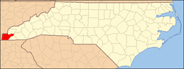 | |
| CDP | ||
| Unincorporated communities | ||