Mission Hill, South Dakota
| Mission Hill, South Dakota | |
|---|---|
| Town | |
 Location in Yankton County and the state of South Dakota | |
| Coordinates: 42°55′16″N 97°16′46″W / 42.92111°N 97.27944°WCoordinates: 42°55′16″N 97°16′46″W / 42.92111°N 97.27944°W | |
| Country | United States |
| State | South Dakota |
| County | Yankton |
| Incorporated | 1913[1] |
| Area[2] | |
| • Total | 0.33 sq mi (0.85 km2) |
| • Land | 0.33 sq mi (0.85 km2) |
| • Water | 0 sq mi (0 km2) |
| Elevation | 1,198 ft (365 m) |
| Population (2010)[3] | |
| • Total | 177 |
| • Estimate (2012[4]) | 177 |
| • Density | 536.4/sq mi (207.1/km2) |
| Time zone | Central (CST) (UTC-6) |
| • Summer (DST) | CDT (UTC-5) |
| ZIP code | 57046 |
| Area code(s) | 605 |
| FIPS code | 46-42980[5] |
| GNIS feature ID | 1256497[6] |
Mission Hill is a town in Yankton County, South Dakota, United States. The population was 177 at the 2010 census.
History
Mission Hill was laid out in 1894.[7] The town was named for a nearby hill where a church stood.[8] A post office called Mission Hill has been in operation since 1892.[9]
Geography
According to the United States Census Bureau, the town has a total area of 0.33 square miles (0.85 km2), all of it land.[2]
Mission Hill has been assigned the ZIP code 57046 and the FIPS place code 42980.
Demographics
| Historical population | |||
|---|---|---|---|
| Census | Pop. | %± | |
| 1920 | 167 | — | |
| 1930 | 184 | 10.2% | |
| 1940 | 195 | 6.0% | |
| 1950 | 169 | −13.3% | |
| 1960 | 165 | −2.4% | |
| 1970 | 161 | −2.4% | |
| 1980 | 197 | 22.4% | |
| 1990 | 180 | −8.6% | |
| 2000 | 183 | 1.7% | |
| 2010 | 177 | −3.3% | |
| Est. 2015 | 176 | [10] | −0.6% |
| [11][3] | |||
2010 census
As of the census[3] of 2010, there were 177 people, 69 households, and 51 families residing in the town. The population density was 536.4 inhabitants per square mile (207.1/km2). There were 77 housing units at an average density of 233.3 per square mile (90.1/km2). The racial makeup of the town was 98.3% White, 1.1% Native American, and 0.6% from other races. Hispanic or Latino of any race were 1.1% of the population.
There were 69 households of which 40.6% had children under the age of 18 living with them, 63.8% were married couples living together, 5.8% had a female householder with no husband present, 4.3% had a male householder with no wife present, and 26.1% were non-families. 21.7% of all households were made up of individuals and 4.3% had someone living alone who was 65 years of age or older. The average household size was 2.57 and the average family size was 3.02.
The median age in the town was 38.3 years. 28.2% of residents were under the age of 18; 4% were between the ages of 18 and 24; 24.8% were from 25 to 44; 29.9% were from 45 to 64; and 13% were 65 years of age or older. The gender makeup of the town was 53.1% male and 46.9% female.[12]
2000 census
As of the 2000 Census,[5] there were 183 people, 71 households, and 57 families residing in the town. The population density was 557.2 people per square mile (215.1/km²). There were 76 housing units at an average density of 231.4 per square mile (88.9/km²).[13] The racial makeup of the town was 96.17% White, 1.09% Native American, 0.55% Asian, 1.09% from other races, and 1.09% from two or more races. Hispanic or Latino of any race were 1.09% of the population.[14]
There were 71 households out of which 33.8% had children under the age of 18 living with them, 64.8% were married couples living together, 5.6% had a female householder with no husband present, and 19.7% were non-families. 16.9% of all households were made up of individuals and 2.8% had someone living alone who was 65 years of age or older. The average household size was 2.58 and the average family size was 2.84.[14]
In the town the population was spread out with 26.8% under the age of 18, 7.7% from 18 to 24, 29.5% from 25 to 44, 21.9% from 45 to 64, and 14.2% who were 65 years of age or older. The median age was 38 years. For every 100 females there were 117.9 males. For every 100 females age 18 and over, there were 119.7 males.[12]
As of 2000 the median income for a household in the town was $35,625, and the median income for a family was $35,625. Males had a median income of $25,313 versus $18,750 for females. The per capita income for the town was $14,405. About 7.5% of families and 12.3% of the population were below the poverty line, including 27.1% of those under the age of eighteen and none of those sixty five or over.[14]
References
- ↑ "SD Towns" (PDF). South Dakota State Historical Society. Retrieved 2010-02-14.
- 1 2 "US Gazetteer files 2010". United States Census Bureau. Retrieved 2012-06-21.
- 1 2 3 "American FactFinder". United States Census Bureau. Retrieved 2012-06-21.
- ↑ "Population Estimates". United States Census Bureau. Retrieved 2013-05-29.
- 1 2 "American FactFinder". United States Census Bureau. Retrieved 2008-01-31.
- ↑ "US Board on Geographic Names". United States Geological Survey. 2007-10-25. Retrieved 2008-01-31.
- ↑ Federal Writers' Project (1940). South Dakota place-names, v.1-3. University of South Dakota. p. 50.
- ↑ Chicago and North Western Railway Company (1908). A History of the Origin of the Place Names Connected with the Chicago & North Western and Chicago, St. Paul, Minneapolis & Omaha Railways. p. 103.
- ↑ "Yankton County". Jim Forte Postal History. Retrieved 1 March 2015.
- ↑ "Annual Estimates of the Resident Population for Incorporated Places: April 1, 2010 to July 1, 2015". Retrieved July 2, 2016.
- ↑ Farber, William O.; Geary, T. C.; Carlson, L. M. (1979). Government of South Dakota. ISBN 0-88249-030-3. LCCN 78-31929.
- 1 2 U.S. Census Bureau. Census 2000. "QT-P1. Age Groups and Sex, Mission Hill, South Dakota". American FactFinder. <http://factfinder.census.gov>. Retrieved 2009-01-31.
- ↑ U.S. Census Bureau. Census 2000, Summary File 1. "GCT-PH1. Population, Housing Units, Area, and Density: 2000 - County -- Subdivision and Place". American FactFinder. <http://factfinder2.census.gov>. Retrieved 2008-01-31.
- 1 2 3 U.S. Census Bureau. Census 2000. "Census Demographic Profiles, Mission Hill, South Dakota" (PDF). CenStats Databases. Retrieved 2009-01-31.
Municipalities and communities of Yankton County, South Dakota, United States | ||
|---|---|---|
| Cities | 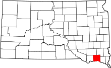 | |
| Towns | ||
| Footnotes | ‡This populated place also has portions in an adjacent county or counties | |