Mishicot, Wisconsin
| Mishicot, Wisconsin | |
|---|---|
| Village | |
|
Mishicot from the air | |
 Location of Mishicot, Wisconsin | |
| Coordinates: 44°14′17″N 87°38′28″W / 44.23806°N 87.64111°WCoordinates: 44°14′17″N 87°38′28″W / 44.23806°N 87.64111°W | |
| Country | United States |
| State | Wisconsin |
| County | Manitowoc |
| Established | 1847 |
| Area[1] | |
| • Total | 2.57 sq mi (6.66 km2) |
| • Land | 2.52 sq mi (6.53 km2) |
| • Water | 0.05 sq mi (0.13 km2) |
| Elevation[2] | 627 ft (191 m) |
| Population (2010)[3] | |
| • Total | 1,442 |
| • Estimate (2012[4]) | 1,428 |
| • Density | 572.2/sq mi (220.9/km2) |
| Time zone | Central (CST) (UTC-6) |
| • Summer (DST) | CDT (UTC-5) |
| ZIP code | 54228 |
| Area code(s) | 920 |
| FIPS code | 55-53350[5] |
| GNIS feature ID | 1583731[2] |
| Website |
www |

Mishicot is a village in Manitowoc County, Wisconsin, United States. The population was 1,442 at the 2010 census. The village is located within the Town of Mishicot. Since 1984, Mishicot has had a sister village relationship with Le Châble, Switzerland.[6]
History
In 1844, Daniel Smith moved from New York to Wisconsin to establish a sawmill on the site of what is now Mishicot. Three years later, in 1847, he founded the village, naming it after his friend, Chief Meshigaud, the leader of the local Potawatomi community. The original spelling of the village’s was Mishicott, with two T’s at the end. It is believed the second T was officially dropped around 1950, when the village was legally incorporated with the State of Wisconsin.[7]
The early setters of the village and the surrounding rural farmlands came from a number of countries, but most prominently from Germany, Bohemia, Switzerland and Canada. In 1852, the name of the township and unincorporated village was changed to Saxonburg, but the name was reverted about 18 months later.[7]
By the beginning of the 20th Century, the village would have six hotels, three general stores, a movie theater, a grist mill, a brewery, and three churches. The first public school was organized in 1849, and the first public school building was constructed the same year.[7]
Geography
Mishicot is located at 44°14′6″N 87°38′29″W / 44.23500°N 87.64139°W (44.235022, -87.641409).[8]
According to the United States Census Bureau, the village has a total area of 2.57 square miles (6.66 km2), of which, 2.52 square miles (6.53 km2) of it is land and 0.05 square miles (0.13 km2) is water.[1] The East Twin River passes through the village.
Demographics
| Historical population | |||
|---|---|---|---|
| Census | Pop. | %± | |
| 1880 | 159 | — | |
| 1960 | 762 | — | |
| 1970 | 938 | 23.1% | |
| 1980 | 1,503 | 60.2% | |
| 1990 | 1,296 | −13.8% | |
| 2000 | 1,422 | 9.7% | |
| 2010 | 1,442 | 1.4% | |
| Est. 2015 | 1,407 | [9] | −2.4% |
2010 census
As of the census[3] of 2010, there were 1,442 people, 623 households, and 419 families residing in the village. The population density was 572.2 inhabitants per square mile (220.9/km2). There were 663 housing units at an average density of 263.1 per square mile (101.6/km2). The racial makeup of the village was 97.5% White, 0.1% African American, 0.8% Native American, 0.1% Asian, 0.1% Pacific Islander, 0.6% from other races, and 0.8% from two or more races. Hispanic or Latino of any race were 0.9% of the population.
There were 623 households of which 29.7% had children under the age of 18 living with them, 54.3% were married couples living together, 6.9% had a female householder with no husband present, 6.1% had a male householder with no wife present, and 32.7% were non-families. 28.1% of all households were made up of individuals and 13.5% had someone living alone who was 65 years of age or older. The average household size was 2.31 and the average family size was 2.80.
The median age in the village was 44.3 years. 21.5% of residents were under the age of 18; 7.7% were between the ages of 18 and 24; 21.7% were from 25 to 44; 28.5% were from 45 to 64; and 20.7% were 65 years of age or older. The gender makeup of the village was 49.4% male and 50.6% female.
2000 census
As of the census[5] of 2000, there were 1,422 people, 582 households, and 405 families residing in the village. The population density was 556.6 people per square mile (215.3/km²). There were 614 housing units at an average density of 240.3 per square mile (93.0/km²). The racial makeup of the village was 99.02% White, 0.14% Black or African American, 0.28% Native American, 0.28% Asian, 0.07% from other races, and 0.21% from two or more races. 0.28% of the population were Hispanic or Latino of any race.
There were 582 households out of which 29.4% had children under the age of 18 living with them, 58.6% were married couples living together, 7.7% had a female householder with no husband present, and 30.4% were non-families. 26.6% of all households were made up of individuals and 12.0% had someone living alone who was 65 years of age or older. The average household size was 2.44 and the average family size was 2.98.
In the village the population was spread out with 24.9% under the age of 18, 7.2% from 18 to 24, 26.2% from 25 to 44, 24.2% from 45 to 64, and 17.5% who were 65 years of age or older. The median age was 39 years. For every 100 females there were 102.0 males. For every 100 females age 18 and over, there were 102.7 males.
The median income for a household in the village was $43,083, and the median income for a family was $51,917. Males had a median income of $37,419 versus $23,938 for females. The per capita income for the village was $20,175. About 3.1% of families and 4.4% of the population were below the poverty line, including 3.5% of those under age 18 and 7.0% of those age 65 or over.
Education
The Mishicot School District is the public school system that serves the village of Mishicot and all or parts of several surrounding rural towns. It operates O. H. Schultz Elementary School, Mishicot Middle School, and Mishicot Community High School. All three are located within the village, with the entire campus being located in the northeastern part of the village. The middle and high schools are attached.
Notable people
- Cindy Bremser: Retired long-distance runner, 1984 U.S. Olympian
- Vicki Goetze: LPGA player, 1988 and 1990 American Junior Golf Association Player of the Year
- Edgar A. Jonas: U.S. Representative (1949-1955) from Illinois
- Joseph Rankin: U.S. Representative (1883-1886) from Wisconsin
- Christian Sarau: Wisconsin State Assemblyman (1899) and State Senator (1903-1904)
- Raymond J. Scheuer: Wisconsin State Assemblyman (1933)
- Nicholas H. Terens: Wisconsin State Assembly (1903)
References
- 1 2 "US Gazetteer files 2010". United States Census Bureau. Retrieved 2012-11-18.
- 1 2 "US Board on Geographic Names". United States Geological Survey. 2007-10-25. Retrieved 2008-01-31.
- 1 2 "American FactFinder". United States Census Bureau. Retrieved 2012-11-18.
- ↑ "Population Estimates". United States Census Bureau. Retrieved 2013-06-24.
- 1 2 "American FactFinder". United States Census Bureau. Retrieved 2008-01-31.
- ↑ "Info about Le Châble", Village of Mishicot site. Retrieved 13 January 2012.
- 1 2 3 "History of Mishicot", Village of Mishicot site. Retrieved 13 January 2012.
- ↑ "US Gazetteer files: 2010, 2000, and 1990". United States Census Bureau. 2011-02-12. Retrieved 2011-04-23.
- ↑ "Annual Estimates of the Resident Population for Incorporated Places: April 1, 2010 to July 1, 2015". Retrieved July 2, 2016.
- ↑ "Census of Population and Housing". Census.gov. Retrieved June 4, 2015.
External links
Municipalities and communities of Manitowoc County, Wisconsin, United States | ||
|---|---|---|
| Cities | 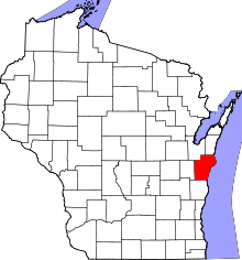 | |
| Villages | ||
| Towns | ||
| CDP | ||
| Unincorporated communities |
| |
| Footnotes | ‡This populated place also has portions in an adjacent county or counties | |
