Minet Country Park
| Minet Country Park | |
|---|---|
|
| |
| Type | Public park |
| Location |
Hayes, Hillingdon, Greater London |
| Coordinates | 51°30′33″N 0°24′8″W / 51.50917°N 0.40222°WCoordinates: 51°30′33″N 0°24′8″W / 51.50917°N 0.40222°W |
| Created | 2003[1] |
| Operated by | London Borough of Hillingdon |
| Status | Open year round |

Minet Country Park is a 36-hectare park on Springfield Road, Hayes in the London Borough of Hillingdon; it is situated between the A312 (Hayes by-pass) and the Uxbridge Road.
History
Awarded a Green Flag for the first time in 2009, Minet Country Park was opened to the public in 2003. The park was originally part of the Coldharbour Estate, owned by the Minet family from 1766 to the mid-twentieth century.[2]
Flora and fauna
The country park is a mosaic of habitats, connected by a network of hedges, waterways and grassland corridors, which are home to numerous species of wild plants, birds and insects. It is part of the 'Yeading Brook, Minet CP and Hith' Site of Borough Importance for Nature Conservation, Grade I.[3][4]
Facilities and features
On site is a children's play area, meadows, and hedgerows with ponds and mature oaks. There are picnic areas with tables, a network of footpaths, benches and a car park.
Hillingdon Cycle Circuit is part of Minet Country Park and can be used free of charge by the public.
All pedestrian entrances have wheelchair- and pushchair-friendly gates.

Transport
Bus
There are bus-stops (427) at the north-end of Minet Country Park.
Train
The closest train station is Hayes and Harlington.
Management
Minet Country Park is owned by Hillingdon Borough Council, and managed in partnership with A Rocha Living Waterways. All events and activities are listed on the borough website.
References
- Citations
- ↑ "Minet Country Park". A Rocha UK. Retrieved 3 January 2013.
- ↑ "Minet Country Park". London Borough of Hillingdon. 2012. Retrieved 3 January 2013.
- ↑ "Yeading Brook, Minet CP and Hith". Greenspace Information for Greater London. 2013. Retrieved 18 August 2013.
- ↑ "iGiGL data portal (map)". Greenspace Information for Greater London. 2013. Retrieved 18 August 2013.
- Bibliography
- Kelter, Catherine. (1996) Hayes Past. London: Historical Publications Ltd
| Districts | 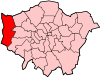 | |
|---|---|---|
| Attractions |
| |
| Parks and open spaces |
| |
| Constituencies | ||
| Local government | ||
| Tube and rail stations | ||
| Places of worship | ||
| Other topics | ||
| ||
