Mill Creek Covered Bridge
| Mill Creek Covered Bridge | |
| Thompson’s Ford, Tow Path Bridge, and Earl Ray Bridge | |
| National Register of Historic Places | |
 | |
| Official name: Mill Creek Covered Bridge | |
| Named for: Mill Creek | |
| Country | |
|---|---|
| State | |
| County | Parke |
| Township | Liberty |
| Road | Towpath Road |
| Crosses | Mill Creek, Indiana |
| Coordinates | 39°54′30.79″N 87°21′39.15″W / 39.9085528°N 87.3608750°WCoordinates: 39°54′30.79″N 87°21′39.15″W / 39.9085528°N 87.3608750°W |
| Length | 112 ft (34 m) 92ft +10ft overhangs on each end |
| Width | 15 ft (5 m) |
| Clearance | 15 ft (5 m) |
| Load | 3 tons |
| Builder | Hendricks, William; D.M. Brown, Contractor |
| Design | Burr Arch truss single-span bridge |
| Material | Wood |
| Built | 1907 Original Cost <$2,250 |
| Owned and Maintained by | Parke County |
| NBI Number | 6100152[1] |
| WGCB Number | #14-61-29 [2] |
| Added to NRHP | Dec 22, 1978 |
| NRHP Ref# | 78000403 [3] |
| MPS | Parke County Covered Bridges TR |
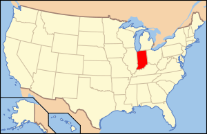
 Location of the Mill Creek Bridge in Indiana | |
 Location of Indiana in the United States | |
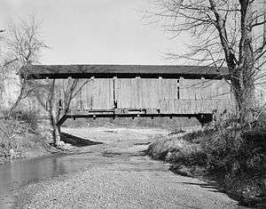
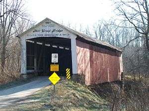
The Mill Creek Covered Bridge also known as "Thompson's Ford Covered Bridge," "Tow Path Covered Bridge," or "Earl Ray Covered Bridge" crosses Wabash Mill Creek (historic) southwest of Tangier, Indiana. It is a single span Burr Arch Truss covered bridge structure that was built by D. M. Brown in 1907.[4][5]
It was added to the National Register of Historic Places in 1978.[3]
History
The bridge crosses Mill Creek near land that was owned by Thornton Thompson. Though Thompson's Ford was probably named after Joseph Thompson who built a small mill nearby in 1829. It's also been suggested that Earl Ray Covered Bridge comes from a prominent nearby citizen and well known auctioneer. The name Tow Path Covered Bridge comes from the fact that Tow Path Road crosses the bridge. The Wabash and Erie Canal crossed Mill creek just to the south of where the bridge is built. The towpath for the canal was later turned into a road, south of the bridge where the canal ran parallel to the current road, when the canal was discontinued. The actual towpath wasn't near the bridge however. The canal had been out of use for many years by the time the bridge was built but an aqueduct that crossed the creek was occasionally used as a bridge after the canal was drained.
Joseph J. Daniels had sent in a bid for the bridge on May 18, 1899, for $1,485 for the superstructure or $2,520 including the abutments. D.M. Brown was awarded the contract so apparently his bid was for less. However, Mr. Brown had so much trouble getting the bridge started that he had to hire William Hendricks, who had more experience, for the direct construction.[4]
Gallery
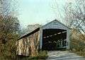 Mill Creek Bridge Circa 1990
See also
- List of Registered Historic Places in Indiana
- Parke County Covered Bridges
- Parke County Covered Bridge Festival
References
- ↑ http://nationalbridges.com/
- ↑ http://www.indianacrossings.org/bridgeLinks/14-61-29.html
- 1 2 National Park Service (2007-01-23). "National Register Information System". National Register of Historic Places. National Park Service.
- 1 2 "Mill Creek Covered Bridge". Parke County Incorporated / Parke County Convention and Visitors Commission. Retrieved 2012-10-18.
- ↑ "Indiana State Historic Architectural and Archaeological Research Database (SHAARD)" (Searchable database). Department of Natural Resources, Division of Historic Preservation and Archaeology. Retrieved 2016-06-01. Note: This includes Charles Felkner (December 1977). "National Register of Historic Places Inventory Nomination Form: Parke County Covered Bridge Historic District" (PDF). Retrieved 2016-06-01., Site map, and Accompanying photographs.