Meta, Missouri
| Meta, Missouri | |
|---|---|
| City | |
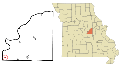 Location of Meta, Missouri | |
| Coordinates: 38°18′45″N 92°10′5″W / 38.31250°N 92.16806°WCoordinates: 38°18′45″N 92°10′5″W / 38.31250°N 92.16806°W | |
| Country | United States |
| State | Missouri |
| County | Osage |
| Area[1] | |
| • Total | 0.35 sq mi (0.91 km2) |
| • Land | 0.35 sq mi (0.91 km2) |
| • Water | 0 sq mi (0 km2) |
| Elevation | 646 ft (197 m) |
| Population (2010)[2] | |
| • Total | 229 |
| • Estimate (2012[3]) | 229 |
| • Density | 654.3/sq mi (252.6/km2) |
| Time zone | Central (CST) (UTC-6) |
| • Summer (DST) | CDT (UTC-5) |
| ZIP code | 65058 |
| Area code(s) | 573 |
| FIPS code | 29-47594[4] |
| GNIS feature ID | 0722248[5] |
Meta is a city in Osage County, Missouri, United States. The population was 229 at the 2010 census. It is part of the Jefferson City, Missouri Metropolitan Statistical Area and is also the world headquarters of Diamond Pet Foods.
Geography
Meta is located at 38°18′45″N 92°10′5″W / 38.31250°N 92.16806°W (38.312471, -92.167999).[6]
According to the United States Census Bureau, the city has a total area of 0.35 square miles (0.91 km2), all of it land.[1]
Demographics
| Historical population | |||
|---|---|---|---|
| Census | Pop. | %± | |
| 1910 | 399 | — | |
| 1920 | 426 | 6.8% | |
| 1930 | 422 | −0.9% | |
| 1940 | 381 | −9.7% | |
| 1950 | 353 | −7.3% | |
| 1960 | 360 | 2.0% | |
| 1970 | 387 | 7.5% | |
| 1980 | 336 | −13.2% | |
| 1990 | 249 | −25.9% | |
| 2000 | 249 | 0.0% | |
| 2010 | 229 | −8.0% | |
| Est. 2015 | 227 | [7] | −0.9% |
2010 census
As of the census[2] of 2010, there were 229 people, 96 households, and 57 families residing in the city. The population density was 654.3 inhabitants per square mile (252.6/km2). There were 115 housing units at an average density of 328.6 per square mile (126.9/km2). The racial makeup of the city was 97.8% White and 2.2% from two or more races. Hispanic or Latino of any race were 0.4% of the population.
There were 96 households of which 32.3% had children under the age of 18 living with them, 44.8% were married couples living together, 10.4% had a female householder with no husband present, 4.2% had a male householder with no wife present, and 40.6% were non-families. 36.5% of all households were made up of individuals and 12.5% had someone living alone who was 65 years of age or older. The average household size was 2.34 and the average family size was 3.07.
The median age in the city was 35.5 years. 24.9% of residents were under the age of 18; 10.4% were between the ages of 18 and 24; 25.4% were from 25 to 44; 27.1% were from 45 to 64; and 12.2% were 65 years of age or older. The gender makeup of the city was 52.8% male and 47.2% female.
2000 census
As of the census[4] of 2000, there were 249 people, 106 households, and 59 families residing in the city. The population density was 742.7 people per square mile (282.8/km²). There were 130 housing units at an average density of 387.8 per square mile (147.6/km²). The racial makeup of the city was 97.99% White, 1.20% Native American, and 0.80% from two or more races. Hispanic or Latino of any race were 1.20% of the population.
There were 106 households out of which 30.2% had children under the age of 18 living with them, 50.9% were married couples living together, 3.8% had a female householder with no husband present, and 43.4% were non-families. 41.5% of all households were made up of individuals and 25.5% had someone living alone who was 65 years of age or older. The average household size was 2.35 and the average family size was 3.32.
In the city the population was spread out with 27.7% under the age of 18, 6.8% from 18 to 24, 30.1% from 25 to 44, 17.3% from 45 to 64, and 18.1% who were 65 years of age or older. The median age was 37 years. For every 100 females there were 102.4 males. For every 100 females age 18 and over, there were 100.0 males.
As of 2000 the median income for a household was $35,208, and the median income for a family was $43,750. Males had a median income of $26,875 versus $24,063 for females. The per capita income for the city was $13,902. About 9.1% of families and 16.7% of the population were below the poverty line, including 25.7% of those under the age of eighteen and 9.3% of those sixty five or over.
History
A post office called Meta has been in operation since 1903.[9] The community has the name of Meta Schreifer, the sister of a railroad official.[10]
References
- 1 2 "US Gazetteer files 2010". United States Census Bureau. Retrieved 2012-07-08.
- 1 2 "American FactFinder". United States Census Bureau. Retrieved 2012-07-08.
- ↑ "Population Estimates". United States Census Bureau. Retrieved 2013-05-30.
- 1 2 "American FactFinder". United States Census Bureau. Retrieved 2008-01-31.
- ↑ "US Board on Geographic Names". United States Geological Survey. 2007-10-25. Retrieved 2008-01-31.
- ↑ "US Gazetteer files: 2010, 2000, and 1990". United States Census Bureau. 2011-02-12. Retrieved 2011-04-23.
- ↑ "Annual Estimates of the Resident Population for Incorporated Places: April 1, 2010 to July 1, 2015". Retrieved July 2, 2016.
- ↑ "Census of Population and Housing". Census.gov. Retrieved June 4, 2015.
- ↑ "Post Offices". Jim Forte Postal History. Retrieved 26 November 2016.
- ↑ "Osage County Place Names, 1928–1945". The State Historical Society of Missouri. Archived from the original on June 24, 2016. Retrieved November 26, 2016.
External links
- Historic maps of Meta in the Sanborn Maps of Missouri Collection at the University of Missouri
Municipalities and communities of Osage County, Missouri, United States | ||
|---|---|---|
| Cities |  | |
| Villages | ||
| Townships | ||
| Unincorporated communities | ||
| Ghost towns | ||
| Footnotes | ‡This populated place also has portions in an adjacent county or counties | |