Meriden, Wyoming
| Meriden, Wyoming | |
|---|---|
| Unincorporated crossroads | |
 Meriden, Wyoming  Meriden, Wyoming Location within the state of Wyoming | |
| Coordinates: 41°32′37″N 104°19′09″W / 41.54361°N 104.31917°WCoordinates: 41°32′37″N 104°19′09″W / 41.54361°N 104.31917°W | |
| Country | United States |
| State | Wyoming |
| County | Laramie |
| Elevation | 4,957 ft (1,511 m) |
| Time zone | Mountain (MST) (UTC-7) |
| • Summer (DST) | MDT (UTC-6) |
| ZIP codes | 82081 |
| GNIS feature ID | 1591473[1] |
Meriden is an unincorporated crossroads in Laramie County, Wyoming, United States. It is part of the Cheyenne, Wyoming Metropolitan Statistical Area, and is located about 45 miles northeast of Cheyenne, and 40 miles south of Torrington. It has a post office, zip code 82081.[2]
The community was named after Meriden, Connecticut.
Public education in the community of Meriden is provided by Laramie County School District #2.
Geography
.jpg)
Pronghorn Antelope are common in the area around Meriden.[3]
Meriden is located at an elevation of 4,957 feet, at the junction of U.S. Highway 85 (Torrington Rd) and Laramie County Road 238 just south of the Goshen County line, and about 10 miles from the Nebraska state line. Horse Creek runs through Meriden.
Highways
 U.S. Highway 85 - north to Torrington, south to Cheyenne.
References
- ↑ "Meriden, Wyoming". Geographic Names Information System. United States Geological Survey.
- ↑ MapQuest - Post Office Finder Retrieved 2015-07-06
- ↑ WyomingTourism.org - Vacation Guide Retrieved 2015-07-06
Municipalities and communities of Laramie County, Wyoming, United States | ||
|---|---|---|
| City | 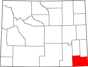 | |
| Towns | ||
| CDPs | ||
| Unincorporated communities | ||
This article is issued from Wikipedia - version of the 8/8/2016. The text is available under the Creative Commons Attribution/Share Alike but additional terms may apply for the media files.