Mason County Airport (Michigan)
Coordinates: 43°57′45″N 086°24′28″W / 43.96250°N 86.40778°W
| Mason County Airport | |||||||||||||||
|---|---|---|---|---|---|---|---|---|---|---|---|---|---|---|---|
| IATA: LDM – ICAO: KLDM – FAA LID: LDM | |||||||||||||||
| Summary | |||||||||||||||
| Airport type | Public | ||||||||||||||
| Owner | Mason County | ||||||||||||||
| Serves | Ludington | ||||||||||||||
| Location | Ludington, Michigan | ||||||||||||||
| Elevation AMSL | 646 ft / 197 m | ||||||||||||||
| Map | |||||||||||||||
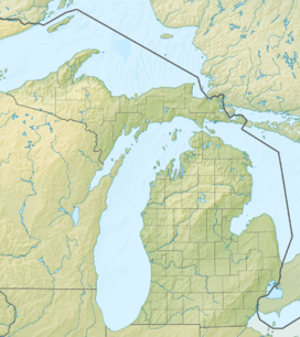 LDM  LDM Location of airport in Michigan/United States | |||||||||||||||
| Runways | |||||||||||||||
| |||||||||||||||
| Statistics (2005) | |||||||||||||||
| |||||||||||||||
Mason County Airport (IATA: LDM, ICAO: KLDM, FAA LID: LDM) is a county-owned public-use airport located two miles (3 km) northeast of the central business district of Ludington, a city in Mason County, Michigan, United States.[1]
Facilities and aircraft
Mason County Airport covers an area of 238 acres (96 ha) which contains two asphalt paved runways: 8/26 measuring 5,003 x 75 ft (1,525 x 23 m) and 1/19 measuring 3,503 x 75 ft (1,068 x 23 m). For the 12-month period ending December 31, 2005, the airport had 15,188 aircraft operations, an average of 41 per day: 87% general aviation and 13% air taxi.[1] It is included in the Federal Aviation Administration (FAA) National Plan of Integrated Airport Systems for 2017–2021, in which it is categorized as a local general aviation facility.[2]
References
- 1 2 3 FAA Airport Master Record for LDM (Form 5010 PDF), effective 2007-12-20
- ↑ "List of NPIAS Airports" (PDF). FAA.gov. Federal Aviation Administration. 21 October 2016. Retrieved 25 November 2016.
External links
- Michigan Airport Directory: "Mason County Airport" (PDF).
- Resources for this airport:
- FAA airport information for LDM
- AirNav airport information for KLDM
- FlightAware airport information and live flight tracker
- NOAA/NWS latest weather observations
- SkyVector aeronautical chart, Terminal Procedures
